On Feb. 12, 1935, during severe weather off Point Sur, Calif., a U.S. Navy flying machine called the USS Macon fell from the sky, plunged into the Pacific Ocean, and sank.
It was the nation's largest rigid, lighter-than-air craft, and the last of its kind.
This month researchers documented the wreckage of the 785-foot dirigible.
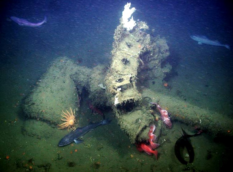
From a Monterey Bay Aquarium Research Institute’s (MBARI) research ship, scientists deployed a remotely operated vehicle to capture high-definition video and still images of wreckage.
Images show the airship's hangar bay, containing four Sparrowhawk biplanes, five of the eight 12-cylinder gasoline engines, and objects from the ship's galley, including two sections of the aluminum stove, propane tanks that supplied fuel for it and a dining table and bench.
A second debris field contained the Macon's bow section, including the mooring mast receptacle, plus aluminum chairs and desks that may have been in a port side officers' or meteorologist's office.
The exact location of the submerged wreckage remained a mystery for nearly 50 years until a commercial fisherman snagged a piece of the USS Macon’s girder in his net, and ended up displaying the artifact at a local seafood restaurant.
Meanwhile, researchers had attempted to locate the airship remains with no luck, because the objects weren’t at the recorded sinking location. In the early 1990s they finally spotted the wreckage at a depth of 1,000 feet.
The new survey included researchers from the NOAA National Marine Sanctuary program, MBARI, the University of New Hampshire and Stanford University. The researchers will now investigate the level of preservation of the artifacts and whether further research at the site is feasible.
