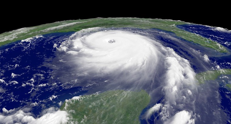
Watching for changes in the inner eyewall of a hurricane may help forecasters overcome one of their most perplexing challenges: predicting sudden strengthening or weakening.
The ability to predict what path a hurricane will follow has improved dramatically in recent years, but anticipating sudden changes in intensity has remained a problem.
And knowing a hurricane's strength is vital to making decisions about evacuating areas when a storm approaches.
Now, a research team led by Robert A. Houze Jr., a University of Washington professor of atmospheric science, is reporting evidence that clouds around the eyewall of a storm can cause sudden changes in intensity.
The findings, in Friday's issue of the journal Science, are based on analyses of data collected in 2005 in storms Katrina and Rita that devastated New Orleans and portions of Mississippi, Alabama, Louisiana and Texas.
The strongest winds in a hurricane circulate in the cloud wall that surrounds the relatively calm and clear eye of the storm.
Taking measurements from aircraft flying into these storms, the researchers led by Houze found that occasionally a "moat" of clear air will form outside the eyewall. Winds funneling toward the center of the storm will then form a new eyewall outside the original one, cutting off the storm center from the incoming flow of energy and eliminating the old eyewall.
Because the new eyewall is larger than the old one, its winds circulate more slowly — as an ice skater with arms extended spins more slowly than one with arms held close to the body — thus reducing the intensity of the storm.
But the new eyewall can then begin to contract, spinning faster and faster and increasing the storm's intensity.
Using aircraft to study these changes could help improve forecasts of storm intensity, Houze said in a telephone interview.
He noted that while Hurricanes Rita and Katrina moved along similar paths, Rita experienced eyewall replacement and Katrina did not. Rita weakened from a category 5 storm to a 3 or 4 after the eyewall was replaced. Katrina was a 5 just offshore but was somewhat less powerful when it came ashore.
Study of the two storms provides a "kind of controlled experiment provided by nature," he said.
Now the researchers are delving into the detailed information to see if they can determine what caused the eyewall replacement in one storm and not the other.
Right now, they're not sure what triggers eyewall replacement.
They are looking at a couple of ideas, he said, "but nothing definitive can answer this yet."
One possibility focuses on the rain bands that move away from the center of the storm, he said. There appears to be a critical distance from the center of a hurricane that they cannot go beyond, and some weather experts think an accumulation of rain bands can form the secondary eyewall.
Another possibility, Houze said, relates to the pattern of humidity. If the storm is very moist in its interior but has lower humidity away from the center, the rain bands may be confined within the humid zone, he said.
High E. Willoughby of Florida International University, who was not part of Houze's team, said in a commentary on the report, "Earth's atmosphere is still fiendishly unpredictable." Developing a way to predict eyewall replacement is crucial to forecasting, he said.
In a separate report, meanwhile, other researchers noted additional evidence that global warming has contributed to stronger hurricanes in the Atlantic Ocean.
The report in Geophysical Research Letters by scientists at the University of Wisconsin-Madison and the government's National Climatic Data Center in Asheville, N.C. added detail to studies last year that found connections between warming and increasingly intense hurricanes.
"The data say that the Atlantic has been trending upward in hurricane intensity quite a bit," said lead researcher James Kossin of Wisconsin. That was not true for other oceans, however.
Sea-surface temperatures may be one reason the Atlantic Ocean is unique, Kossin said. "The average conditions in the Atlantic at any given time are just on the cusp of what it takes for a hurricane to form. So it might be that only a small change in conditions creates a much better chance of having a hurricane."
Both research efforts were funded by the National Science Foundation.
