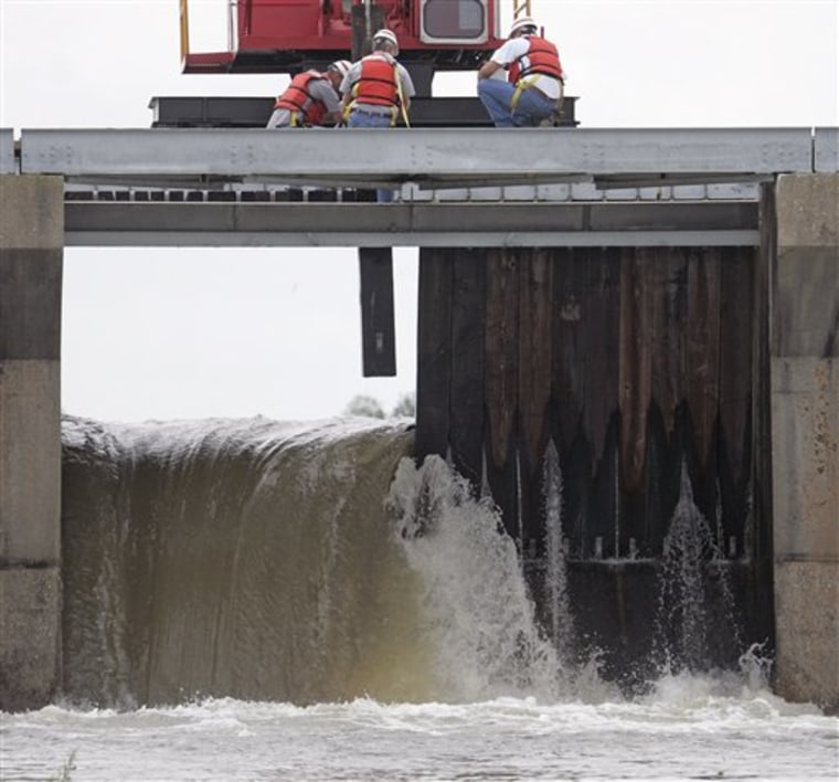
Riverfront communities across the central United States on Sunday kept up watches for new flooding, while high reservoir levels have forced the Army Corps of Engineers to open spillways.
On Saturday, a levee along a river in southeast Missouri failed for the second time in recent weeks, causing widespread flooding and forcing the evacuation of homes.
About 50 homes east of Poplar Bluff were evacuated Saturday, but no injuries were reported, Butler County Fire Chief Bob Fredwell said. Some homes had 3 feet of water in them, he said.
The section of the temporary levee that failed was along the Black River and was built to repair a break in March. That breach flooded about 1,000 people out of their homes, authorities said.
The latest flooding is much less severe than what happened in March, Fredwell said. The area has had unusually wet weather over the past few weeks.
In Arkansas, meanwhile, authorities said two people drowned Friday in Yell County when their pickup truck left a water-covered highway and was submerged.
Engineers cracked open spillways Saturday at Arkansas’ Bull Shoals Lake, allowing excess water brimming near the rim of the dam to rush down the White River to communities already flooded by weeks of rain.
More than three-fourths of Arkansas’ counties have been declared disaster areas by Gov. Mike Beebe since tornadoes tore across the state Feb. 5.
On Friday, the Army Corps of Engineers opened a spillway near New Orleans for the first time in 11 years in an effort to spare the city any flooding from the swollen Mississippi River.
Heavy rain in the Mississippi Valley prompted the decision to open the Bonnet Carre Spillway, about 30 miles north of New Orleans.
The corps said the spillway could be open for a month. Gov. Bobby Jindal, who gave the cue to open the spillway with a thumbs-up to workers, said corps officials assured him levees should hold and should not be topped.
In addition to helping guard against flooding, opening the spillway is meant to ease pressure on levees and make it safer for ships and barges to navigate the river. The Mississippi River between Baton Rouge and New Orleans is one of the world’s busiest commercial waterways.
The river is typically high in spring as a combination of northern snow melt and rain in the U.S. heartland turns it into a rushing torrent of muddy water.
Despite the annual rising of the river, the corps seldom employs the spillway. Friday’s opening was only the ninth since the spillway’s construction in 1931.
The spillway diverts river water to Lake Pontchartrain, and from there into the Gulf of Mexico. The runoff from the river is not expected to significantly raise the level of the lake, but it is expected to affect plant and marine life as fresh river water pours into the brackish lake. The state plans to monitor its effects.
The spillway has 350 gated bays, each of which holds 20 large timbers — “needles” — that are removed by cranes to allow river water to flow through. The corps planned to open 38 bays initially, though Lt. Col. Murray Starkel said more could be opened if conditions warranted.
