Like Dustin Hoffman’s Rain Man, today’s GPS navigation systems are founts of detailed data that can sometimes be maddeningly challenging in the real world. Unlike that movie’s eponymous character, however, GPS navigation systems will soon get much smarter about applying their encyclopedic knowledge.
The problem is that while most of today’s navigation systems know where the roads are and what points of interest are nearby, they don’t know how to apply that information to the driver’s current situation, said Thilo Koslowski, automotive analyst for industry researcher Gartner, Inc. “The navigation systems are not intelligent enough today to make this information contextual. Ultimately navigation must become much more ‘situational aware.’ Today it is only ‘locational aware.’”
For example, inside the Washington, D.C. Beltway, Interstate 66 and the Dulles Access Road are restricted to cars carrying two or more people headed into the city in the morning, and to those headed back out to the Virginia suburbs in the afternoon. These roads are unrestricted at other times.
But car makers such as Jaguar, Land Rover and Mazda have programmed their built-in navigation systems to exclude these roads entirely from their maps because of there are some limits on using the roads.
That's because the manufacturers didn’t want to show drivers routes that they could be ticketed for using at the wrong time, said Koslowski, so they removed I-66 and other roads which have similar restrictions. None of the car makers could provide estimates of how many roads in the United States are similarly excluded from their maps.
The complete absence of major highways that drivers can not only see but may be driving on at the time they’re checking their navigation map causes customers to distrust their nav system, said Koslowski. “When you start to distrust the navigation system, it is not good,” and could turn buyers away, he said.
Navteq, the company that provides the map data to all three automakers, assures that it is well aware of the existence of those highways and that they are included in the map data it gives car companies.
“The information for travelling on the I-66 is correctly referenced in the Navteq map and is made available to our customers,” said Navteq spokesman Bob Richter. He added, “We regret we cannot comment on the actual system performance, as it is our policy not to speak on behalf of our customers who make other necessary decisions in the final system development once we deliver our data.”
Handheld GPS maker Garmin International spokeswoman Jessica Myers said that the company would never exclude entire roads from its maps, but that its systems do not warn drivers of carpool restrictions or automatically offer to reroute directions to avoid those roads during the affected hours.
Garmin does cull some data that is provided to it by Navteq and by its other data supplier, Tele Atlas (which is a subsidiary of TomTom), she said. Points of interest that are not readily accessible to people are removed from Garmin’s database, so the devices will not direct users to ATMs or fast food stores located, for example, at airports, behind their security checkpoints, Myers said.
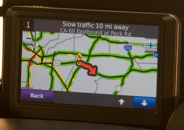
Customers can choose to avoid routes that include dirt roads, one-way streets, toll roads and ferries, she said. These options, along with the emerging availability of real-time traffic information, are the beginnings of nav systems applying intelligence to their vast knowledge.
Nav systems should consider a wide variety of factors when suggesting routes, said Koslowski. If a driver is leaving home in the morning, the computer should recognize that they are commuting to work and that there is likely to be rush hour traffic. It could also consider, in the case of the absent carpool highways, the hours of carpool restrictions and the number of people in the car — which is already known by the car for its safety systems.
Smarter computers could also consider other factors, such as a trip that passes near a stadium on the day of a game, so that it could route the driver’s trip on a longer drive that avoids the congestion that will predictably occur on highways nearby.
Web access will help
One way that navigation devices can become smarter is for them to go online and use the power of information gathered by other drivers, Koslowski said. Just as encyclopedia went from printed editions to CD-ROM-based editions to continuously updated online data sources, so mapping will evolve. It has gone from paper maps to disk-based, on-board systems requiring periodic updates, to online mapping that reflects real-world conditions.
With wireless connectivity in autos becoming increasingly pervasive, the same thing will happen with data that customers need when driving.
An early example is TomTom’s IQ Routes technology, which uses a wireless modem to devise intelligent routes based not only on real-time traffic conditions, but also on historical patterns, considering both time of day and the day of the week. This historical speed information has been gathered — with permission — over the years from TomTom customers by tracking their devices on the road, according to the company.
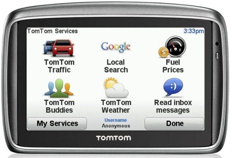
The TomTom GO 740 Live device checks for traffic updates every two to five minutes, and also offers additional services such as Google search, gas prices and weather.
But this information is available only by subscription for $9.95 a month, and subscription services are also likely to eventually become obsolete, according to Koslowski.

That's because similar information can be gathered from mobile phone users who have data plans, he pointed out.
With an already-paid-for data plan on a GPS-equipped phone, drivers should eventually be able to exploit information gathered from the movement of other such drivers, he said.
Construction delays alert
Israeli company Waze is building such a database in that country right now and plans to expand to the United States.
In addition to real-time traffic, Waze promises to be able to warn drivers of construction delays and even police enforcement — the mere presence of which can cause miles-long backups as drivers slam on their brakes and gawk at patrol cars.
“With today’s Internet-enabled GPS devices, such as smartphones, the need for real time or ‘live’ apps can be met,” said Noam Bardin, CEO of Waze. Users run a free smartphone app which lets Waze track their vehicle’s progress and warn other users if slowdowns are encountered.
This live data lets Waze calculate whether bailing off the main highway for a surface street will save time, because if that alternate route has been overwhelmed by traffic, Waze will know and can tell customers to stick with the highway or it can suggest Plan C.
In Israel, the company has achieved 15 percent penetration of the smartphone market, with 100,000 users in a nation of 7 million, said Bardin. The company will launch a beta test in the United States in July at Waze.com.
Because the system automatically generates maps based on where users are driving, no map database is required, and the company estimates that it will take customers about six months to create driver-generated maps of major metropolitan areas where the system is deployed. Those maps would include, for example, I-66 inside the Washington Beltway.
Such navigation services will eventually be much more flexible, accurate, timely and useful than today’s comparatively rigid Rain Main-style phone book recitations, matching encyclopedic knowledge with common-sense information.
