The weather in Southern California has swung from stormy to warm and dry with locally gusty winds. In other words, typical weather for the fall wildfire season.
Californians are breathing easier after a powerful storm packing strong winds and rain eased today without causing widespread mudslides and flowing debris.
The storm lost momentum by the time it reached Southern California, where up to 5 inches of rain had been forecast, and there were no thunderstorm downpours.
The National Weather Service says a ridge of high pressure will set up weak to moderate offshore flow into the weekend, with humidity levels as low as the teens and inland temperatures up to the mid-80s.
"A couple of days of Santa Ana winds and low humidities will really minimize any impact these rains might have given our fire season," said Los Angeles County fire Capt. Mark Savage.
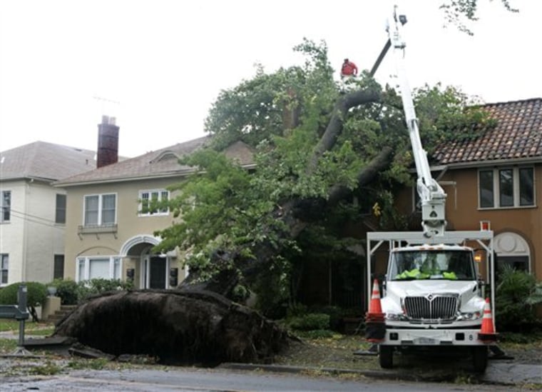
The storm delivered its biggest punch to California's northern and central areas, knocking out power to 870,000 utility customers from Southern California to the San Joaquin Valley, the Eastern Sierra and Eureka on the north coast.
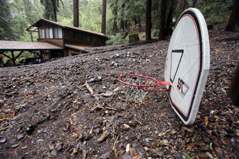
A mandatory evacuation order remained in effect for residents of about 40 homes in central coast mountains near Watsonville, east of Monterey Bay, due to mudslides, said Chris Hirsch, a spokeswoman for Santa Cruz County emergency services.
A house in Corralitos was left surrounded by mud that buried cars up to their windows and a basketball hoop to the net.
A dozen other homes were isolated because fallen trees and debris blocked roads.
"We can't get in, they can't get out," Hirsch said.
Messy commute
A snarled commute was the storm's biggest immediate impact in Los Angeles County, as vehicles collided on wet pavement and water pooled on some routes. The California Highway Patrol tallied 186 crashes between midnight and 6 a.m., nearly 10 times more than the same period a week earlier.
The storm, however, lost momentum by the time it reached Southern California, where up to 5 inches of rain had been forecast, and there were no thunderstorm downpours.
"This strong system sort of just rained itself out over Central California and as it moved down lower it had already started to exhaust itself slightly," said Jamie Stern, a National Weather Service spokeswoman. "As it moved on downward we didn't get the full effect of what the storm originally was."
Mountainsides made bare from summer fires have raised fears of mudslides and debris flows.

Many parts of the state remained under flash flood watches, meaning conditions were favorable for flooding.
Two inches of rain had fallen by midmorning in La Canada Flintridge, one of a string of Los Angeles suburbs on the foothills of the San Gabriel Mountains, where the Station Fire burned 250 square miles this summer.
Residents began breathing easier as drizzle fell on the foothill suburbs, but it continued to rain harder at higher elevations.
"From our standpoint, we're in pretty good shape, unless we have a huge increase in rain," said retired geologist Jim Conel outside his home near a damp hillside blackened by the flames. "Thank the Lord, or whoever: it's OK."
Crews continued to put movable concrete barriers and sandbags in place in communities to contain potential debris flows and direct them away from properties. The thousands of feet of barriers, called K-rail, may have to remain in place for years until the slopes stabilize.
In nearby La Crescenta, Sandra Burch waited in the rain under a blue and white golf umbrella for crews to deliver railing to protect her home. In the meantime, she and her family had placed 75 sandbags to divert water.
"I feel good that the storm wasn't as big as we thought it would be," Burch said. "I feel we are out of the woods right now."
Next door in Glendale, authorities had kept watch through Tuesday night, ready to order 65 homes evacuated if the rate of rainfall reached a half-inch an hour. Instead, the most was .2 inch an hour, said city spokeswoman Vicki Gardner.
"We're on the trailing edge of it now," she said.
Northwest of Los Angeles, Santa Barbara County resident Cherie Topper could see little flow in a creek running through her San Roque Canyon property within the steep Santa Ynez Mountains, close to where a wildfire early this year burned thousands of acres below.
"It's a warm, very gentle rain," she said. "There doesn't appear to be much in the way of drainage."
About 76,000 Pacific Gas & Electric customers were without power Wednesday, down from 686,000.
The storm damaged 140 poles and more than 102 miles of power lines, PG&E spokesman Joe Molica said.
Residents in rural areas may not have their power restored for a few more days, Molica said.
Some 11,760 Southern California Edison customers remained blacked out, down from 183,000 who had interruptions since early Tuesday, said spokeswoman Lauren Bartlett.
Reservoirs still low
While the storm brought heavy rainfall to some parts of the state, it did little to boost California's reservoirs in the Northern Sierra, which are the starting point for state and federal water supplies. That's because snow fell higher than 9,000 feet and above the snowpack that feeds the state and federal reservoirs, said Elissa Lynn, a meteorologist at the Department of Water Resources.
"The storms were big deals from a local point, but from a statewide water perspective, it hasn't yet improved things greatly," Lynn said.
Three years of below-normal rainfall and snowfall have left California's major reservoirs with less water than normal. Lake Oroville is about 37 percent full, which is about 60 percent of normal for this time of year.
