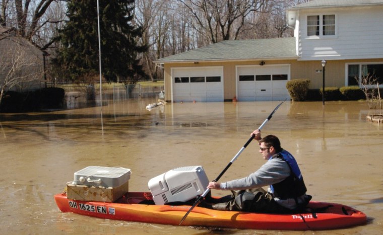
/ Source: The Weather Channel
Grounds are becoming saturated over parts of the eastern third of the United States. Earlier this week, a slow-moving storm system with high-water content dropped inches and inches of rain over the Ohio Valley and Tennessee Valley. Rivers rose rapidly and flash flooding ensued.
Another storm will strike the same regions along with the Northeast later this week, creating even more flood dangers. Below is an outline of the three regions to be impacted by flooding rains this weekend and why we are worried that this rain will give way to widespread floodwaters from the mid South to northern New England.
Flood Region #1: Ohio Valley
- Soil is already saturated due to heavy rain event on Sunday and Monday;
- Flood threshold is very low; not much additional rain is necessary before more flooding is triggered;
- Rivers are running high with more than a dozen at moderate flood stage and another 2 at major flood stage;
- Similar setup as Sunday and Monday's flood event; rich moisture tap to the Gulf of Mexico;
- Training rain and thunderstorm complexes (thunderstorms that move repeatedly over the same area);
- This flood event begins Friday morning, peaks Saturday morning and continues into Saturday night;
- Highest rainfall amounts (2 to 3 inches) forecast for in Ohio and Kentucky.
Flood Region #2: New England
- Snowpack remains over New York State and majority of New England;
- Existing snowpack translates to several inches of liquid water equivalent;
- Heavy rainfall event expected from late Friday night through Sunday night;
- Long, rich moisture feed extends from Gulf of Mexico into eastern Canada;
- Max rain amounts in the 2-to-4-inch range focused over New York State and northern New England;
- Although no rivers are currently in a certain flood stage, we are expect rapid river rises and consequential river flooding.
Flood Region #3: Tennessee Valley
- As is the case with the Ohio Valley, the region's soil is already saturated due to heavy rain event on Sunday and Monday;
- Greater risk for flash flooding as compared to river flooding;
- Training thunderstorm complexes (thunderstorms that move repeatedly over the same area);
- It wasn't that long ago (earlier this week) that we saw scenes like this in eastern Tennessee. It is likely we'll see similar images by Saturday night;
- Heaviest rainfall located over eastern TN, the southern Appalachians and far north Georgia;
- As of Wednesday afternoon, highest rain amounts will range between 2 and 4 inches;
- Rain event will begin late Friday night and end by early Sunday morning.
