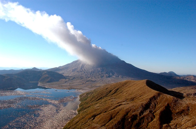
Geologist David Johnston wouldn’t have died on Mount St. Helens today.
New equipment developed since the 1980 eruption of the volcano has made it possible for volcanologists to take better measurements without hiking up the volatile mountain, a requirement 24 years ago that cost Johnston his life.
“Those measurements can be made remotely now with GPS equipment. You don’t need to be up there on the volcano,” said Dan Dzurisin, a fellow geologist who was Johnston’s friend and colleague.
New technology has also allowed scientists to make better predictions and improve their overall understanding about the complex geological forces at work at a much safer distance.
Eruption risk reduced
The instruments that ring the mountain prompted scientists to announce Wednesday that the danger of a strong eruption at any moment has passed. Even so, they warned the mountain could continue venting steam and volcanic rock for several weeks. And they said Thursday that a section of the volcano’s crater floor continued to rise, showing magma was still moving upward, but without much resistance.
“We no longer think that an eruption is imminent in the sense of minutes or hours,” Willie Scott, a geologist with the U.S. Geological Survey, said after scientists reported a lower level of seismic activity at the mountain.
Modern instruments have the advantage of measuring deformation — changes in the shape of a volcano — in three dimensions, unlike the obsolete laser reflection systems in use in 1980 that could detect changes in only one direction, Dzurisin said.
The more sophisticated Global Positioning System, or GPS, instruments would have revealed movement in the mountain that was not detected by the final reading Johnston made before Mount St. Helens exploded.
“Today, we would have known,” Dzurisin said.
Detectors and more detectors
Other tools have been added to the volcano kit for geologists over the past quarter-century, and computers have greatly enhanced analysis of the data received from those improved sensors, scientists say.
“Gee, let me count the ways it’s gotten better,” said Jake Lowenstern, who leads USGS volcano research at Yellowstone National Park and has been part of the team working at Mount St. Helens.
Besides GPS sensors that can detect movement of just half an inch, scientists can use infrared heat detectors and specialized radar to track changes in a volcano, Lowenstern said.
Seismometers, equipment that detects earthquakes, also are more sophisticated, reliable and numerous, and their signals can be fed to a computer for detailed analysis. Tremors usually are precursors to a volcano.
Newer digital broadband seismometers separate any volcano movement into three-dimensional data, Lowenstern said. “In 1980 there was only one component — you were just watching up-and-down movement,” he said.
Sampling the gases
Deformation and seismic activity are two of the three key sets of data that scientists rely on to make predictions about volcanoes. Advances also have come in the third set, volcanic gases.
Now scientists can fly over a volcano and take repeated samples of such gases, and even use GPS systems to track the flight so that computers can provide important details on changes in gas levels and concentration.
Also, scientists can use microphones to measure noise from shifting rock and video cameras to constantly monitor areas that otherwise could be inspected only periodically.
The most important change, however, is the improvement in telemetry, or the transmission of data from various remote control instruments by radio, microwave or even cell phones.
“There was essentially no way in 1980 to do anything remotely,” Lowenstern said.
