Perhaps Oswegatchie means “black river,” as Onondaga tradition claims. Or perhaps it means “coming or going around a hill.” Or maybe, as my friend suggested, it’s the trash talk you dish out to mosquitoes as you slap them: “Oss, I gotch ye!” But regardless of the correct derivation, the Oswegatchie River of New York’s Adirondacks offers many more mysterious bends than it does cryptic meanings.
Our August trip on the Oswegatchie began at the Inlet put-in, and we easily slipped upstream around a series of meandering curves. The way was initially lined with spruce and balsam, but soon opened into a sunny expanse dominated by alder thickets that choked the banks and tightly crowded out all visibility 10 to 12 feet above the river. The gray skeletons of dead snags accented this undergrowth, and higher bluffs were topped with spruces, firs, and pines, providing perches where alder flycatchers and cedar waxwings gleaned insects and hairy woodpeckers hammered.
The Oswegatchie bisects the northern region of the Five Ponds Wilderness Area in upstate New York.
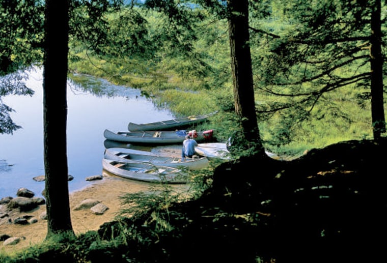
The Oswegatchie bisects the northern region of the Five Ponds Wilderness Area, and after winding upstream for a few miles, the river began to narrow and the bluffs were closer to the waterway, presenting us with places to camp. Camping is permitted either 150 feet from waterways or trails or in designated sites along the Oswegatchie corridor; some of these contain privies, others lean-tos.
Our campsite offered both. Setup was hasty because of numerous mosquitoes in the on-shore greeting party, but we had places to swim (the many curves offer excellent pools), and my east-facing tent was bathed by a golden sunrise, accompanied by a chorus of songbirds that included northern waterthrush and black-billed cuckoo.
Seren streamside camp
While the curves often separated us visually, our small string of canoes grouped at the beaver dams and strainers that became prevalent as the stream narrowed. Beaver drag paths through the alder were obvious, too, well-worn tunnels through the brush strewn with dead leaves and twigs. Our shoes and shorts were soon wet from the series of liftovers that the dams afforded us, but the sun was warm. Although most of us had to settle for seeing such evidence of beavers, the lead canoe spooked two of what they called “enormous beavers,” and the disturbed workers offered them an annoyed tail slap and disappearing dive. Maybe these builders should have contacted their union representative about being harassed on the job.
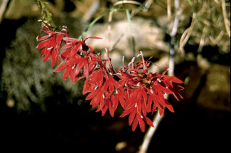
Slow stretches and rodent-induced liftovers also gave us time to take note of the bulb-like purple blooms of closed gentian and the brilliant, yet delicate, red offered to the sun by strings of cardinal flowers along the banks. Here, too, in the sand deposited by the river’s curves were otter, raccoon, and bobcat tracks—impressions from the night’s forays.
The forest eventually dominated the passage, and a phalanx of spruce and fir guarded either shore as the trip continued south. When we reached the small footbridge that marked a trail crossing 11 miles upstream from Inlet, we traded our paddles for hiking boots, taking the few-mile round-trip into the five ponds for which the wilderness area is named. It is an easy hike, hugging the contours of a glacial esker and ending in the clear reflections of the small ponds such as Big Shallow and Little Five, where we dodged a passing thunderstorm, sharing our lean-to shelter with some Russian tourists.
Many paddlers continue upstream to High Falls, a small but pretty cascade that often marks the end of paddling. Canoes lifted above the falls can travel several more miles (4-7), depending on water level, where there is a series of designated campsites. The campsites at High Falls are popular with hikers and paddlers alike, so if you want to stay there, arrive early and plan on sharing space.
Another attractive site is High Rock (it sits about four miles from Inlet), so named because it rises high above the river. It too offers several places to tent and a view from above of the stream’s wandering path, but its popularity makes it a difficult campsite to reliably plan on. We were fortunate, for on our return trip downstream we raced from a thick black line of clouds booming ominously at our stern. We had barely enough time to secure our boats and set our tents before the deluge came.
My tent was, perhaps unwisely, pitched at the highest point on High Rock, and I watched in awed terror from my lookout as lightning poured from the clouds above to illuminate the wide swath of alder that stretched below. I felt a bit like John Muir in his tree during a windstorm in the Sierras, but chose to come down from my pinnacle as the storm passed directly overhead, bringing a bolt that appeared to strike but 30 feet from my comrade’s suddenly well-lit tent, where he lay hunkered. He swears it struck closer than that.
Our trip returned to Inlet, offering us a chance to run the series of beaver dams while heading downstream, and we could often build up enough speed to pass over the low dams in this manner. To avoid doubling back to Inlet as we did, begin your trip by paddling the Bog River, which dumps into Lows Lake, the western shores of which border the wilderness area. From the eastern end of Lows it is about a three-mile portage (broken up by Big Deer Pond) to the Oswegatchie a few miles upstream from High Falls.

Below Inlet, the Oswegatchie is all but impassable for the two-mile stretch to the town of Wanakena. Paddlers can, however, put in at Wanakena and negotiate the growing expanse of Cranberry Lake, the southern shore of which forms the northern boundary of the wilderness area. Cranberry Lake does allow for some exploration of the long arms of its almost spiderlike shape, but paddlers should be wary of both strong winds and the noise and wake of motorboats. The folks I met while paddling the lake were gracious with their speed, but the lake is not optimal for quiet or seclusion.
The Oswegatchie reforms as the northbound outflow of Cranberry Lake and winds its way out of Adirondack Park in pursuit of the St. Lawrence River. This stretch of the Oswegatchie is dammed in many places—not by the alder sticks of beaver architects but by concrete—retarding its flow to lakelike stillness. You will not find the wilderness solitude of the Five Ponds, but they are good places to see loons and bald eagles attracted to the wider bodies of water. One such location is the Chaumont Swamp region, just west of the town of Newton Falls, where tamaracks border a relatively secluded swamp.
is the number one paddlesports resource, with a wealth of information about canoeing and kayaking destinations, gear, and techniques.
