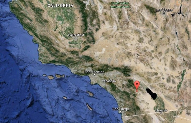
Residents across Southern California were jarred awake early Friday by a 5.1-magnitude earthquake that rocked the region but left no significant damage.

The U.S. Geological Survey said the moderate earthquake struck a desert area around 60 miles northeast of San Diego and 30 miles south of Palm Springs at 1:05 a.m. local time (4:05 a.m. ET).
The quake, which struck at a depth of less than 1 mile, was followed by three nearby aftershocks over the next three minutes measuring between magnitude 2.8 and 3.5, according to the USGS. Another two aftershocks of similar magnitudes were recorded over the next 40 minutes.
The epicenter was around 13 miles north of Borrego Springs, which has a population of around 3,500.
The local police department, Los Angeles County Fire Department and the Riverside County Sheriff's office said they had received no reports of damage.
The quake was near the San Jacinto Fault, which is historically Southern California's most active fault.
Lucy Jones, a seismologist with the USGS, tweeted that aftershocks could occur, but it was otherwise "normal activity."
Facebook and other social media sites carried posts from people in San Diego and Los Angeles, about 100 miles to the west, reporting they felt the quake:
