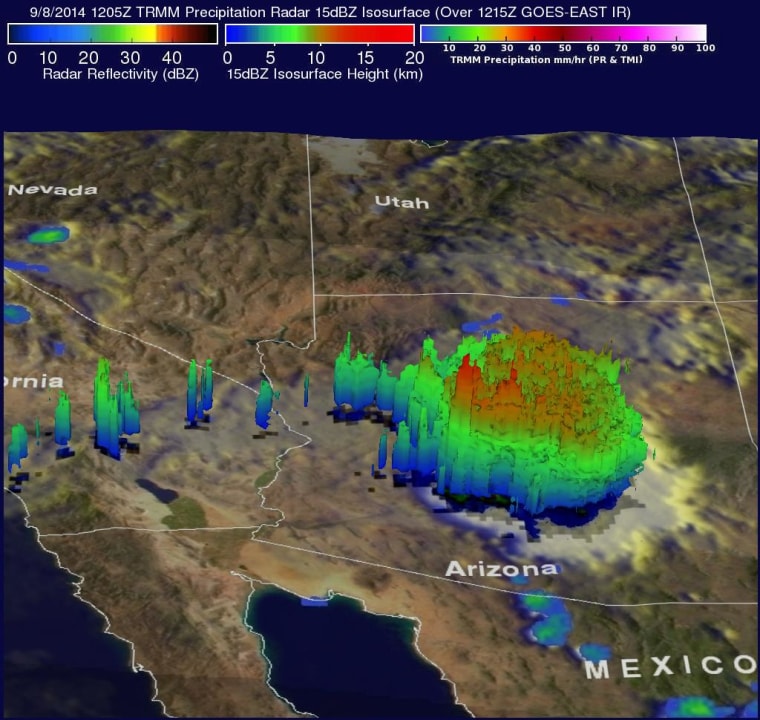
A NASA satellite got a bird’s-eye view of the record rain that dumped on Phoenix and other parts of Arizona on Monday, and the resulting data add another perspective on just how strong the storms were. The TRIMM satellite flew above the remnants of Hurricane Norbert early Monday and spotted just light to moderate rainfall directly over the storm’s center of circulation, NASA said.
But a later pass by the satellite that day showed that 1,000 miles to the northeast, Norbert’s counterclockwise circulation was generating huge thunderstorms over central Arizona. Data from TRIMM’s Precipitation Radar was used to produce a 3-D image showing the intensity of the rainfall: more than 2.4 inches (62 millimeters) per hour in some places. The result was a record 3.29 inches of rain on Monday in Phoenix that swamped highways and homes, knocked out power and left at least one person dead. The TRIMM data showed that the tops of some of the thunderstorms rose nearly 8.5 miles (13.5 kilometers) high, NASA said. Too bad all that rain might not do much to alleviate the region’s long-term drought.
IN-DEPTH
- California Wildfire Seen From Space
- SpaceX Launches Satellite After Weeks of Delay
- Gallery: Heavy Rains Flood Parts of Southwest
