IE 11 is not supported. For an optimal experience visit our site on another browser.
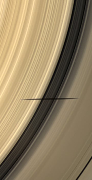
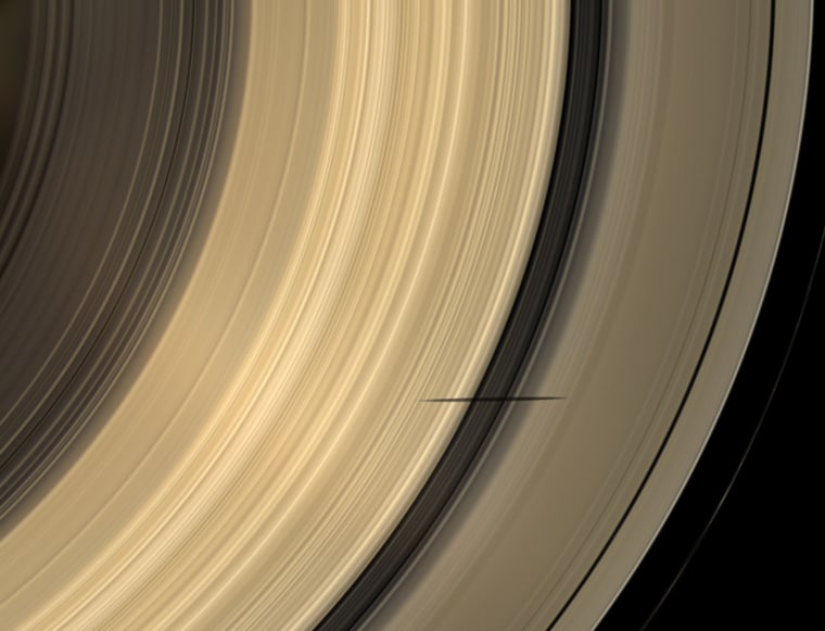
The shadow of Saturn's moon Mimas dips onto the planet's rings and straddles the Cassini Division in this natural color image taken as Saturn approaches its August 2009 equinox. The novel illumination geometry created as the Saturnian system approaches equinox allows moons orbiting in or near the plane of Saturn's equatorial rings to cast shadows onto the rings. These scenes are possible only during the few months before and after Saturn's equinox which occurs only once in about 15 Earth years. To see a movie of Mimas' shadow moving across the rings, see PIA11658 <view.php?id=5591>. Mimas (396 kilometers, 246 miles across) does not appear in this image, but the moon has a flattened, or oblate, shape (see PIA07534 <view.php?id=1138>). This view looks toward the sunlit side of the rings from about 52 degrees below the ringplane. Images taken using red, green and blue spectral filters were combined to create this natural color view. The images were obtained with the Cassini spacecraft wide-angle camera

Science News

Month in Space: June 2009

See moonshadows on Saturn's rings, volcanoes on Earth and Mars and other out-of-this-world imagery from June 2009.
/ 17 PHOTOS
The shadow of Saturn's moon Mimas dips onto the planet's rings and straddles the Cassini Division in this natural color image taken as Saturn approaches its August 2009 equinox.

The novel illumination geometry created as the Saturnian system approaches equinox allows moons orbiting in or near the plane of Saturn's equatorial rings to cast shadows onto the rings. These scenes are possible only during the few months before and after Saturn's equinox which occurs only once in about 15 Earth years. To see a movie of Mimas' shadow moving across the rings, see PIA11658 <view.php?id=5591>. Mimas (396 kilometers, 246 miles across) does not appear in this image, but the moon has a flattened, or oblate, shape (see PIA07534 <view.php?id=1138>).

This view looks toward the sunlit side of the rings from about 52 degrees below the ringplane. Images taken using red, green and blue spectral filters were combined to create this natural color view. The images were obtained with the Cassini spacecraft wide-angle came

Moonshadow on Saturn's rings

The spiky black shadow of Saturn's moon Mimas dips onto the planet's rings and straddles the Cassini Division in this natural color image, taken by the Cassini orbiter as Saturn approaches its August equinox. Shadows on Saturn's rings are extremely elongated at this time in Saturn's 29.5-year orbit because the rings are facing the sun nearly edge-on. The picture was taken on April 8 and released on June 22.
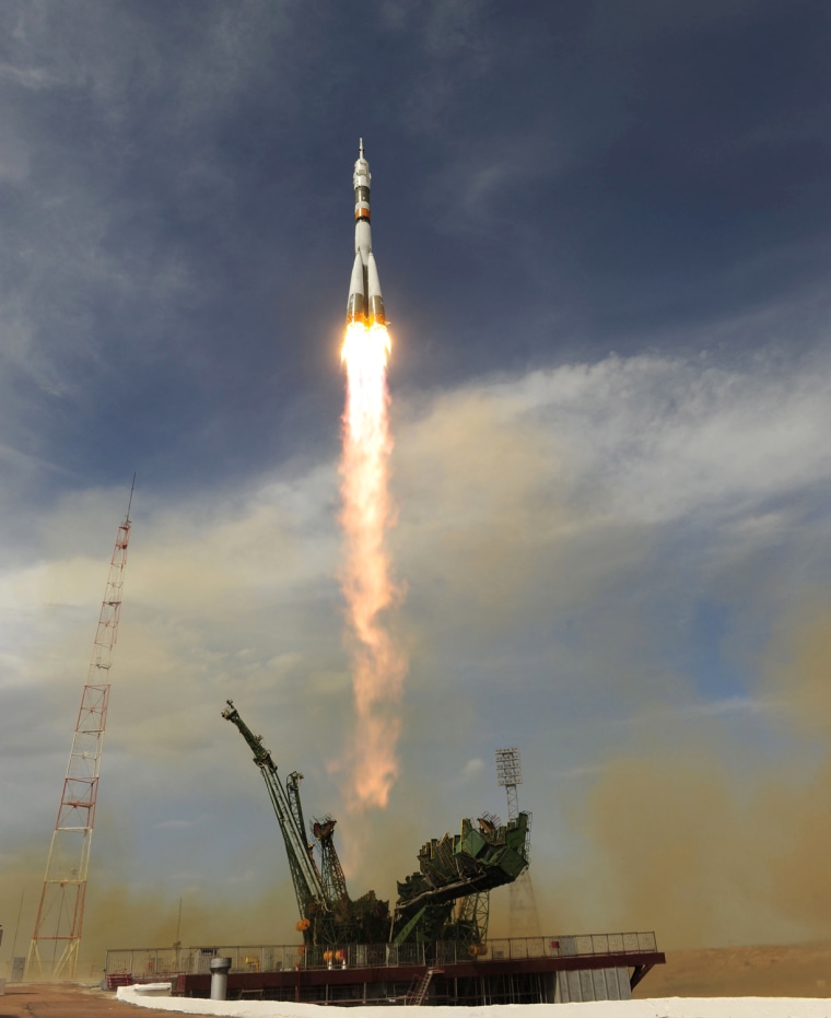
Soyuz TMA-15 Launches In Kazakhstan

Tail of flame

Russia's Soyuz TMA-15 spacecraft is launched from the Baikonur Cosmodrome in Kazakhstan on May 27. The Soyuz craft brought three more astronauts to the international space station, expanding the station's expedition crew to six for the first time.

Esa / Getty Images Europe
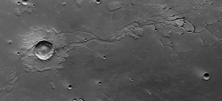
This image of Hephaestus Fossae was obtained by ESAÕs Mars Express orbiter on 28 December 2007. The region is dotted with craters and channel systems and lies at about 21¡N and 126¡E on the Red Planet. Named after the Greek god of fire, Hephaestus Fossae extends for more than 600 km on the western flank of Elysium Mons in the Utopia Planitia region.

Channels on Mars

This image of Hephaestus Fossae, acquired in December 2007 and released on June 5, comes from the European Space Agency's Mars Express orbiter. Named after the Greek god of fire, Hephaestus Fossae extends for more than 375 miles on the western flank of the Martian mountain Elysium Mons. The region's channel system may have been created when a giant impact penetrated the surface enough to melt a reservoir of frozen water, creating runoff.
Marine green

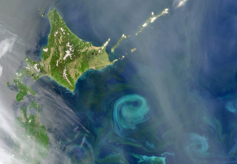
In the northwest Pacific Ocean, the Oyashio Current flows down out of the Arctic, past Siberia and the Kamchatka Peninsula. Around the latitude of Japan's Hokkaido Island, it begins to veer eastward and converges with the warmer Kuroshio Current. This image from NASA's Aqua satellite, captured May 21, shows how the convergence of these two currents affects blue-green swirls of phytoplankton floating in the sea.
Ares I-X Hardware Stacking
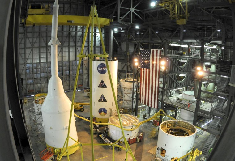
June 18, 2009 -- Hardware for the Ares I-X flight test rocket is prepared for stacking in NASA's Vehicle Assembly Building at Kennedy Space Center in Florida. Rocket pieces that were once at various manufacturing sites spread across the country in a 2,000 mile circle are now within a quarter mile of the NASA processing facilities. Next month, the pieces will be moved within an 18 foot circle as the Ares I-X team prepares to stack the vehicle.

Stacking up

Components for the Ares I-X flight test rocket are prepared for stacking in NASA's Vehicle Assembly Building at Kennedy Space Center in Florida on June 18. Rocket pieces that were once at various manufacturing sites spread across the country will be assembled for a test launch later this year.
Sulface and clay strata in Gale crater on Mars

Mars revealed

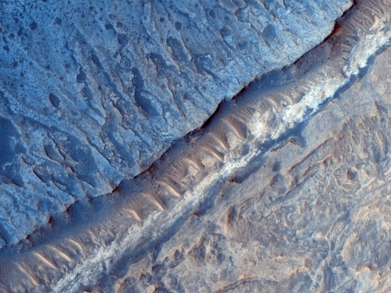
A false-color image from the high-resolution camera on NASA's Mars Reconnaissance Orbiter reveals variations in the composition of clay and sulfate-bearing rocks in Gale Crater on the Red Planet. Gale Crater is one of the potential landing sites being considered for NASA's Curiosity rover, which is due for launch in 2011. This picture, released June 17, is based on data acquired in March.
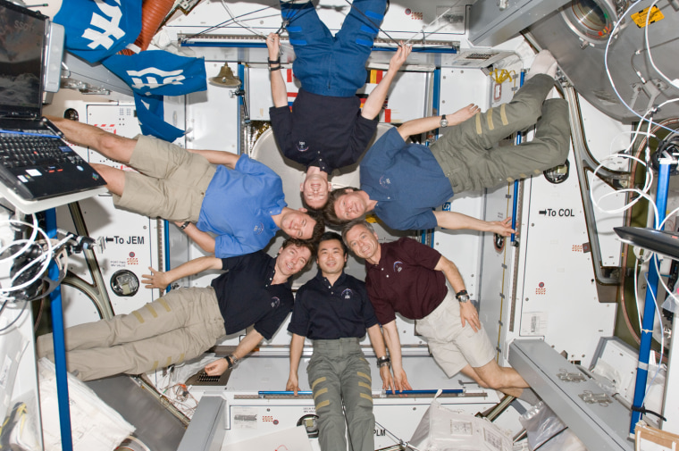
ISS020-E-008898 (14 June 2009) --- The six-person Expedition 20 crew poses in \"star-burst\" formation for an in-flight portrait in the Harmony node of the International Space Station. Pictured clockwise from right (center) are cosmonaut Gennady Padalka, commander; Canadian Space Agency astronaut Robert Thirsk, Japan Aerospace Exploration Agency (JAXA) astronaut Koichi Wakata, NASA astronaut Michael Barratt, cosmonaut Roman Romanenko and European Space Agency astronaut Frank De Winne, all flight engineers.

Putting their heads together

The six-person Expedition 20 crew poses in "starburst" formation for an in-flight portrait in the Harmony node of the international space station on June 14. Pictured clockwise, from right center, are Russian commander Gennady Padalka, Canada's Robert Thirsk, Japan's Koichi Wakata, NASA's Michael Barratt, Russia's Roman Romanenko and the European Space Agency's Frank De Winne.
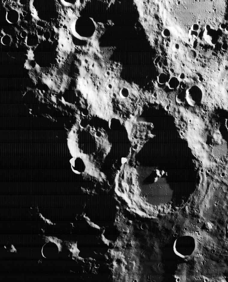
This image was taken by Lunar Orbiter IV in May 1967 and shows the south pole of the Moon. Figure 1 shows the region without labels. Figure 2 shows major features plus notation regarding processing artifacts from the spacecraft's film processing system. The moon's south pole is located near the rim of Shackleton Crater <http://en.wikipedia.org/wiki/Shackleton_(crater)>. 
Adjacent to the south pole is Shoemaker crater <http://en.wikipedia.org/wiki/Shoemaker_(lunar_crater)> named in honor of famed planetary geologist Eugene Shoemaker <http://en.wikipedia.org/wiki/Eugene_Shoemaker>. The Lunar Prospector <http://en.wikipedia.org/wiki/Lunar_Prospector> spacecraft, carrying some of Shoemaker's ashes, was deliberately crashed in this crater in an attempt to see if any water ice would be thrown up by the impact.
The Lunar CRater Observation and Sensing Satellite <http://lcross.arc.nasa.gov/> (LCROSS) will be targeted to impact at the south pole of the moon. As such, the moon's polar regions are of great inter

Old moon ...

This image, taken by Lunar Orbiter 4 in May 1967, shows the south pole of the moon. The picture was recovered from the original Lunar Orbiter project data tapes, reprocessed and then released in high definition on June 14.

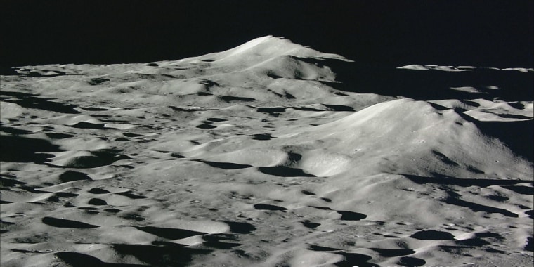
The Japan Aerospace Exploration Agency (JAXA) and the Japan Broadcasting Corporation (NHK) would like to release the final still images taken by the onboard High Definition Television (HDTV) of the lunar explorer \"KAGUYA\" just prior to its maneuvered falling to the Moon. The images are attached below. The KAGUYA was launched on September 14, 2007, and was controlled to be dropped to the Moon on June 11, 2009, as its mission was completed.

The series of continued shots was taken with an interval of about one minute by the HDTV (Teltephoto) while the KAGUYA was maneuvered to decrease its altitude toward the impact position (around GILL crater.)

We can see the approaching Moon surface as the KAGUYA went closer to it. After the final image, the KAGUYA moved into the shaded area to make its final landing, thus it was pitch dark while taking an image. This is the very final image shooting of the Moon by the KAGUYA HDTV.

You can enjoy images taken by the KAGUYA HDTV through JAXA Digital Archives, th

... And new moon

This is one of the last high-resolution images of lunar terrain sent back from Japan's Kaguya orbiter, just before it made a controlled crash onto the moon's surface on June 11.

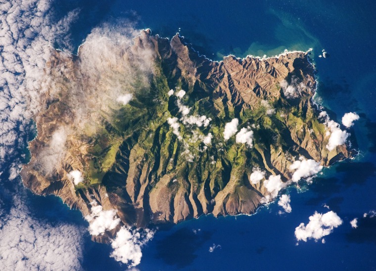
Saint Helena Island, located in the South Atlantic Ocean approximately 1,860 kilometers (1,156 miles) west of Africa, was one of the many isolated islands that naturalist Charles Darwin visited during his scientific voyages in the nineteenth century. He visited the island in 1836 aboard the HMS Beagle, recording observations of the plants, animals, and geology that would shape his theory of evolution. This image was acquired by astronauts onboard the International Space Station as part of an ongoing effort (the HMS Beagle Project <http://www.thebeagleproject.com/index.html> to document current biodiversity in areas visited by Charles Darwin.
This astronaut photograph shows the islandÕs sharp peaks and deep ravines; the rugged topography results from erosion of the volcanic rocks that make up the island. The change in elevation from the coast to the interior creates a climate gradient. The higher, wetter center is covered with green vegetation, whereas the lower coastal areas are drier and hotter, wit

Evolving island

St. Helena, located in the South Atlantic Ocean, was one of the many isolated islands that naturalist Charles Darwin visited during his scientific voyages in the nineteenth century. This image of St. Helena was acquired by astronauts onboard the international space station in May and released on June 15 as part of the HMS Beagle Project, an effort to document current biodiversity in the areas Darwin visited. Before Darwin's day, St. Helena was where an exiled Napoleon Bonaparte spent the last years of his life.
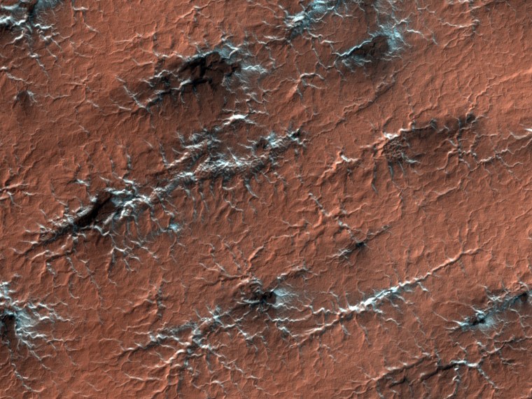
How Martian spiders evolve

Formations shaped like spider webs stretch over Martian terrain in this high-resolution image from NASA's Mars Reconnaissance Orbiter, released on May 27. Scientists don't fully understand the origins of the formations, but the "spiders" emerge when carbon dioxide ice dissipates on Mars, revealing the soil below.
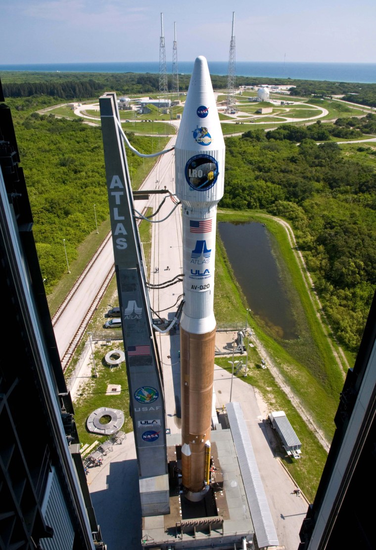
This NASA handout photo shows NASA's Lunar Reconnaissance Orbiter, or LRO, and Lunar Crater Observation and Sensing Satellite, or LCROSS, rolled aboard their Atlas V rocket to the launch pad at Cape Canaveral Air Force Station in Florida in preparation for launch. NASA is set to blast off probes June 18, 2009 on a landmark lunar exploration mission to scout water sources and landing sites in anticipation of leading man back to the moon.The US space agency, hoping to send astronauts to Earth's natural satellite by 2020 for the first visit since 1972, announced it is on course to launch the dual LRO and LCROSS missions atop an Atlas V rocket from Florida's Kennedy Space Center. A day after scrubbing the shuttle Endeavour launch for the second time in a week because of a nagging hydrogen fuel leak, NASA said it has three launch windows ready at 5:12 pm (2112 GMT), 5:22 pm (2122 GMT) and 5:32 pm (2132 GMT). (Photo credit should read HO/AFP/Getty Images)

To the moon!

NASA's first lunar probes in a decade - the Lunar Reconnaissance Orbiter and the Lunar Crater Observation and Sensing Satellite, or LCROSS - sit atop an Atlas 5 rocket during the rollout to the launch pad in preparation for liftoff on June 18. The spacecraft will scout potential water sources and landing sites in anticipation of human missions to the moon.
Ho / NASA

Mercury's rays

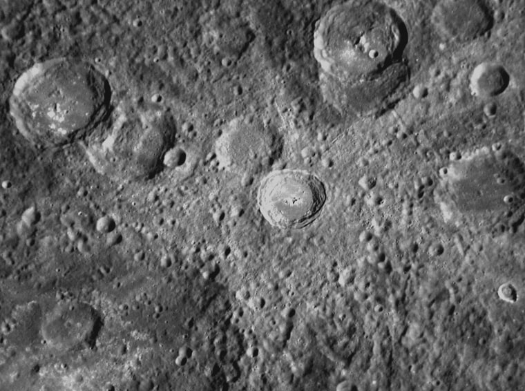
This image from NASA's Messenger spacecraft shows a crater on the planet Mercury with a set of light-colored rays radiating outward. Such rays are formed when an impact excavates material from below the surface and throws it out from the crater. Messenger acquired the data for the picture during a flyby in October 2008, and the resulting picture was released June 9.
Nasa / Johns Hopkins University
Image from NASA's Mars Reconnaissance Orbiter

Valleys on Mars

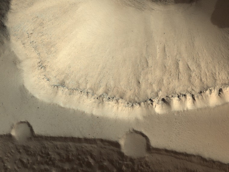
This image from NASA's Mars Reconnaissance Orbiter, released on June 18, shows a series of flat-bottomed valleys along the flanks of the Martian shield volcano Elysium Mons.

Ho / X80001
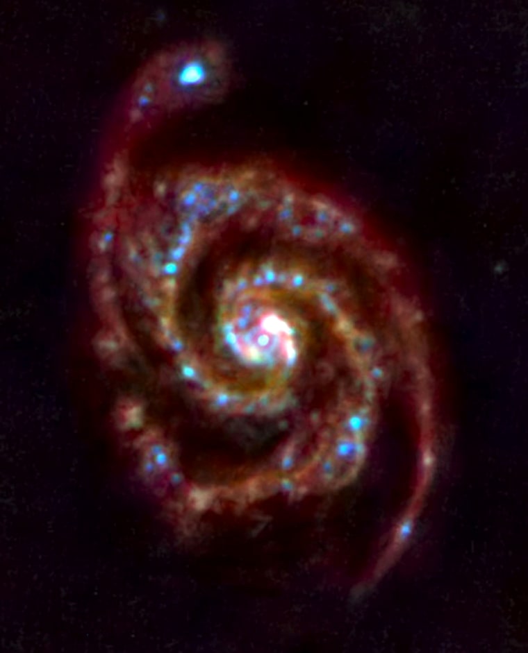
Three-colour far-infrared image of M51, the Ôwhirlpool galaxyÕ. 

Red, green and blue correspond to the 160-micron, 100-micron and 70-micron wavelength bands of the HerschelÕs Photoconductor Array Camera and Spectrometer, PACS. 

Glowing light from clouds of dust and gas around and between the stars is visible clearly. These clouds are a reservoir of raw material for ongoing star formation in this galaxy. Blue indicates regions of warm dust that is heated by young stars, while the colder dust shows up in red.

First look

This infrared view of M51, the Whirlpool Galaxy, represents the first test observation by the European Space Agency's recently launched Herschel spacecraft. The image, released June 19, combines three infrared wavelengths to produce a view of the galaxy's stars and clouds of dust and gas.
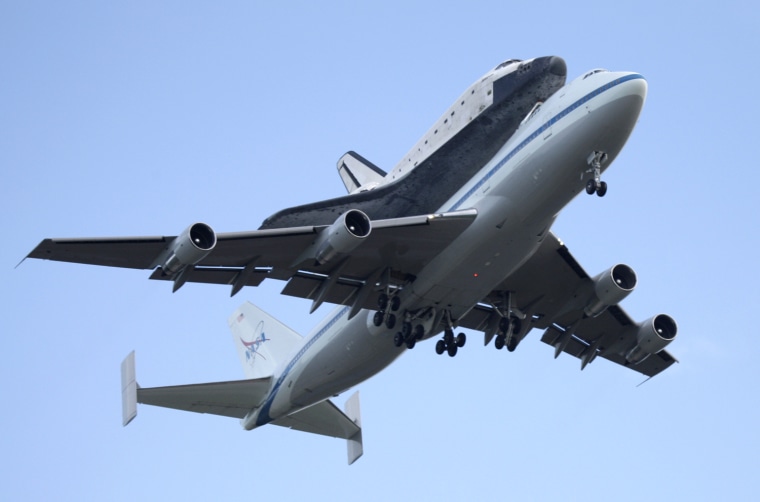
After a flight from Edwards Air Force Base space shuttle Atlantis returns to Kennedy Space Center aboard a NASA 747 in Cape Canaveral, Fla., Tuesday, June 2, 2009. (AP Photo/John Raoux)

Take me home

The space shuttle Atlantis takes a piggyback ride back home to NASA's Kennedy Space Center in Florida on June 2, on top of a modified Boeing 747 jet. The $1.8 million cross-country trip was required because Atlantis landed in California at the end of its flight to fix the Hubble Space Telescope.

John Raoux / AP
1/17