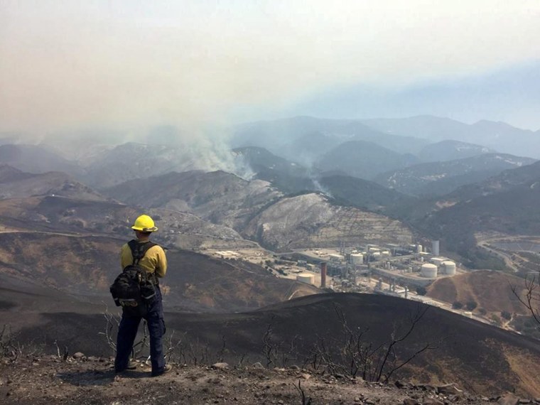
Firefighters battling a growing wildfire near the Southern California coast got a small reprieve Friday night but were bracing for rising temperatures as an extreme heatwave threatened to roast the Southwest with triple-digit temperatures this weekend.
The so-called Sherpa Fire — one of several active wildfires burning in 10 states on Saturday — more than tripled in size Friday in Santa Barbara County, and by Saturday afternoon and had scorched more than 7,811 acres, officials said.
PHOTOS: Sherpa Wildfire Threatens Santa Barbara
There was some good news: The blaze was 45 percent contained as of Saturday afternoon, up from 24 percent earlier in the day.
And U.S. 101, the state's major coastal highway, in the Santa Barbara area which officials shuttered for two nights in a row, was reopened Saturday morning.

But authorities feared so-called "sundowner" winds, which rush down the mountains in 40 mph gusts, would return by nightfall, complicating efforts to quell the flames.
The notorious winds can produce powerful gusts and raise temperatures due to the collision of hot air from the Santa Ynez Mountains and the cool air of the Pacific Ocean, according to The Los Angeles Times.
They were forecast for Friday night, but officials said at a news conference Saturday morning that they got a lucky break and no significant sundowner winds surfaced.
"We had a very good night last night," said Santa Barbara County Fire Chief Eric Peterson.
Related: Santa Barbara-Area Homeowners Forced to Flee Growing Sherpa Wildfire
A red flag warning — meaning weather conditions would be particularly conducive to fires — was in effect from 5 p.m. PT Sunday to 10 a.m. PT Tuesday for gusty sundowner winds, according to the National Weather Service.
No one has been killed or injured in the three-day-old fire, and no structures have been lost, officials said. But with temperatures forecast to go up and the ongoing threat of sundowner winds, the fire was still a formidable force.
Blazing temperatures of up to 120 degrees in some parts of Southern California were expected to worsen the fire dangers. Potentially record-shattering temperatures could affect some 65 million people across the South and Southwest, including in Phoenix, which could see mercury levels rise to 118 degrees.
Multiple air quality alerts were also issued, specifically for people with respiratory problems.
"It's very hot and dangerous," Susan Klein-Rothschild with the county health department said of the blaze. "The last couple of nights ... it's calmer during the day and the eruptions and explosions and expansions have happened during the night hours."
More than 1,200 fire personnel have been battling the blaze since Wednesday by ground and by air. The cause of the Sherpa Fire was under investigation.
Meanwhile, another fire erupted Friday afternoon in Northern California. The wind-driven blaze southwest of Sacramento quickly burned 200 acres of grasslands and prompted the evacuation of China Gulch, a tiny community in the historic Gold Country.
By evening, though, the fire's forward movement had been stopped.
In central New Mexico, a blaze that began Tuesday had destroyed 24 homes and charred more than 26 square miles near the small community of Chilili. The so-called Dog Head Fire remained 0 percent contained on Saturday morning.
Lighter winds were helping firefighters battle the blaze in triple-digit temperatures.
The California inferno appeared to support national wildfire authorities' predictions of another dangerous and difficult year for the state after years of drought. State firefighters and the U.S. Forest Service already have fought more than 1,800 wildfires since Jan. 1, the California Department of Forestry and Fire Protection said.
While El Nino delivered rain and snow to Northern California this winter, the south was bypassed. What rain fell was just enough to sprout grasses that quickly died, adding to the danger of long-dead vegetation.
About 270 homes and ranches were considered at risk in southern Santa Barbara County at the foot of the Santa Ynez Mountains, an east-west trending range that parallels the south-facing coast.
In east-central Arizona, progress was made against a 15-square-mile blaze that broke out Wednesday south of Show Low.
Crews deliberately burned thousands of acres to deprive the fire of fuel.
Much of the fire is burning in terrain too rugged for safe work on the ground, so crews have concentrated on clearing firelines along a highway, roads and a power line, said Rick Miller, the fire team's operations section chief.
However, a small Navajo County community remained evacuated and thousands of other residents were told to be prepared in case they had to leave.
