Ever wish Google's Street View extended into your back yard, or the little museum down the street, or your favorite hiking trail? Make your fantasy a reality by doing it yourself with a few of Android's "photo spheres" and a new online tool.
First, you'll need to take a few dozen pictures. Most new Android phones have the "photo sphere" panoramic function built into the camera app, so go to your location and start snapping away. You can also take pictures with a regular camera and stitch it together later, but the Android method is quicker.
Take photo spheres 20 or 30 feet away from each other, so that navigating between them won't be tedious (sometimes it takes quite a few clicks to get around in Street View). Then when you're all done, upload them (in full resolution) to your Google+ account's Views section.
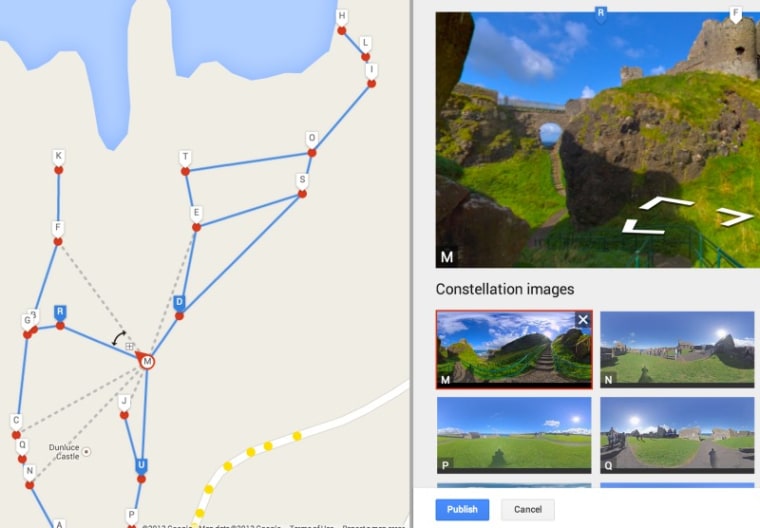
In a browser, go to your photo sphere collection and select the ones you'd like to connect. It should pop them onto an overhead map of the area you took them. Drag them to the right spots to correct for GPS errors, make sure the spheres are orientated correctly, and then click the dotted lines to select the paths viewers can go along.
More detailed instructions are provided here, but a little trial and error won't hurt. And be careful to check the privacy settings on your spheres and newly created Street View — you don't want a tour of your house to show up next to maps of your home town.
Devin Coldewey is a contributing writer for NBC News Digital. His personal website is coldewey.cc.
