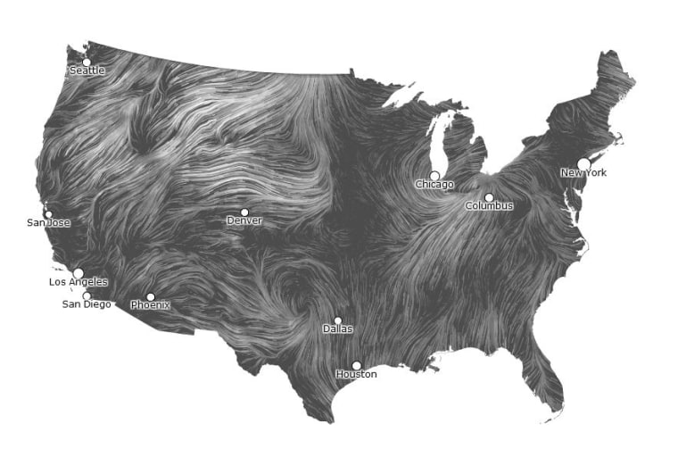
The wind is all around us. You can see it move the trees, sweep through grasses, and ruffle your child’s hair. And now, we can click on a wind map of the United States and see it streaking across the country in real time.
The wind map is the creation of technologists Fernanda Viegas and Martin Wattenberg, who lead Google’s "Big Picture" visualization research group in Cambridge, Mass. Their aim is to "invent new ways for people to think and talk about data," they explain on their website.
Wind, they note, is an ancient source energy that is all around us –- "energy that powered the first explorations of the world, and that may be key to the future."
The wind map, they team notes, is a personal art project that is not associated with any company. This project echoes computer-generated visualizations of how Earth’s oceans flow and the universe grew up, highlighted in msnbc.com’s Cosmic Log.
--Via Discovery News
John Roach is a contributing writer for msnbc.com. To learn more about him, check out his website and follow him on Twitter. For more of our Future of Technology series, watch the featured video below.