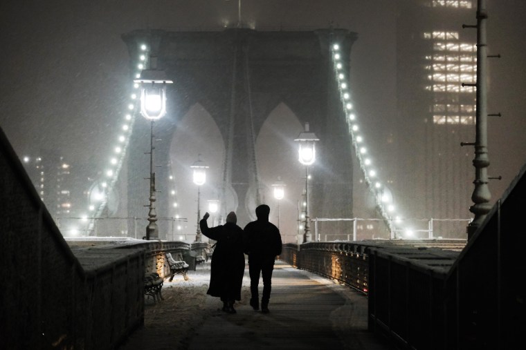
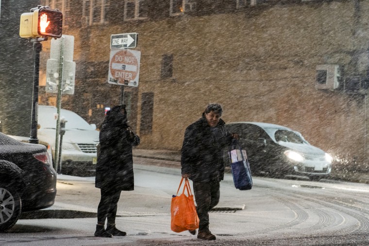
Forecasters expect another powerful storm system to cross the country this week after the Northeast was hit with multiple inches of snow Tuesday in what was deemed the biggest snowstorm of a relatively dry winter.
At least 33 million people are under winter alerts from California through the upper Midwest and into the Northeast. The storm will blast points north and east with snow, as well, the National Weather Service said, with some places in New England having already awakened to 8 inches.
Snow began falling Monday evening, covering streets and vehicles in a thin layer of snow in New York City. Parts of upstate New York were in for more snow during the first half of the day Tuesday, while New York City’s accumulating snow ended by midmorning.
The final snow total in New York City was 1.8 inches, according to the National Weather Service.

"We haven’t seen snow this year, but we’re ready for it," New York Mayor Eric Adams tweeted Monday.
Adams said city workers were "prepared to plow anywhere we accumulate 2 inches" of snow.
The National Weather Service said New York City was on the southern edge of the storm, which would have limited precipitation "but still likely [be] the biggest snowstorm of the season."
Much of the Hudson Valley and northern New Jersey also got several inches of snow by Tuesday morning, including 6 inches in Bloomingdale, New Jersey.
Federal forecasters in Buffalo, in western New York, said the storm dropped a 4-inch blanket of snow in a few hours Monday night, with more expected Tuesday.
The National Weather Service office that covers Buffalo described it on Twitter as a “burst of heavy snow.”
Storm could cause travel chaos
The National Weather Service warned of "hazardous driving conditions" in parts of New England and upstate New York. "Use extra caution while driving," it said, noting that closings and disruptions to infrastructure could occur.
By early Tuesday, dozens of flights within, into and out of the U.S. had been canceled at New York airports. It was not immediately clear whether the cancellations were due to the weather.

At least 85 flights were canceled at LaGuardia Airport, while 36 more were listed as canceled at John F. Kennedy International Airport, according to the online flight tracker FlightAware. At least 26 were halted at Newark Liberty International Airport in New Jersey.
Overall, more than 400 U.S. flights were canceled early Tuesday, at least 44 of them at Boston Logan International Airport, according to the flight tracking website.
Nearby states prepare for impact
The forecast prompted Gov. Ned Lamont of neighboring Connecticut to close all state buildings under his office's control Tuesday. In a statement Monday night, he urged people to stay off the roads if possible.
"We’ve lucked out so far this winter season with very little snow up until now, however that is looking like it will change Monday night as a significant snowstorm will come through Connecticut,” Lamont said.
He ordered nonessential state workers to work from home or, if that wasn't possible, to stay put, as 600 trucks used to salt roads and plow snow were being deployed to keep Connecticut's roadways open.
The Massachusetts Emergency Management Agency said Monday that power outages were possible in central and western regions of the state, where higher snowfall was expected.
Federal forecasters blamed a system, with cold air "locked in place," that is moving east from the Great Lakes to the Northeast and eventually into the northern edges of New England.
The system triggered winter storm warnings and other winter weather advisories from central Pennsylvania to coastal Maine.
As forecasters in parts of New York tracked snowfall across the state, the storm was also bringing steady rainfall to Baltimore and Washington on Monday, while the Allegheny Mountains to the west were likely to get freezing fog, the weather service said.
Cross-country storm beginning in California
Another storm affecting California on Tuesday is expected to make its way across the U.S. over the next few days, ending in the Great Lakes and Northeast regions by Friday.
California, which has already had unusually large amounts of rain and snow, will get more Tuesday. The Sierra Nevada could get 2 to 4 more feet of snow into Wednesday.
States such as Arkansas, Tennessee and Mississippi should brace for severe thunderstorms capable of hail, high winds and a tornado or two Wednesday.
Other areas of the country will get more severe weather on Thursday; 34 million people in the southern Plains and Southeast are likely to be at risk for hail, wind and few strong tornadoes. A severe weather outbreak is possible.
The system is expected to hit the Eastern seaboard Friday in a wintry mix of rain, sleet, hail and snow.
Outages continue in Michigan and California
Other parts of the country continue to grapple with the aftermath of recent severe weather, with more than 147,000 utility customers still without power in Michigan early Tuesday after a brutal ice storm last week. Many have been without power for days as officials work to restore service.
Nearly 50,000 people were also without power after storms pummeled parts of California, prompting rare blizzard warnings.


