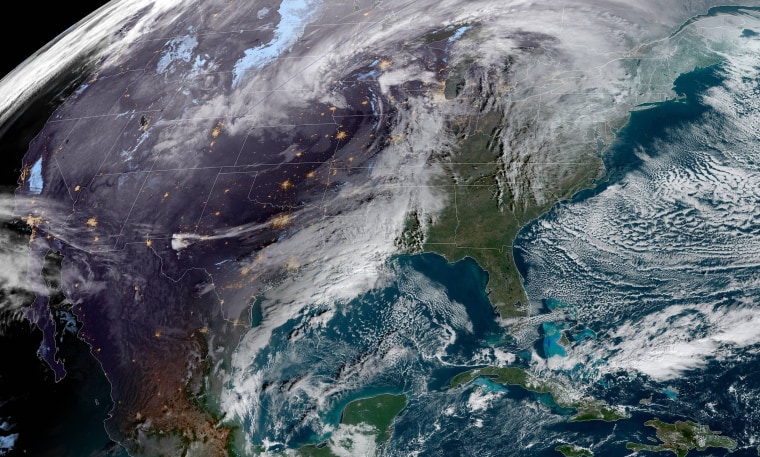
Expect a wet, windy and, yes, even white Christmas week, as a powerful storm system makes its way across the country through Friday.
Heavy snow and high winds are expected to cause blizzard conditions in the Plains and the upper Midwest, including Minneapolis, on Wednesday. Heavy rain is expected across the Midwest, while severe thunderstorms are likely across the Gulf Coast, including in New Orleans.
On Christmas Eve, snow and wind are expected across the Great Lakes and the Ohio Valley, while soaking rain and high winds will spread over the East Coast. Severe thunderstorms for parts of southern Virginia and the eastern Carolinas could be capable of destructive winds and isolated tornadoes.
On Christmas, windswept rain and a flood risk will persist for parts of the Northeast and New England, especially during the morning hours.
More than 100 million people are under some sort of winter storm warning or watch.
Heavy rain of 1-3 inches over deep snowpack could spark flood concerns across the Northeast and New England.
Snowfall totals will be 3-6 inches from the Upper Midwest to the Ohio Valley with isolated totals up to 12 inches near downwind of the Great Lakes and in the Appalachian Mountains.
Wind gusts of 50-65 mph on the East Coast on Thursday and Friday could cause downed trees and significant power outages.
Meteorologists suggest that all Christmas decorations that could be blown away are brought inside and also are recommending that people in areas where severe weather is possible charge devices and unclog gutters and storm drains before the rain and wind arrive Thursday.
Washington, D.C., is under a flash flood watch beginning Thursday afternoon and lasting through late Thursday night for downpours that could drop 1-3 inches of rain.
New York and Boston are both under high wind watches as gusts of up to 60 mph are expected. Timing of the strongest winds will be Thursday evening through Friday morning.
While the storm will mean not-so-festive weather across much of the U.S. on Christmas Eve and Christmas Day, it will produce a white Christmas across the Upper Midwest, the Great Lakes and the Ohio Valley. The strong winds could also mean favorable tailwinds for Santa Claus, which could help him deliver presents.
The storm will be followed by a blast of cold air, with temperatures dropping by 20-30 degrees in some places. The cold blast will make its way all the way to South Florida. Miami is forecast to experience its coldest Christmas in 21 years, with highs expected to be in the 60s on Christmas Day. Other cities, including, Atlanta and Charlotte, North Carolina, where highs will be in the 30s and 40s, will see their coldest Christmas Days since 2004.
Although the storm is moving east, parts of the West Coast still are forecast to have dangerous weather for the holiday. Red flag warnings are in effect for 19 million people as Santa Ana winds with gusts up to 60 mph are forecast to lead to a critical fire risk Wednesday and Thursday. This threat may cause power companies to pre-emptively cut power for safety reasons, which could plunge thousands of Californians into darkness just before Christmas.

