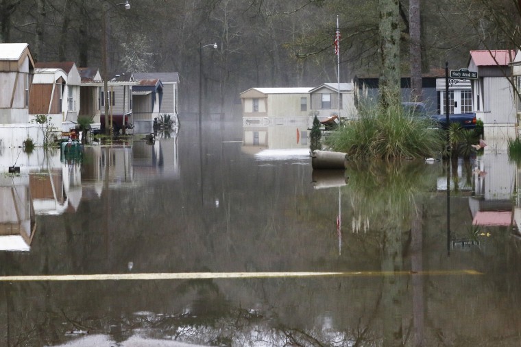
Rain-soaked regions through the Southeast are forecast to see a brief respite from recent downpours Wednesday, but storms on Thursday could stress already elevated rivers and risk more flooding.
Wednesday is expected to be a drier day for the rain-soaked South compared to previous days, with the heaviest rain confined to portions of central and eastern Texas.
By Wednesday night, this heavy rain is forecast to move east and back over saturated portions of the Southeast, and on Thursday rain will be widespread from the Southeast and Gulf Coast to the Tennessee Valley and eventually into North Carolina, South Carolina and the southern Mid-Atlantic by Thursday evening. An additional 1-2 inches of rain, with locally higher amounts possible, can be expected across the region through Thursday night.
Nearly 150 river gauges remained above flood stage Wednesday morning, with this number expected to increase as more rain falls over the region through Thursday night. Rivers are expected to stay high through next week, as the water slowly drains downstream toward the Gulf of Mexico.
The weather could take a surprising turn in the South with a rare bout of snow in the forecast.
On Thursday afternoon, all eyes will be on the potential for snow to fall across portions of Tennessee, northwest South Carolina, North Carolina and southern Virginia.
There’s uncertainty regarding potential snow totals based off when the change from rain to snow occurs and antecedent warm surface temperatures that could keep the snow from sticking. The current forecast calls for a dusting to a few inches of snow, especially across portions of central and eastern North Carolina. The National Weather Service may issue winter weather alerts later on Wednesday to reflect this potential.
Regardless if the snow sticks, there's concern that the quick switch from rain to snow during the Thursday evening commute for cities like Raleigh and Norfolk could spell travel trouble.
Depending on how much snow some Southern cities get, they could exceed the seasonal snow totals so far compared to northern cities like Washington and Philadelphia. That would be a testament both to the rare Southern snow as well as the lackluster winter across the Mid-Atlantic and Northeast.
In addition to the snow potential, winter will leave another mark in the form of bitterly cold temperatures.
Temperatures are plummeting across the central part of the country Wednesday morning as Arctic air takes over. Wind chill alerts have been issued for parts of Montana, North Dakota, Minnesota and Wisconsin for wind chills as cold as 30 degrees below zero F. Highs on Wednesday will be 10-20 degrees below average across the middle of the country, and by Thursday this cold air will spill east into the Midwest, Northeast and even Southeast.
On Friday temperatures will remain colder than average for the eastern third of the country, before rebounding over the weekend.

