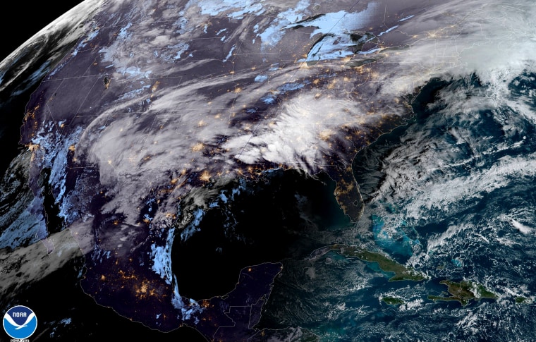
Flood alerts are in effect for 7 million people from eastern Texas to western North Carolina through Tuesday morning. Within the flood watch areas, rainfall totals of 3-7 inches or more are possible through Thursday.
To kick off the week, Monday morning featured heavy rain from eastern Texas up through Pennsylvania, and light to moderate snow across the interior Northeast and New England. Through Monday, extremely heavy rain will fall across portions of the southeast and Tennessee Valley. At the same time, rain will also move into the Mid-Atlantic and Northeast. Due to excessive rainfall over already saturated soils in the South, there is a high risk for flash flooding for parts of northern Mississippi and Alabama through Tuesday morning.
Highs risks for flash flooding have been issued by the National Oceanic and Atmospheric Administration's Weather Prediction Center. While they are relatively rare (about 15 issued per year), approximately 40 percent of flood-related fatalities occur on days when a high risk is in effect.
In addition to the flash flood risk, severe thunderstorms capable of damaging winds, brief tornadoes and hail could affect 2 million people across a small section of eastern Texas, northern Louisiana and central Mississippi. Jackson, Mississippi, should be prepared for severe storms later Monday.
On the northern side of the system, light to moderate snow will continue through Tuesday morning in New England. Snowfall accumulations will be light, generally an inch or less.
By Tuesday afternoon, the next storm that will cross the country will be taking shape in the Southern Plains. It will begin as rain and snow over New Mexico and the Texas Panhandle. By Wednesday, heavy rain and severe thunderstorms capable of tornadoes, damaging winds and hail will be possible across the Gulf Coast and South as snow breaks out across the Midwest and interior Northeast. About 14 million people are already under risk for severe weather across Louisiana, Mississippi, Alabama and Tennessee.
By Thursday, the heavy rain axis shifts east bringing heavy rain to the I-95 corridor from northern Florida to New England. Snow and wind will be possible across the Great Lakes and New England. This storm will produce higher snow totals than the first storm this week. A swath of 1-4 inches of snow will be possible from southwest Texas up through the Great Lakes and New England. Across the northeast and New England, the high elevations and areas downwind of the lakes could see 4-6 inches of snow through Thursday.

