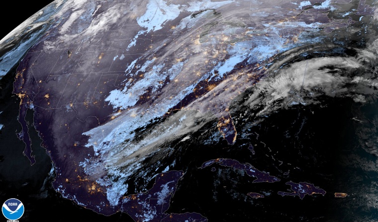
The National Weather Service has issued winter alerts for 30 million people stretching nearly 1,500 miles from central Missouri up through parts of northern Maine.
On Wednesday, snow is expected to move down from west to east across the Great Lakes while rain moves into the mid-Atlantic and a mix of rain and snow moves into the interior Northeast.
In addition to the snow, wind gusts up to 40 mph will cause blowing snow and travel delays, especially across the Midwest.
On Wednesday evening, strong storms are possible across central Florida, as well as parts of the mid-Atlantic. Tampa, Florida, Orlando, Florida, Raleigh, North Carolina, Richmond, Virginia, Washington, D.C., and Baltimore are cities that could experience thunderstorms packing damaging winds. Even a rumble of thunder or two can't be ruled out for Philadelphia and New York City overnight Wednesday.
On Thursday, rain will end early along the I-95 corridor, but lingering strong winds could spell travel delays for the big eastern hubs. In the wake of the storm, lake-effect snow ramps up and this will last through the weekend when snowfall totals will be measured in feet, especially across New York's Tug Hill Plateau.
Additional rainfall totals with this storm will be 0.50-2 inches across the East Coast.
Additional snow totals will be 1-6 inches from Missouri to Michigan and up through northern New England. Higher totals of 9-12 inches will be possible downwind of the lakes and at the high elevations of northern New England, with localized areas picking up 24-36 inches.
As the winter storm exits, the next blast of cold air enters. Highs Wednesday are 10-20 degrees above average across the East, but this will flip-flop Thursday when the next round of cold air drops temperatures to 10-20 degrees below average. While the middle of the country will warm up by the weekend, the East will have to wait until early next week for temperatures to warm back closer to average.
Speaking of warm East Coast temperatures, a startling statistic to confirm just how mild of a winter it has been for many cities: In both New York City and Boston, days with highs at or above 60 degrees are outpacing days with highs below freezing.

