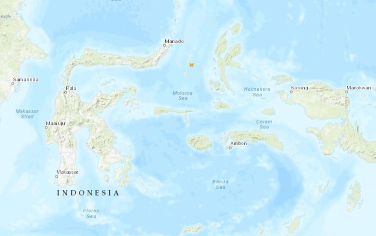
JAKARTA, Indonesia — Indonesian authorities issued a tsunami warning after a strong earthquake struck late Sunday night in the Molucca Sea between North Sulawesi and the Maluku archipelago. The warning was later lifted.
The national disaster agency said the tsunami warning that was in place for North Sulawesi and North Maluku was canceled just after midnight, about two hours after the quake hit.
"The tsunami early warning has ended," Indonesia's Meteorological, Geophysical and Climatological Agency said in a statement.
The U.S. Geological Survey said the magnitude 6.9 quake was centered 115 miles southeast of Manado at a depth of 15 miles.

A graphic posted on Twitter by Indonesia's geophysics agency predicted waves of 1.6 feet for parts of North Sulawesi and North Maluku. There were no immediate reports of major damage or casualties.
The quake caused panic in the city of Ternate in the Maluku island chain, where people ran to higher ground, a witness told The Associated Press.
Radio El Shinta reported that residents in Manado, North Sulawesi's provincial capital, ran out of their houses.
Indonesia, a vast archipelago of 260 million people, is frequently struck by earthquakes, volcanic eruptions and tsunamis because of its location on the "Ring of Fire," an arc of volcanoes and fault lines in the Pacific Basin.