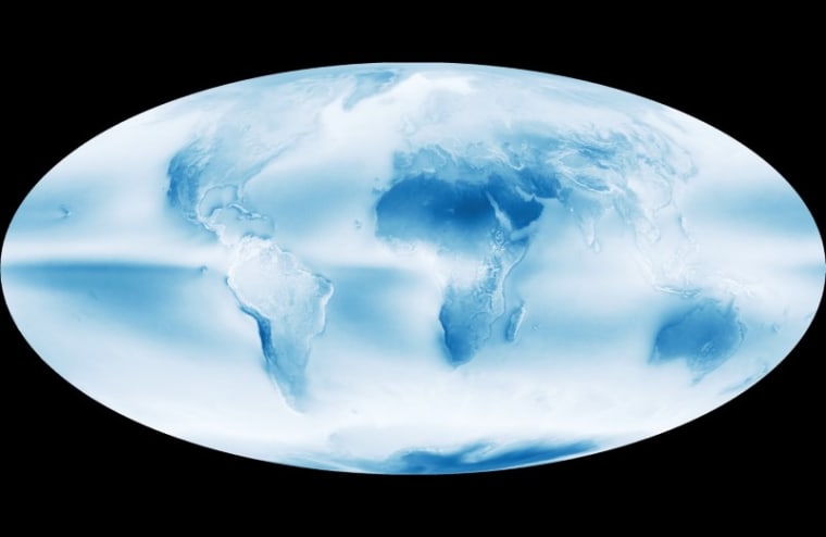
As a new NASA image reveals, the Earth is a cloudy place. According to the space agency, clouds cover about 67 percent of the Earth's surface at any given time, and less than 10 percent of the skies over the ocean are sunny and blue. Now, more than a decade's worth of data from the Moderate Resolution Imaging Spectroradiometer on NASA's Aqua satellite reveals where clouds gather and where skies tend to be clear.
On the satellite image, these cloudy zones are seen in bright white; the bluer the region, the clearer the skies. The image averages daily cloud observations from the satellite between July 2002 and April 2015. It reveals a mostly hazy Earth with three especially cloudy zones.
These zones are linked to the global circulation patterns that cause air to rise around 60 degrees north and south of the equator, promoting the formation of clouds. These same patterns push air downward between 15 degrees and 30 degrees from the equator, resulting in the cloud-free zones seen in desert areas such as Australia and northern Africa.
The third particularly cloudy zone is found over the equator, where circulation cells called Hadley cells dominate. In these zones, warm air rises and condenses, creating both clouds and storms.
This is a condensed version of a report from LiveScience. Read the full report. Follow Stephanie Pappas on Twitter and Google+. Follow Live Science @livescience, Facebook & Google+.

