IE 11 is not supported. For an optimal experience visit our site on another browser.

New Photos Show Different Angles on Mudslide Destruction

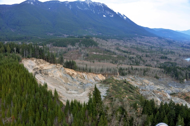
New aerial photographs shot by King County Sheriff's air support unit on March 24 were released by the Associated Press Wednesday.
Image: U.S. Geological Survey show the extent and impacts from the March 22 mudslide
This March 24 aerial photo released by the U.S. Geological Survey show the extent and impacts from the March 22 mudslide near Arlington in northwest Washington state.King County Sheriff via AP
/ Source: The Associated Press

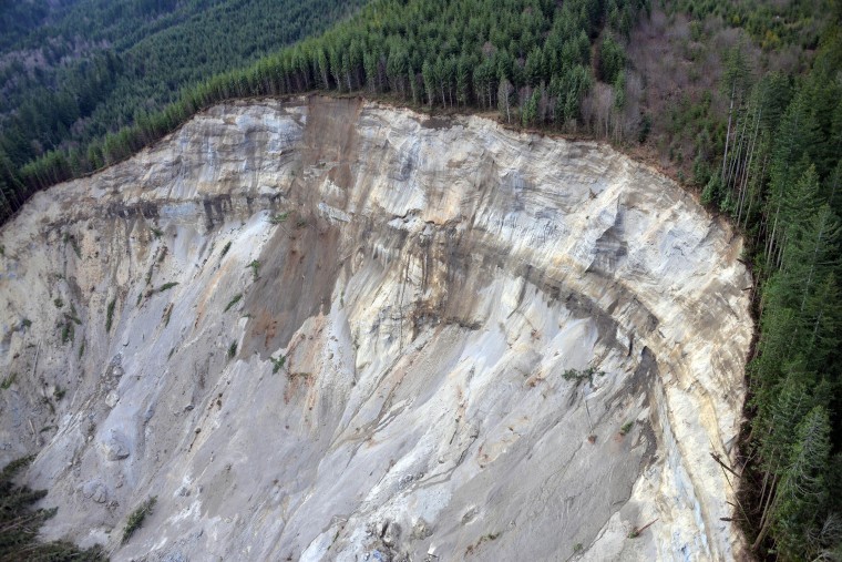
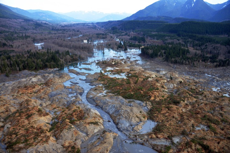
New aerial photographs shot by King County Sheriff's air support unit on March 24 were released by the Associated Press Wednesday night. They show the destruction wrought by the March 22 mudslide that claimed at least 16 lives from several different angles, including looking south towards highway 530 from the hills above.
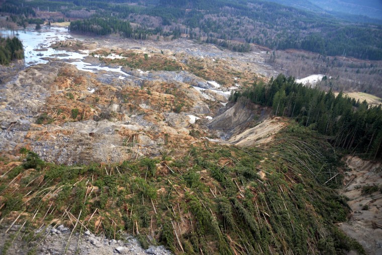
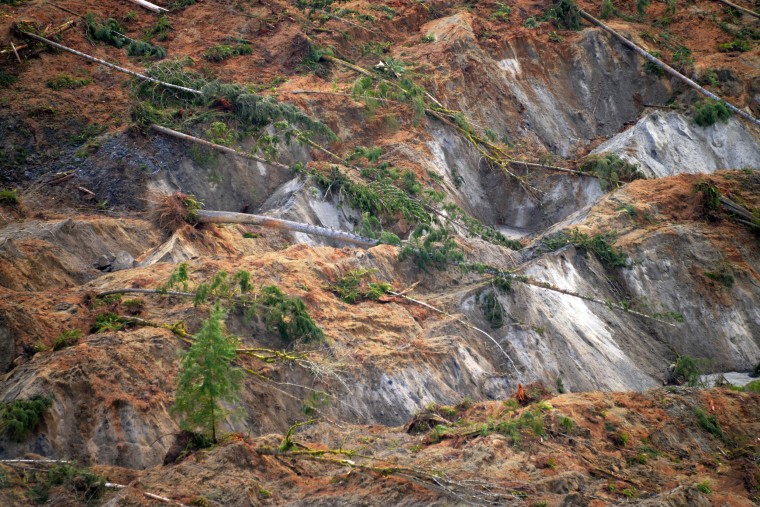
Image:U.S. Geological Survey show the extent and impacts from the March 22 mudslide
This March 24 aerial photo released by the U.S. Geological Survey show the extent and impacts from the March 22 mudslide near Arlington in northwest Washington state.King County Sheriff via AP
Image: U.S. Geological Survey show the extent and impacts from the March 22 mudslide
This March 24 aerial photo released by the U.S. Geological Survey show the extent and impacts from the March 22 mudslide near Arlington in northwest Washington state.King County Sheriff via AP
Image: U.S. Geological Survey show the extent and impacts from the March 22 mudslide
This March 24 aerial photo released by the U.S. Geological Survey show the extent and impacts from the March 22 mudslide near Arlington in northwest Washington state.King County Sheriff via AP
Image: U.S. Geological Survey show the extent and impacts from the March 22 mudslide
This March 24 aerial photo released by the U.S. Geological Survey show the extent and impacts from the March 22 mudslide near Arlington in northwest Washington state.King County Sheriff via AP

—Associated Press