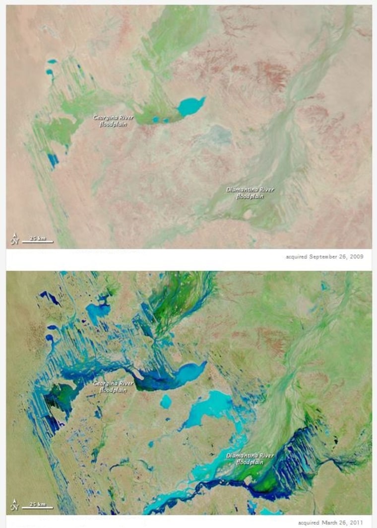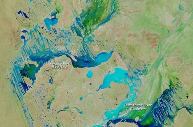
A serendipitous convergence of weather patterns funneled so much water over Australia that normally rising global sea levels actually fell in 2011, according to a new study.
In other words, the rain in Australia stays mainly ... out of the ocean.
Unlike other land masses, the soils and topography of Australia are such that the continent acts like a giant sponge, preventing most of the rainfall it receives from quickly running off into the sea.
"Half the continent has no orchestrated runoff at all," John Fasullo, a climate scientist at the National Center for Atmospheric Research in Boulder, Colo., and lead author of the study, told NBC News.
The finding to be published next month in the journal Geophysical Research Letters helps explain the drop in global sea levels during a powerful La Niña weather pattern that lasted for about 18 months in 2010 and 2011.
Typically, Fasullo noted, much of the rain that falls over land wends its way back to the sea over the course of a few months via streams and rivers. As a result, even when weather patterns send more rain than usual over land, the effect on global sea levels is almost imperceptible.
But during the La Niña of 2010-2011, which is characterized by a cooling of the eastern Pacific Ocean and increased rainfall over land, global sea levels dropped by about 0.3 inches for more than a year.
The drop is a stark contrast to the trend of a 0.1 inch annual rise since 1993, driven largely by increased runoff from glaciers and ice sheets as well as ocean warming, which causes water to expand — factors linked to global warming. The halt in sea level rise thus had climate scientists perplexed.
Since 2011, when atmospheric patterns shifted out of their unusual combination, sea levels have been rising at a faster pace of about 0.4 inches per year, perhaps linked to evaporation in Australia as well as drought in parts of North America and South America, Fasullo noted.
In research published in Geophysical Research Letters in 2012, he and colleagues linked the fall in sea levels to increased water storage on land, which coincided with La Niña.
"But it raised a lot of questions," Fasullo said. "We have a lot of other La Niña events, for example, during the (instrument) record and we didn't a sea level drop nearly as large as it did in 2010-2011."
The new research illustrates that the 2010-2011 La Nina converged with two other atmospheric weather patterns that resulted in the funnel of water over Australia where rainfall is typically scarce.
One pattern, called the Indian Ocean Dipole, pulled moisture west-to-east across the Indian Ocean, where it collided with the east-to-west moving moisture from La Niña. A third pattern called the Southern Annular Mode then drew that moisture into Australia, Fasullo explained.
"You have this collision of transports in the Pacific and then southward into Australia — so a big funnel of tropical moisture into Australia — and that led to one of the wettest years on record in Australia, if not the wettest."
Once the rain reached the interior of Australia, it had no immediate exit. Much of the water collected in the Lake Eyre basin — an inland sea — in the east and much of the rest percolated down into the dry, granular soils of the Western Plateau.
Whether this type of convergence will increase on a warming planet is unknown, Fasullo said. For one, scientists are unclear how climate change will impact the cycle of El Niño and La Niña.
What is clear, he added, is that warmer oceans lead to increased water vapor in the atmosphere and thus there is an expectation of more intense rainfall in a warmer climate.
"So there is some component here of climate change," he said. "But there is also a strong natural component to what is going on here and it is just a serendipitous interaction of these climate modes that really gave us what we saw."
John Roach is a contributing writer for NBC News. To learn more about him, visit his website.
