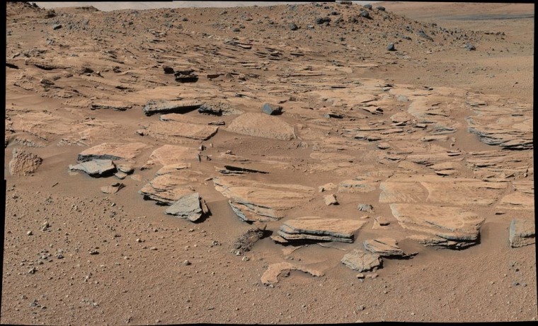
Geological observations from NASA's Curiosity rover have helped scientists come up with a scenario for the creation of a lake that's bigger than Salt Lake and a mountain that's higher than Mount Rainier on ancient Mars.
The scenario suggests that water could have filled much of 96-mile-wide (154-kilometer-wide) Gale Crater 3.5 billion years ago or so, and that the 3.5-mile-high (5-kilometer-high) mountain in the middle of the crater could have been formed by repeated cycles of sediment buildup and erosion.
The findings provide further support for the view that ancient Mars could have sustained life as we know it on Earth.
Sanjeev Gupta, a member of the $2.5 billion Curiosity mission's science team from Imperial College London, compared the task of reconstructing the geological history of the crater and the mountain, known as Mount Sharp or Aeolis Mons, to piecing together a jigsaw puzzle.
"We're now in a position where the jigsaw puzzle is beginning to come into view," he told reporters on Monday during a NASA teleconference.
The key puzzle pieces have to do with the way rock is layered inside Gale Crater, the place where the Curiosity rover landed almost two-and-a-half years ago.
For months, Curiosity has been making its way southward, heading into the foothills of Mount Sharp. Its instruments have now taken readings at a variety of rock formations, and scientists noticed that the layers of bedrock took on a progressive slant that would be consistent with the pattern set by rivers emptying into a large, shallow lake.
"These beds are recording build-out ... of sediment toward the south," Gupta said.

How to build a mountain
So far, Curiosity's data suggests the cycles of sediment deposition occurred at least three times, and probably many more, he said. The geology of that process could have left layers of sediment sitting at the bottom of the lake, in the center of Gale Crater — and over the course of millions or tens of millions of years, erosion could have sculpted that central mound into the mountain that exists today.
"If our hypothesis for Mount Sharp holds up, it challenges the notion that warm and wet conditions were transient, local or only underground on Mars," Ashwin Vasavada, the Curiosity mission's deputy project scientist at NASA's Jet Propulsion Laboratory, said in a news release. "A more radical explanation is that Mars' ancient, thicker atmosphere raised temperatures above freezing globally, but so far we don't know how the atmosphere did that."
During the teleconference, Vasavada told NBC News that Gale Crater's lake could have persisted for millions of years — or it might have come and gone, with wet periods lasting just hundreds or thousands of years at a time. The latter scenario would be consistent with a view voiced by other scientists that water was released only episodically on "Snowball Mars," perhaps as the result of cosmic impacts or volcanic outbursts.
Scientists have been studying orbital pictures of Mars' valley networks in hopes of unraveling the mystery. "Our data will allow another very close-up, different kind of study, from the sedimentology, to understand those same questions," Vasavada said. "I think at this point, the jury's out."

Looking ahead
He said the science team was even now considering the next target for Curiosity's sampling drill and onboard chemical labs. The chemistry of the rock laid down at different sites could reveal more about how lakes might have expanded and dried up on ancient Mars.
"Knowledge we're gaining about Mars' environmental evolution by deciphering how Mount Sharp formed will also help guide plans for future missions to seek signs of Martian life," Michael Meyer, lead scientist for NASA's Mars exploration program, said in Monday's news release.
Caltech planetary scientist John Grotzinger, the Curiosity mission's principal investigator, said the latest observations flesh out previous findings that indicated the rover was moving through areas that were once wet enough to harbor the kinds of microbes found on Earth.
He told NBC News that the Curiosity team has not yet prepared a manuscript about the latest findings for publication in a scientific journal.
"One of the things we're trying to do at this point in the mission is to share the results that we get in a more raw, more immediate form with the public, with the understanding that the journals support this kind of activity," he said. "We think it's fun for the public to see these as hypotheses that we'll test as we go along."