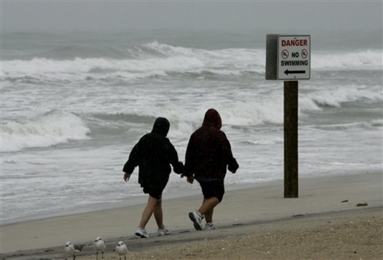
A storm that worried forecasters but never gained tropical strength over the Atlantic pushed across the Carolinas on Friday with scattered power outages and propelled rain and rough surf farther up Atlantic seaboard.
Meteorologist Barrett Smith at the National Weather Service in Raleigh said the low pressure in the storm would continue to weaken as the center moved northward and out of North Carolina by Saturday.
Smith said no serious problems were reported from the rain or wind, which gusted to 40 mph early Friday. Precipitation averaged 2 to 4 inches. About 2 p.m., the center of the storm was southwest of Charlotte.
The wet weather forced postponement of more than a dozen high school football games in central North Carolina. At the Outer Banks, officials posted red warning flags on the beaches to keep people out of rough surf.
Smith said forecasters took the system seriously as it approached the coastline because it had potential to intensify quickly.
Although the center of the storm was well to the south, forecasters said it was so large that rain and some wind would be felt in the Northeast. Small craft advisories, meaning strong winds and choppy seas, were issued from Savannah, Ga., to Maine with high surf advisories in some places.
“Much of the winds have diminished,” said meteorologist Dave Loewenthal at the National Weather Service in Wilmington. “It’s a very large system. It goes all up and down the eastern seaboard.”
Forecasters turned their attention to Tropical Storm Kyle in the open Atlantic, south of Bermuda. The National Hurricane Center said Kyle could become a hurricane by Saturday as it moved north.
At 2 p.m. EDT, Kyle was centered about 445 miles south-southwest of Bermuda and moving north-northwest near 12 mph. Kyle has top sustained winds near 60 mph. Its tropical storm force winds extend up to 205 miles from the center.
A tropical storm warning was in effect for Bermuda.
In the Carolinas, the storm knocked out power to about 3,600 utility customers.
A dozen houses were condemned in the Outer Banks town of Nags Head when waves exposed septic tanks, WRAL-TV reported. Officials said wind-driven tides flooded NC Highway 12 at times on Hatteras Island.
Dare County spokeswoman Dorothy Toolan said damage assessment teams were headed to Hatteras Island and checking with towns and that “the sun is out.” County schools opened for a half day.
NC Highway 12 on Hatteras Island was open, Toolan said, but still had water and sand on the roadway. She said the road would experience flooding at high tides.
Forecasters said the storm lacked the ingredients of a tropical system, but had looked enough like one that the National Hurricane Center sent aircraft into it several times to explore.
“This was very close to a tropical system,” said Brandon Vincent of the National Weather Service. “Before it came inland, it had a pretty impressive radar impression that was reminiscent of a tropical storm.”
