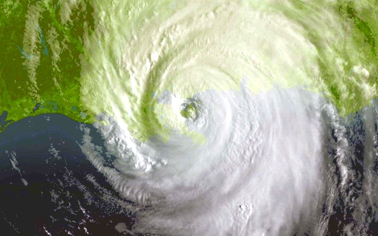
Devastating as Katrina was, it would have been far worse but for a puff of dry air that came out of the Midwest, weakening the hurricane just before it reached land and pushing it slightly to the east.
The gust transformed a Category 5 monster into a less-threatening Category 4 storm, and pushed Katrina off its Big Easy-bound trajectory, sparing New Orleans a direct hit — though not horrendous harm.
"It was kind of an amazing sequence of events," said Peter Black, a meteorologist at the Hurricane Research Division of the federal government's Atlantic Oceanographic and Meteorological Laboratory.
On Sunday, meteorologists watched in awe as one of the most powerful hurricanes they had ever seen churned northward over the Gulf of Mexico on a direct bearing for New Orleans. Fed by unusually warm waters in the central gulf, Katrina easily pumped itself up to a Category 5 monster, with top winds approaching 175 mph. That afternoon a National Oceanographic and Atmospheric Administration aircraft flying through the storm pegged its minimum barometric pressure at 902 millibars, making Katrina the fourth most powerful hurricane ever observed.
But by the time it reached land Monday, Katrina was no stronger than any of a dozen or more hurricanes that have hit the United States in the past century. Hurricane Camille had a substantially lower central pressure when it slammed into Mississippi in 1969. Hurricane Charley blasted the Sunshine State with higher winds when it came ashore near Tampa last year.
So if it wasn't so powerful, how did Hurricane Katrina inflict so much destruction?
The storm's sheer size was one factor. As powerful as Hurricane Charley was, that storm's swath of destruction was only about 10 miles wide. Katrina battered everything from just west of New Orleans to Pensacola, Fla., a span of more than 200 miles. At noon Monday, hurricane force winds extended to 125 miles from Katrina's center.
"This storm was quite a bit larger, so the extent of the damaging wind field would have covered a much larger geographic area," said Marc Levitan, a professor of Civil and Environmental Engineering at Louisiana State University.
Geography also played a role in the hurricane's destructiveness. The Gulf of Mexico's northern fringe is an extremely shallow shelf extending up to 120 miles offshore. That makes the region's coastline extremely vulnerable to the storm surges that hurricanes create as their winds and low pressure pile up water and push it ashore.
And Katrina was moving fairly slowly, about 12 to 15 mph. That gave the storm surge more time to build up as the hurricane approached the coast and then moved inland.
Those circumstances made Katrina "nearly a worst-case scenario," said Hurricane Research Division meteorologist Stanley Goldberg. Some witnesses reported storm surges of more than 25 feet along the Mississippi coast, among the highest ever recorded. The waters around New Orleans rose as much as 22 feet.
But the catastrophic sequence of events that appeared highly likely on Sunday afternoon — a Category 5 hurricane washing over the Big Easy's ramparts and filling it like a bowl — did not come to pass.
Instead, a different scenario unfolded. Several levees failed on Tuesday, unleashing floods that placed the city of 480,000 in peril long after Hurricane Katrina had dissipated.
