Slow-moving Hermine was still delivering strong winds, dangerous storm surges and rip currents to the Northeast on Sunday after causing destruction along its path, which began in Florida and stretched up the East Coast.
"The event is far from over," said Dennis Feltgen, a meteorologist for the National Hurricane Center.
Hermine was the first hurricane to strike Florida in more than a decade, and two deaths — one in Florida and one in North Carolina — have been blamed on the storm.
On Sunday, Hermine was technically a post-tropical cyclone off the shores of Long Island, New York, and Ocean City, Maryland, according to the National Weather Service.
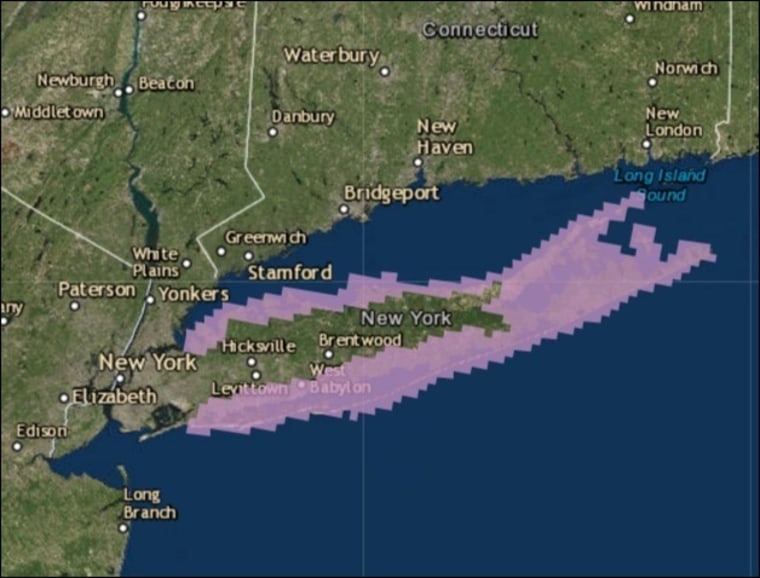
The storm had moved farther out to sea than expected, which meant it would bring a negligible amount of rain. But Hermine could still pack a destructive punch: On Sunday night, the National Weather Service extended a Tropical Storm Warning from Long Island to all of New York City.
Sustained winds of 20 mph to 30 mph and gusts of 50 mph were expected to begin as early as Sunday night and last through Tuesday, a 7 p.m. ET bulletin said.
Related: Hermine to Deliver 'Life-Threatening' Surf, Winds From North Carolina to New England
"Hermine has a large wind field. Tropical-storm-force winds extend outward up to 205 miles from the center," the NWS said, adding that the storm could reach hurricane strength again within the next two days.
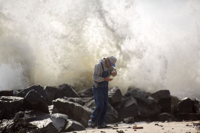
Feltgen said heavy winds, triggering large waves and swells, would affect coastal areas from New Jersey to New York on Sunday and then bring the same to New England through Monday.
"These waves are likely to cause life-threatening surf and rip current conditions and significant beach erosion," Feltgen told NBC News.
New Jersey Gov. Chris Christie said at a news briefing Sunday afternoon that he didn't see the need for evacuations from the shore yet, but "we are prepared if things wobble west." He said 90,000 extra visitors, in addition to residents, were staying on the coast during the holiday weekend, making emergency evacuations, if they become necessary, "a little trickier."
Christie and other authorities warned people to stay away from the water, and beaches in New York City and on Long Island — which would have been full of Labor Day weekend revelers — were closed to swimmers Sunday. New York City beaches will remain closed to swimmers on Labor Day and possibly Tuesday, the city said.
Coast Guard crews were searching off the coast of Long Island for two fishermen who slipped into choppy waters off the coast of Wading River, on the eastern part of the island.

The Coast Guard also rescued a kite surfer from the waters off Fire Island, New York, on Saturday. The island, a narrow barrier island off Long Island's southern coast, which fills with beach house owners and renters on weekends — especially long ones — was under a voluntary evacuation warning Sunday.
Photos: Dangerous Storm Pounds the East Coast
"Moderate to locally major coastal flooding" is also expected along the East Coast, according to The Weather Channel. "While this storm will likely not be nearly as large as Superstorm Sandy, you don't need a storm as large as Sandy to be destructive."

The winds, of up to 70 mph, could also cause power outages, according to the NWS.
The Weather Channel also warned that because Hermine was a slow-moving storm, it has more of an opportunity to change course and cause more of a threat than originally anticipated.
Hermine had already struck Florida, North Carolina and Virginia hard during its journey to the Northeast, which began Friday.
Hundreds of thousands of residents in Florida lost power when the storm made landfall, and Gov. Rick Scott declared a state of emergency in 51 counties, which were cleaning up after thrashing winds and up to nearly 2 feet of rain in some areas.
A homeless man in Marion County, in the northern part of the state, died when a tree was ripped from the ground by high winds and fell on him.
Pasco County, just north of Tampa, was still dealing with effects Sunday as run-off from flooded northern parts of the state washed over roads and through houses, according to the Pasco County Sheriff's Office. Residents in the county were being urged to evacuate their homes Sunday afternoon as high tide threatened to bring even more water.
Another man died in North Carolina when his tractor-trailer overturned Saturday morning amid strong winds on a bridge near Dare County, the Tyrrell County Sheriff's Office said. Three more people were injured in the county when a tornado touched down and damaged trailer homes, according to the NWS.
