IE 11 is not supported. For an optimal experience visit our site on another browser.
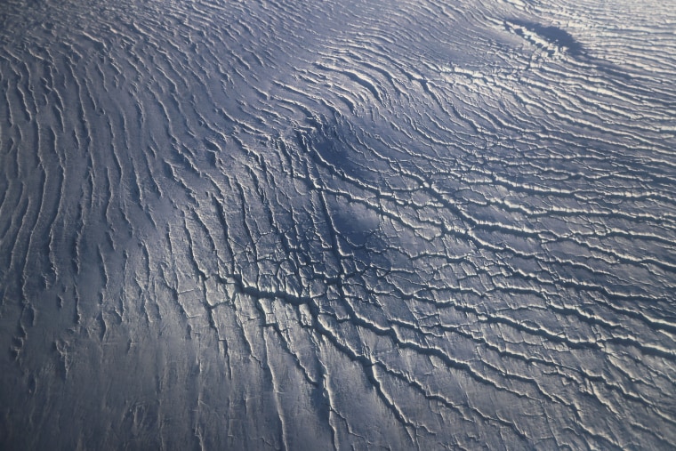
A section of glacier flows between ridges on Ellesmere Island, Canada.

Environment

NASA Flyover Reveals Arctic Ice in Retreat

NASA is conducting an airborne survey of how ice in the Arctic is responding to a changing climate.
/ 18 PHOTOS
Image: NASA Continues Efforts To Monitor Arctic Ice Loss With Research Flights Over Greenland and Canada

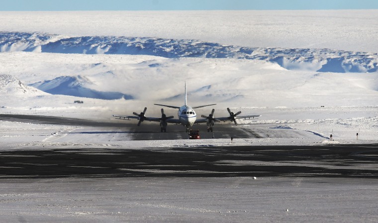
NASA's Operation IceBridge research aircraft taxis after landing at Thule Air Base on March 24, 2017 in Pituffik, Greenland.

NASA’s view from space shows our planet is changing, but to really understand the nitty-gritty of these shifts and what they mean for our future, scientists need a closer look. 

For the past eight years, Operation IceBridge has been conducting aerial surveys of polar ice. 
Mario Tama / Getty Images
Image: NASA Continues Efforts To Monitor Arctic Ice Loss With Research Flights Over Greenland and Canada

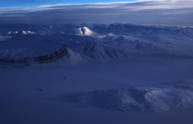
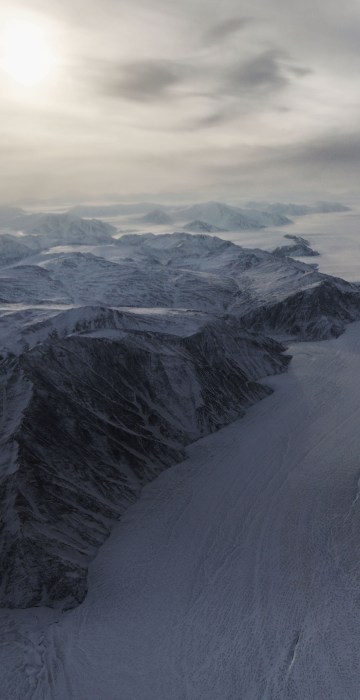
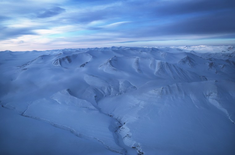
Mountains rise from an ice field on Ellesmere Island, Canada, as seen from the research aircraft. 

Scientists have said the Arctic is one of the regions hardest hit by climate change and the research flights monitor the ice's decline. 


Mario Tama / Getty Images
Image: NASA Continues Efforts To Monitor Arctic Ice Loss With Research Flights Over Greenland and Canada

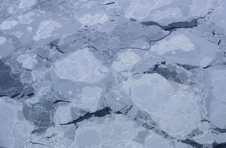
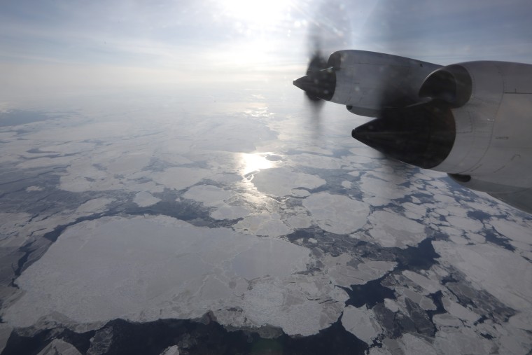
Chunks of sea ice float near Ellesmere Island, Canada.

Arctic sea ice appeared to have reached a record wintertime low on March 7, according to scientists at NASA and the NASA-supported National Snow and Ice Data Center (NSIDC) in Boulder, Colorado. 

Since satellites began monitoring sea ice in 1978, researchers have observed a steep decline in the average extent of Arctic sea ice for every month of the year.

 

Mario Tama / Getty Images
A section of glacier flows between ridges on Ellesmere Island, Canada.

A section of glacier flows between mountains on Ellesmere Island, Canada.

Mario Tama / Getty Images file
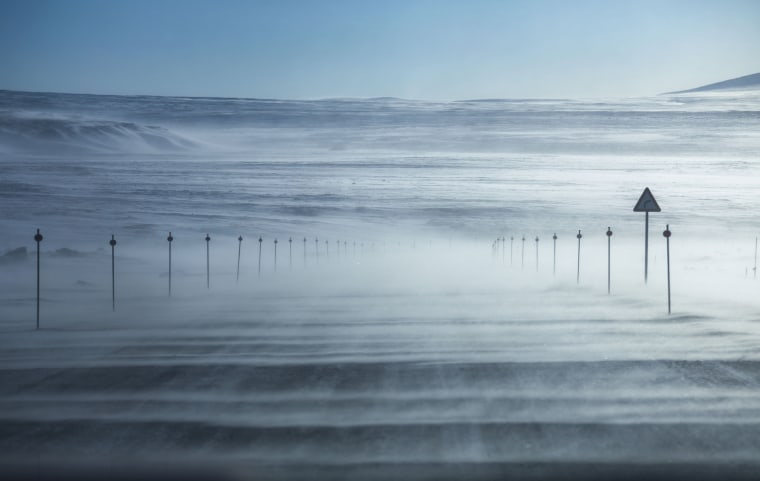
Image: NASA Continues Efforts To Monitor Arctic Ice Loss With Research Flights Over Greenland and Canada

Snow blows near Thule Air Base on March 25, 2017.

At 750 miles north of the Arctic Circle, Thule is the U.S. Air Force's northernmost base. 

Mario Tama / Getty Images
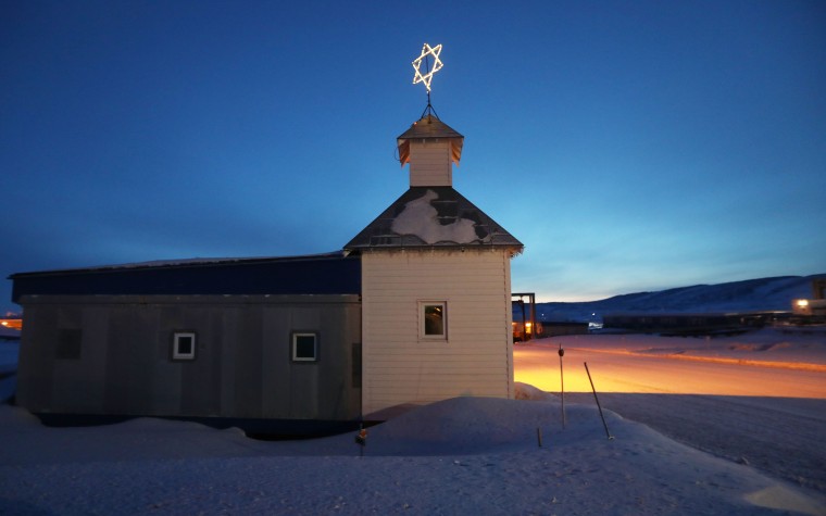
Image: NASA Continues Efforts To Monitor Arctic Ice Loss With Research Flights Over Greenland and Canada

Night descends on the chapel at Thule Air Base on March 29.

Mario Tama / Getty Images
Image: NASA Continues Efforts To Monitor Arctic Ice Loss With Research Flights Over Greenland and Canada

NASA's retrofitted 1966 Lockheed P-3 aircraft flies off the northeast coast of Greenland on March 30 during one of its eight-hour research missions. 

Mario Tama / Getty Images
Image: NASA Continues Efforts To Monitor Arctic Ice Loss With Research Flights Over Greenland and Canada

A ridge rises out of the ice sheet along Greenland's Upper Baffin Bay coast. 

Mario Tama / Getty Images
Image: NASA Continues Efforts To Monitor Arctic Ice Loss With Research Flights Over Greenland and Canada

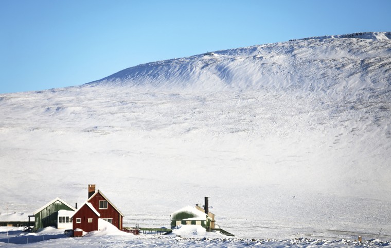
Snowdrifts are piled against houses near Thule Air Base. 

Mario Tama / Getty Images
Image: NASA Continues Efforts To Monitor Arctic Ice Loss With Research Flights Over Greenland and Canada

A patch of sunlight illuminates an ice field on March 30 on Ellesmere Island, Canada.

Mario Tama / Getty Images
Image: NASA Continues Efforts To Monitor Arctic Ice Loss With Research Flights Over Greenland and Canada

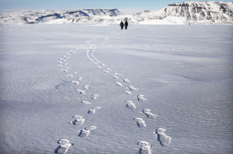
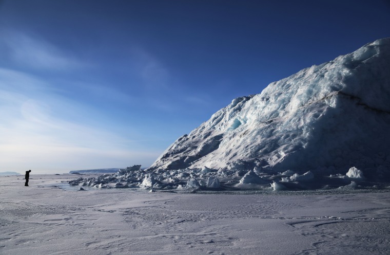
Project scientist Nathan Kurtz and senior support scientist Jeremy Harbeck walk to survey an iceberg locked in sea ice near Thule Air Base.

Mario Tama / Getty Images
Image: NASA Continues Efforts To Monitor Arctic Ice Loss With Research Flights Over Greenland and Canada

Kurtz surveys an iceberg locked in sea ice near Thule Air Base. 

Mario Tama / Getty Images
Image: NASA Continues Efforts To Monitor Arctic Ice Loss With Research Flights Over Greenland and Canada

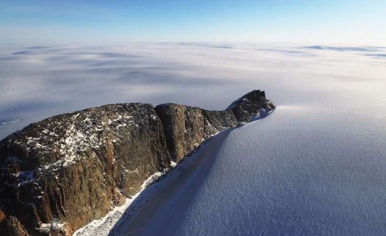
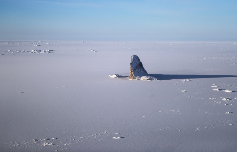
A dramatic rock formation is surrounded by sea ice along Greenland's Upper Baffin Bay coast. 

Mario Tama / Getty Images
Image: NASA Continues Efforts To Monitor Arctic Ice Loss With Research Flights Over Greenland and Canada

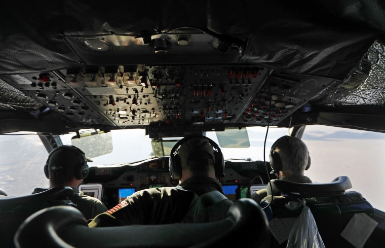
Flight crew sit in the cockpit of NASA's Operation IceBridge research aircraft as it flies over Greenland.

Mario Tama / Getty Images
Image: NASA Continues Efforts To Monitor Arctic Ice Loss With Research Flights Over Greenland and Canada

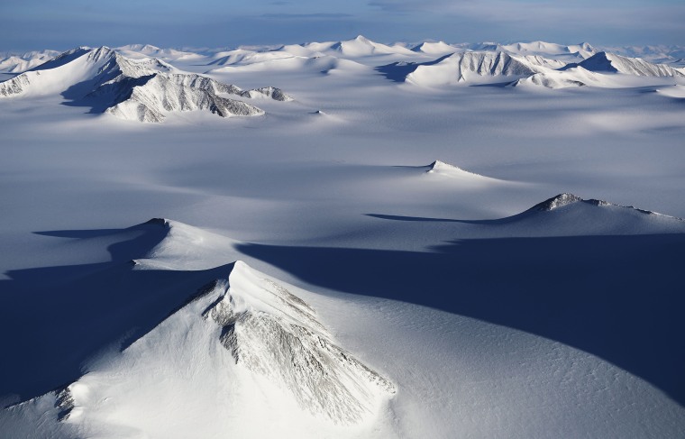
Mountain peaks emerge from the ice on Ellesmere Island, Canada.

Mario Tama / Getty Images
Image: NASA Continues Efforts To Monitor Arctic Ice Loss With Research Flights Over Greenland and Canada

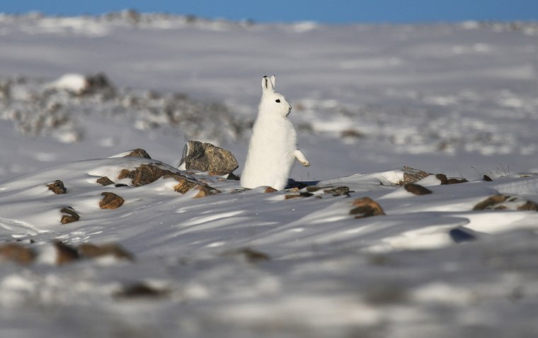
A snowshoe hare surveys his surroundings near Thule Air Base. 

Mario Tama / Getty Images
Image: NASA Continues Efforts To Monitor Arctic Ice Loss With Research Flights Over Greenland and Canada

Crevasses line a glacier on Greenland's Upper Baffin Bay coast. 

Mario Tama / Getty Images
Image: NASA Continues Efforts To Monitor Arctic Ice Loss With Research Flights Over Greenland and Canada

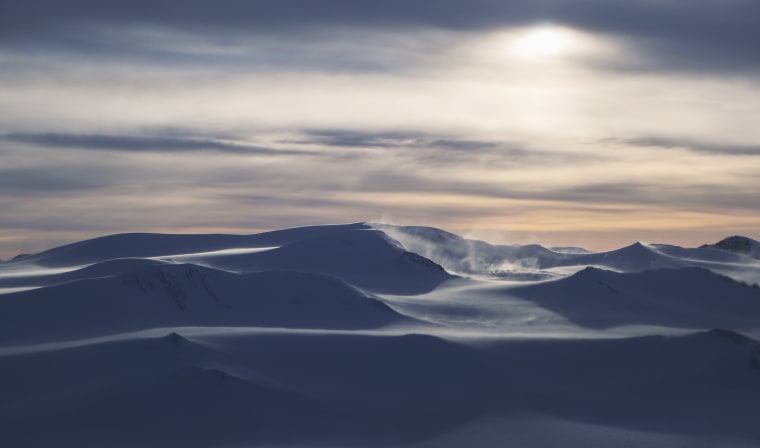
Wind blows snow on an ice field on Ellesmere Island, Canada.
See photos from NASA's Antarctica survey 

Mario Tama / Getty Images
1/18