Climate experts at NASA believe they have found a way of forecasting droughts and floods months in advance, New Scientist magazine reported Wednesday.
The magazine said that until now, forecasting more than a week ahead had proved impossible because the atmosphere is so unpredictable.
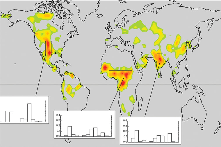
But NASA’s Goddard Space Flight Center in Maryland has located a series of “hot spots” in the middle of continents where changes in the moisture content in soils may signal droughts or floods to come.
“In these hot spots, soil moisture and precipitation are tightly linked,” the magazine quoted NASA’s Randal Koster as saying.
The theory runs that water evaporating from soil is a major source of vapor that creates cloud and rain, so the drier the earth, the greater the chance of drought — and vice-versa.
The researchers found the Sahel, on the southern fringes of the Sahara Desert, northern India and the Great Plains of North America were particularly good regions to observe.
Similar signals from oceans are already well-known, the magazine said. For instance, El Niño, the weather anomaly that distorts wind and rainfall patterns around the world, is generally flagged up by changes in sea temperatures in the eastern Pacific months beforehand.
