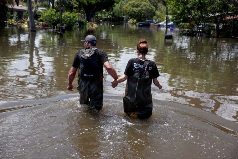
A slow-moving batch of thunderstorms brought 3 to 6 inches of rain to parts of South Florida on Tuesday, concerning forecasters, given that while thunderstorms were in the forecast, the heavier rain event with the the higher flash flood risk wasn’t supposed to begin until midday Wednesday.
The flooding made the areas drenched on Tuesday night even more susceptible to flooding with Wednesday's rainfall.
On Wednesday morning, 7 million people were already under a flood watch along Florida’s east coast south toward parts of the Keys that will remain in effect until Thursday afternoon. The flood watch included Daytona Beach, Melbourne, West Palm Beach, Fort Lauderdale, Miami, Key Largo and Marathon.
On Wednesday, forecasters warned of a significant flood threat for southeast Florida and the Florida Keys; a flood risk was expected to continue overnight Wednesday into Thursday morning. The timing of the heaviest rainfall rates, as high as 3 inches per hour, was expected Wednesday afternoon into early Thursday.
The most likely scenario given the forecast was a large area of 4 to 8 inches of rain from the Keys to the West Palm Beach area. A worst case scenario would be double-digit rainfall totals over highly localized areas. The major metros of Fort Lauderdale and Miami were squarely in the risk area, meteorologists said.
In addition to the heavy rain risk, strong onshore easterly winds gusting up to 40 mph could exacerbate the flood threat. If the heavy rain coincides with the high king tide, it could make flooding worse as it would prevent any floodwaters from being able to recede or run off.
Tuesday’s heavy rainfall brought Fort Lauderdale’s annual rainfall total to over 100 inches. This is more than 40 inches above average, and only the second time in 111 years of record-keeping that their annual rainfall has eclipsed the 100-inch mark.
A historic rainfall event on April 12 that dropped up to 25 inches in a 24-hour period over the Fort Lauderdale metro area contributed to a large portion of the city's rainfall this year.
Fort Lauderdale is already having its wettest year on record, and will likely add to its rainfall tally on Wednesday and Thursday.
The same storm system that is expected to form off the east coast of Florida and bring a deluge to the state on Wednesday will be the same one that moves up the Atlantic Coast and drenches New England over the weekend.
On Friday, this storm system will graze the Mid-Atlantic coast, bringing the potential for heavy rain and gusty winds to the coastal Carolinas including the Outer Banks.
By Saturday, the storm system will clip coastal New England, bringing the potential for heavy rain from eastern Long Island to Downeast Maine.

