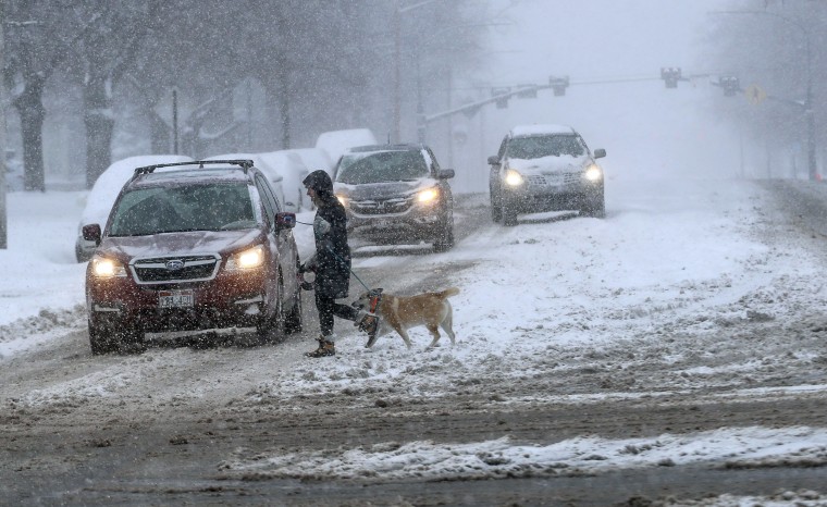
More than 25 million people are under winter alerts from the Rockies to the southern Plains and the Midwest.
A powerful cold front charging south across the southern Plains will meet up with tropical moisture from the Gulf of Mexico. When they clash, the result will be a large storm system that will bring snow, ice and severe thunderstorms capable of producing hail, damaging winds and isolated tornadoes for the next few days.
The storm has already made headlines, blanketing parts of the West and the Rockies in heavy snow. Salt Lake City got a total of nearly a foot of snow, including a record 8.6 inches that fell Monday.
On Tuesday, snow was to continue across the Rockies, with a light icy mix breaking out from the central Plains and the Midwest into New England. Ice accumulations along this swath will generally be 0.10 inches to 0.25 inches. Those ice amounts are enough to cause slick roadways, a glaze on trees and spotty power failures.
On the southern side of the system, strong thunderstorms capable of damaging winds and large hail are possible across parts of Tennessee, Arkansas, Louisiana, Texas and Mississippi. Shreveport, Louisiana; Houston; Memphis, Tennessee; and Little Rock, Arkansas, are in the risk zone.
On Wednesday, moderate to heavy snow, along with an icy mix, will affect the southern Plains, including parts of Texas and Oklahoma. Even the Dallas area will need to brace for a light wintry mix Wednesday morning. Two to 8 inches of snow is possible from southwest Texas to Missouri.
The chance of severe thunderstorms returns, with 9 million people at risk in New Orleans; Mobile and Birmingham, Alabama; and Panama City, Florida, among other cities. Damaging winds will be the most likely threat associated with the thunderstorms.
Download the NBC News app for breaking news
By Thursday, the storm reaches the East Coast. The Northeast may start with a wintry mix in the morning before it changes to a cold rain in the afternoon. Northern New England will see mostly snow, with possible total accumulations of 9 to 12 inches.
Severe thunderstorms capable of damaging winds and hail are possible again for 28 million people across parts of Florida, Georgia and the Carolinas. While damaging winds will be the most likely threat, isolated tornadoes are also possible.
Cities to watch will be Tampa, Orlando, Tallahassee and Jacksonville in Florida; Charleston, South Carolina; and Charlotte and Raleigh in North Carolina. Rainfall totals of 2 to 4 inches are possible from the Gulf Coast up through the Appalachians by Friday.
Travel delays are likely, especially Wednesday and Thursday.
And as if that wasn't enough, the temperature tumble associated with the storm will be extreme. Temperatures across the eastern half of the country are 10 to 20 degrees above average Tuesday, but for many locations, it will be 20 to 30 degrees colder on Wednesday, especially across the southern Plains and the Midwest.
In perhaps the most impressive example, Dallas will go from a high in the upper 60s on Tuesday to a high in the mid-30s on Wednesday.

