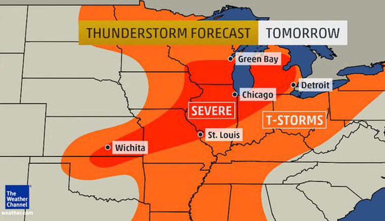
A vast pattern of severe thunderstorms will bring high winds and heavy rain to much of the Plains and the Midwest over the next two days, culminating in a possible tornadoes or even a derecho on Tuesday or Wednesday, forecasters said.
Thunderstorms will begin Monday in Nebraska, South Dakota and North Kansas and then spread to wider areas on Tuesday.
Northeastern areas such as New York City, Philadelphia and Washington could also see thunderstorms during the evening commute Tuesday - but these are not expected to be severe, Weather Channel lead forecaster Kevin Roth said.
Cosmic Log: What is a derecho?
Isolated severe thunderstorms producing strong wind gusts and hail are possible Wisconsin and Michigan to southwest Missouri and southeast Kansas.
The most severe weather is expected to come in the Plains and Midwest very late Tuesday and into Wednesday when the conditions are most favorable for tornadoes or even a derecho – a continuous 200-mile-long line of damaging high winds.
“All these individual thunderstorms are expected to congeal together into one long system – most likely along a path from southern Iowa, north and central Missouri and into the Ohio Valley,” Roth said.
“It’s not guaranteed but if a derecho did occur it would be most likely very late Tuesday or into Wednesday.”
Hot weather could also generate afternoon and evening thunderstorms in the Southeast over the coming days, the Weather Channel said.
