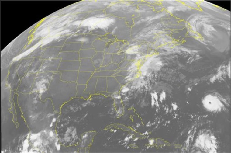
Tropical Storm Helene moved quickly in the open Atlantic early Thursday, and a powerful Hurricane Gordon held on to its Category 3 strength, but neither posed any threat to land, forecasters said.
In Canada, where Hurricane Florence’s remnants raked Newfoundland with 100 mph wind gusts and bands of rain on Wednesday, the winds were expected to drop as the storm moved eastward during the day, the Canadian Hurricane Center said.
Helene, the eighth named storm of the Atlantic hurricane season, had top sustained winds near 45 mph Thursday morning, well below the 74 mph threshold for a hurricane. It formed late Wednesday night and was not expected to threaten land, National Hurricane Center forecasters said.
“We feel fairly confident that this thing could end up over the middle of the Atlantic,” meteorologist Hugh Cobb said.
At 11 a.m. EDT, it was centered 835 miles west of the southernmost Cape Verde Islands and moving west over warm Atlantic waters at 20 mph, forecasters said. A gradual strengthening and turn toward the west-northwest was expected Thursday and Friday morning.
While the storm’s path was somewhat uncertain, forecasters expected the storm to eventually turn northward, Cobb said.
Gordon was upgraded to a Category 3 hurricane late Wednesday when its top sustained winds jumped to 120 mph, up from 110 mph earlier in the day, forecasters said.
The hurricane was moving out to sea and was no threat to land, according to the hurricane center. Gordon’s clearly defined eye was centered about 560 miles east-southeast of Bermuda and moving north-northeast near 12 mph. Some gradual weakening was expected Thursday and Friday, forecasters said.
“Although Gordon’s eye remains distinct, it has become smaller and a little less well-defined,” said Richard Knabb, a senior hurricane specialist.
Some waves could reach Bermuda, but the British territory should not feel tropical storm force winds, forecasters said.
The Atlantic hurricane season began June 1 and ends Nov. 30. The National Hurricane Center’s latest forecast for the season expects between seven and nine hurricanes, a slight reduction from earlier predictions.
Federal scientists said Wednesday that the season hasn’t been as busy because weak El Nino conditions have developed in the tropical Pacific. El Nino means higher ocean temperatures that inhibit hurricanes by increasing crosswinds over the Caribbean. This vertical wind shear can rip storms apart or even stop them from forming.
But National Oceanic and Atmospheric Administration scientists warned that the El Nino impacts on hurricanes have been small so far.
“We are still in the peak months of the Atlantic hurricane season, and conditions remain generally conducive for hurricane formation,” said Gerry Bell, the agency’s lead seasonal hurricane forecaster.
