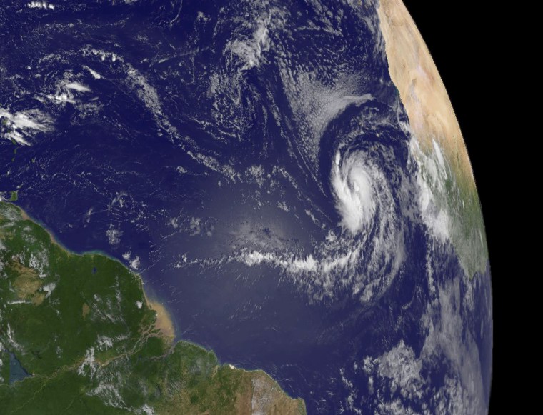
Tropical Storm Fred neared hurricane strength as it spun through the open waters of the eastern Atlantic on Tuesday but its path should keep it clear of any land for several days and perhaps until it dies.
Located southwest of the Cape Verde Islands off the west coast of Africa, Fred was expected to take a track thousands of miles east of the populous U.S. East Coast and the Gulf of Mexico oil patch.
The sixth tropical storm of the 2009 Atlantic season had sustained winds of 70 miles per hour, shy of the 74 mph needed for a Category 1 hurricane on the five-step Saffir-Simpson intensity scale. It was expected to reach hurricane status by late Tuesday or early Wednesday.
The five-day forecast track issued by the U.S. National Hurricane Center would keep it in the eastern Atlantic for all of that time, far from any land.
By 5 p.m. ET, the storm was located about 410 miles west-southwest of the southernmost Cape Verde Islands and was moving to the west at about 14 mph, forecasters said.
Fred's sustained winds were expected to reach about 90 mph, making it a strong Category 1, before it starts to weaken in two days, the NHC said.
"Cooler waters, stronger (wind) shear and drier air should significantly weaken Fred, and it would not be surprising if Fred was only a remnant low by day 5," the hurricane center said in a statement.
Hurricanes draw energy from warm water, so cooler sea surface temperatures can weaken them, while wind shear — a difference in wind speeds at different altitudes — can inhibit their growth or tear them apart.
The cyclone's anticipated track would keep it far from the Gulf of Mexico, where U.S. oil and gas operations are clustered. Energy traders keep a close eye on storms that could enter the Gulf and disrupt offshore production or refinery operations along the coast.
Commodities traders also watch for storms that could damage citrus, cotton and other crops in southern U.S. states.
With the peak of the hurricane season two days away, the Atlantic-Caribbean basin has seen five tropical storms and one hurricane with little damage.
Hurricane Bill, which reached Category 4 in the open ocean, hit Canada's Atlantic provinces as a Category 1 storm.
Tropical storms Ana and Erika sloshed through the northern Caribbean islands, Claudette went ashore in north Florida and Danny fizzled off the Carolinas.
In the Pacific, Tropical Storm Linda spun farther out to sea with maximum sustained winds remaining near 60 mph. The storm is centered about 1,320 miles west-southwest of the southern tip of Mexico's Baja California peninsula. It is moving west near 2 mph.
