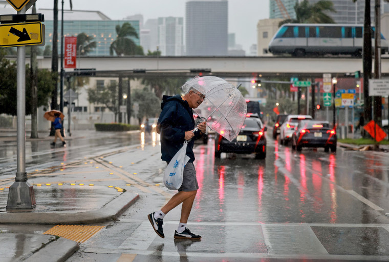
Intense rain in parts of Florida has submerged neighborhoods, turned roads into rivers, closed schools and left more than 108,000 customers without power.
Heavy rain fell over central and southern Florida from Wednesday into early Thursday because of a slow-moving storm system over the Gulf of Mexico.
As many as 7 million people were under flood watches Wednesday. Meanwhile, strong onshore winds created gusts that reached 74 mph at an elevated weather station near Miami and 63 mph at Dania Pier near Fort Lauderdale.

Miami-Dade County recorded 9.35 inches of rainfall in Cache, 7.58 inches in Coral Gables and 4.90 in Miami. Meanwhile, Broward County recorded 8.30 inches in Plantation and parts of Fort Lauderdale picked up anywhere from 2.48 to 5.85 inches.
Radar estimates between Key Largo and the southern Everglades recorded a whopping 15 to 20 inches of rain.
Videos and photos of the deluge showed cars driving on partially submerged highways, streets turned into streams of floodwater and fierce winds whipping palm trees.
Broward County Public Schools were closed Thursday because of the “inclement weather.” In Miami-Dade County, the Metromover transit system was out of service Thursday, replaced with a free bus shuttle service, and all other modes of public transport were experiencing delays because of major flooding.
The city of Fort Lauderdale said in a 7:30 a.m. update that overnight, the city experienced 4 to 8 inches of heavy rainfall and there were reports of power outages, mooring issues, road flooding and wind damage across the area.
“The groundwater table is near saturation, which means additional rain may not be able to drain,” the city said in a release. At the same time, Fort Lauderdale was expecting “the highest tide of the year" Thursday morning, which “could exacerbate the current conditions.”
An additional 2 to 4 inches was expected this afternoon, paired with possible wind gusts up to 40 mph. A flood watch was in effect through noon Thursday, the city said. Drivers were urged to remain off roadways as many traffic lights were down and roads were flooded or had debris.
As of 8:30 a.m. ET, more than 108,000 customers were out of power across Miami-Dade, Broward and Palm Beach counties, according to PowerOutage.Us.
A high wind warning was in effect Thursday morning through 1 p.m. for wind gusts up to 60 mph along coastal Miami-Dade, Broward and Palm Beach County. A storm warning was also in effect for the Atlantic waters through 1 p.m. for gusts of 50 to 60 knots over the waters.
The heavy rainfall this week already brought Fort Lauderdale’s annual rainfall total to more than 100 inches by Wednesday — more than 40 inches above average. This marked only the second time in 111 years of record-keeping that the city's annual rainfall had eclipsed the 100-inch mark. Fort Lauderdale was already having its wettest year on record.
As of Thursday morning, the storm system was pulling away from the Sunshine State, with most of the rain off the southeast coast, but gusty winds remained.
The system was now moving parallel to the Florida coast, but some tropical downpours were still possible across central and northern Florida.
The storm was expected to graze the coastal Carolinas on Friday, producing some spotty tropical downpours and breezy conditions. By Saturday, the storm was expected to clip the New England coast, including Cape Cod, but widespread significant rainfall totals were not expected.
