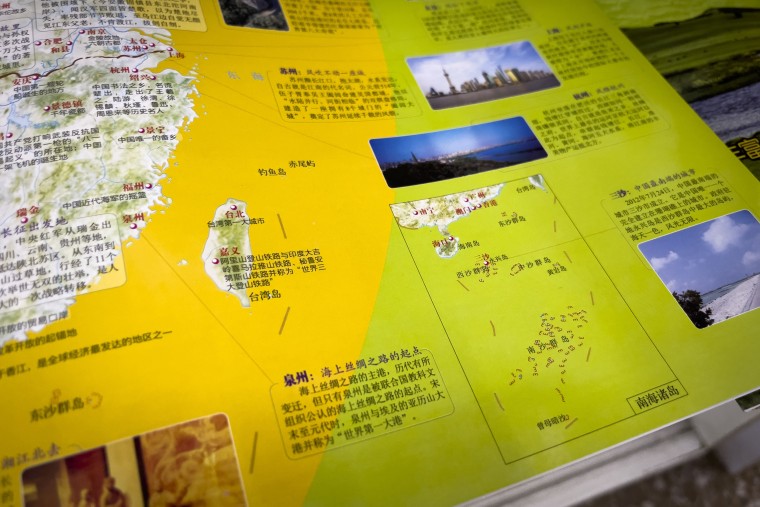
HONG KONG — From the peaks of the Himalayan mountains to the shoals of the South China Sea, China lays claim to a vast territory — and a new national map produced by Beijing is the latest expansive conception of its borders to outrage its neighbors.
The Philippines, Malaysia, Vietnam, Taiwan and India, all of which have territorial disputes with China, have objected to the 2023 version of the country’s “standard map,” released Monday by the Chinese Ministry of Natural Resources.
The map includes a U-shaped line that reaffirms Beijing’s claims to sovereignty over almost all of the South China Sea, a resource-rich and strategically important region through which trillions of dollars in trade flows each year. The line extends into the exclusive economic zones of a number of countries.
China’s new map could worsen clashes in the area, said Donald Rothwell, a professor of law at the Australian National University in Canberra, who focuses on the law of the sea.
Though other countries may object to it, now that the map has been approved by the Chinese government and published, the Chinese navy and coast guard “will seek to assert Chinese sovereignty and jurisdiction based on the map,” he told NBC News on Friday.

‘Consistent and clear’
The Philippines, Malaysia and Vietnam all rejected the map in strongly worded statements.
“This latest attempt to legitimize China’s purported sovereignty and jurisdiction over Philippine features and maritime zones has no basis under international law,” the Philippine Foreign Ministry said Thursday.
It called on China to “act responsibly and abide by its obligations” under international law, as well as a 2016 ruling by an international tribunal in The Hague rejecting Beijing’s South China Sea claims. China, which did not participate in the tribunal’s proceedings, has never accepted the ruling.
Unlike most recent Chinese maps that encircle the South China Sea with a “nine-dash line,” the line on the new map has 10 dashes, although China has used the 10-dash line in the past.
The 10th dash appears to the east of Taiwan, a self-governing island democracy that Beijing claims as its territory. The Taiwanese Foreign Ministry reiterated this week that Taiwan is not a part of China.

“No matter how the Chinese government twists its position on Taiwan’s sovereignty, it cannot change the objective fact of our country’s existence,” ministry spokesperson Jeff Liu said at a news briefing.
The Chinese Foreign Ministry said Thursday that Beijing’s position on the South China Sea was “consistent and clear.”
“The competent authorities of China routinely publish standard maps of various types every year,” ministry spokesperson Wang Wenbin said at a regular news briefing in Beijing on Thursday.
“We hope parties concerned can view it in an objective and rational light,” he added.
Earlier this week, India also said it had lodged a strong protest with China over the map, which lays claim to the Indian state of Arunachal Pradesh, as well as the Aksai Chin plateau, a disputed area in the western Himalayas that is claimed by India but controlled by China.
The Indian Foreign Ministry said the map would only complicate attempts to resolve the deadly border dispute, after Chinese President Xi Jinping and Indian Prime Minister Narendra Modi agreed only last week to intensify those efforts.
The map’s publication comes less than two weeks before India hosts the annual summit of the Group of 20, whose members include China. It is unclear whether Xi will attend, a Biden administration official told NBC News on Thursday.
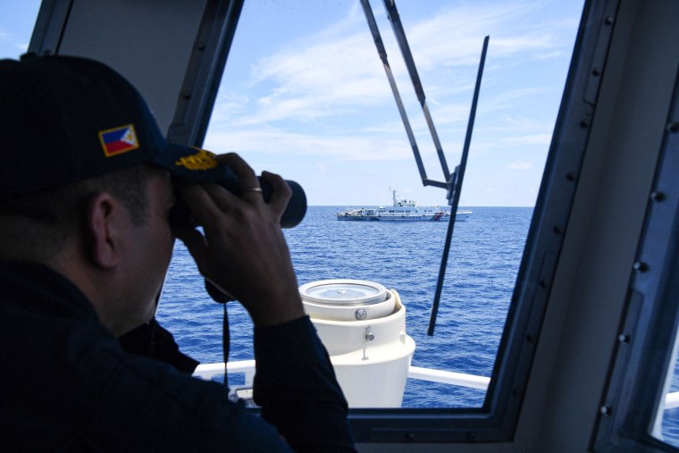
Disputes over the South China Sea go far beyond maps, with the Philippines and China clashing last month over an incident in which China blocked and fired water cannons at Philippine vessels in the waterway.
China has also built on disputed islands, intimidated fishermen and harassed planes and ships from the U.S. and elsewhere whose “freedom of navigation” operations it says threaten Chinese sovereignty.
Rothwell said the timing of the map’s publication was “significant,” coming less than a month after China’s clash with the Philippines, which fueled debate over the legitimacy of any dashed-line map from China and prompted renewed expressions of international support for the 2016 tribunal ruling.
“We now have China reasserting its position and possibly seeking to expand its position, especially with respect to Taiwan,” he said.
The timing is especially significant, he said, because members of the Association of Southeast Asian Nations — including the Philippines, Malaysia and Vietnam — are meeting for a summit in Indonesia next week. China and ASEAN have been negotiating a code of conduct for the South China Sea.
Controversies over maps are not uncommon in Asia, where governments are quick to push back against anything that could be seen as legitimizing Beijing’s territorial claims.
In July, the movie “Barbie” was banned in Vietnam over a scene featuring a map that included what film censors said was the nine-dash line. Warner Bros., the studio behind the film, defended the map — whose line is made up of eight dashes — as a “child-like crayon drawing” and said it was not intended as a political statement.
The film review board in the Philippines disagreed with Vietnam’s interpretation, allowing the movie to be screened.