Depending on where you are and how much you're affected by Hurricane Irene — the storm battering the East Coast — you may or may not be able to get online consistently. But if you can access the Internet, you should know that there are many terrific sites which will help you track weather developments, local situations, and more.
Here's a list of some key online resources.
This is the National Weather Service's official hurricane site. It provides some of the most up-to-date information on the storm.
We've got our own interactive maps ready to help you track the storm.
The Weather Channel's hurricane tracker
Data on the hurricane's predicted path as well as vital statistics such as wind speeds, ground speeds, pressure, and so on.
The New York Times' hurricane tracking map
An oddly beautiful interactive visualization of the storm and its predicted path.
The National Oceanic and Atmospheric Administration's website
More storm maps than most would ever want to see, with a more intense science focus.
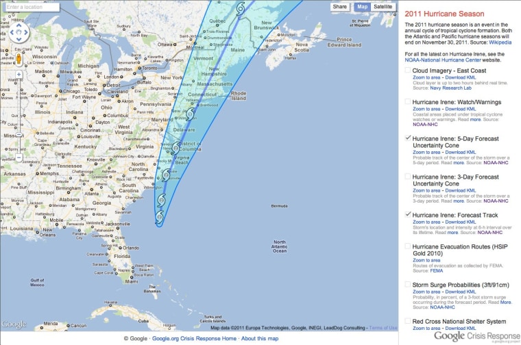
The Google Crisis Response Center
A dashboard with maps that you can use to overlay various data, Google Maps style.
Your local TV or newspaper sites
For the best granular information in your particular city or region, it's probably a good idea to check your local media outlets' websites.
Plenty of scary photos of the storm (which you can turn into wallpapers or something once everything is well and calm again).
Related stories:
- How to prepare, really, tips from a hurricane vet
- Obama: All signs show Irene will be 'historic' storm
- Airlines begin canceling flights as Irene nears
Rosa Golijan writes about tech here and there. She's obsessed with Twitter and loves to be liked on Facebook. Oh, and she can be found on Google+, too.
