Robotic aerial vehicles are on the front lines for combat and security monitoring, but they're also increasingly on the front lines for archaeology and other research.
Archaeologists at Peru's Catholic University are using custom-made drones to help map sites associated with the 1,300-year-old Moche civilization, which pre-dates the rise of the Incas. The ruins of ancient cities lie along the Peruvian coast north of Lima, around San Idelfonso and San Jose del Moro, but they've deteriorated so much that they're hard to make out with the human eye.
"We can convert the images that the drones provide into topographical and photogrammetry data to build three-dimensional models," archaeologist Luis Jaime Castillo told the AFP news service. "By using the pictures taken by drones, we can see walls, patios, the fabric of the city."

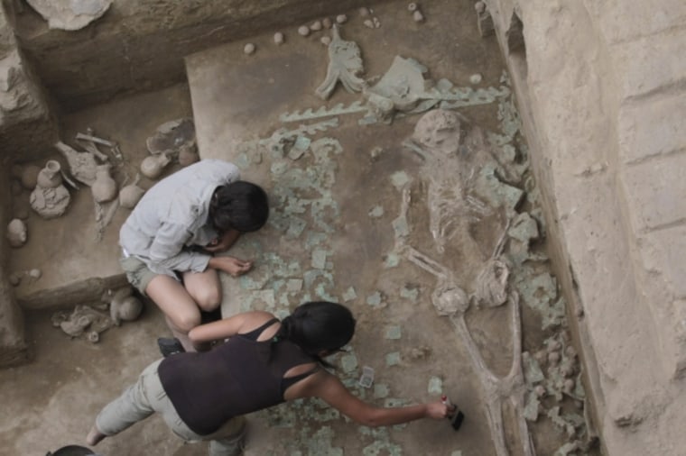
Just this month, Castillo's team reported the discovery of a 320-square-foot (30-square-meter) burial chamber, apparently containing the remains of a Moche priestess and seven other individuals. It's just one of the finds facilitated by robotic reconnaissance.
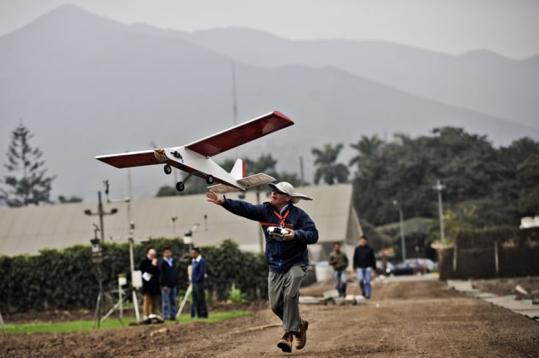
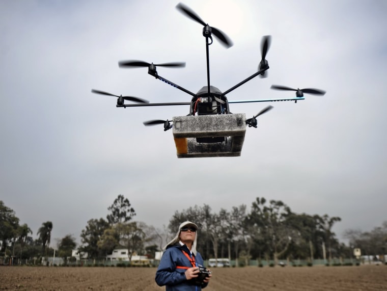
Catholic University's Unmanned Aircraft Systems Group is looking into applications ranging from archaeology to agriculture to public safety. The drones are built by the university's engineers, and equipped with cameras, computers, GPS trackers and other sensors and navigational equipment. They're programmed using Google Maps to fly autonomously and return to base with their data.
"In agriculture, drones allow us to observe a larger cultivation area and estimate the health of the plants and the growth of the crops," Hildo Loayza, a physicist with the International Potato Center in Lima, told AFP. "The cameras aboard the drones provide us with 500 pieces of high-technology data, while with the human eye one can barely collect 10."

Andres Flores, an electrical engineer who heads Catholic University's UAS Group, said the drones could be used to study wildlife in the Amazon jungle. "Every time an animal goes by, it can snap a picture," he told AFP.
Meanwhile, archaeologists and engineers from Vanderbilt University have been looking into using backpack-sized drones for mapping purposes in Peru. Elsewhere, researchers have used robotic aerial vehicles to map the Himera archaeological dig in northern Sicily, which was the site of an ancient city going as far back as the 7th century B.C. And in Israel, drones have created 3-D maps for the Galilee Prehistory Project.
Several issues looms over the development of drones for scientific purposes: For example, many countries are still working out the regulations for the operation of robotic air vehicles. Such vehicles have to be operated safely, so that they don't injure the people nearby — or, for that matter, the ancient sites being mapped. And even though scientific drones aren't nearly as fearsome as the U.S. military's Predators and Reapers, they do raise privacy concerns. To learn more about those issues and how they're being addressed, check out this report in Anthropology News from Austin "Chad" Hill of Christian Albrechts University.
More about aerial archaeology:
- Laser scans flesh out saga of Cambodian lost city
- Aerial imagery reveals lost city in Honduras
- Space scientists spot lost pyramids in Egypt
Alan Boyle is NBCNews.com's science editor. Connect with the Cosmic Log community by "liking" the NBC News Science Facebook page, following @b0yle on Twitter and adding +Alan Boyle to your Google+ circles. To keep up with NBCNews.com's stories about science and space, sign up for the Tech & Science newsletter, delivered to your email in-box every weekday. You can also check out "The Case for Pluto," my book about the controversial dwarf planet and the search for new worlds.
