Coverage on this live blog has ended. Please click here for the latest updates.
Tropical Storm Idalia continued to bring heavy rains to South Carolina and posed a risk of sending storm surge ashore, hours after it made landfall in western Florida as a Category 3 hurricane, officials said.
The hurricane destroyed homes and flooded coastal communities in Florida, and at least one death there, a car crash, was blamed on the weather, officials said.
As a tropical storm, Idalia flooded parts of Charleston, and the harbor in the South Carolina city recorded its fifth-highest peak tide Wednesday night, according to the National Weather Service.
Big Bend counties bore the brunt of the storm, Florida Gov. Ron DeSantis said at a news conference.
“We haven’t had a storm take this path at this level since the 1890s, that hit this part of Florida, so this is something that that is a really big deal,” DeSantis said.
Around 150,000 customers were without electricity in Florida late Wednesday, and around 149,000 were without power in Georgia, according to tracking website poweroutage.us.
More on Hurricane Idalia
- Idalia made landfall in Florida's Big Bend near Keaton Beach just before 8 a.m. ET., with maximum sustained winds of 125 mph.
- The storm has flooded streets, closed airports and canceled flights, as well as caused widespread power outages.
- Idalia is now a tropical storm after it briefly reached Category 4 hurricane status overnight.
- Storm surge warnings and watches have been ended for Florida. The hurricane watches for Georgia and South Carolina have also ended. A tropical storm warning remains in effect for parts of the Savannah River and two North Carolina sounds.
- NBC News has a team on the ground reporting on the hurricane's impact.
Around 330,000 customers without power in Florida, Georgia, S.C.
Power outage numbers improved in Florida and Georgia after Idalia, but around 300,000 customers in the two states remained in the dark late tonight after the storm, according to the tracking website poweroutage.us.
South Carolina, where the storm was centered late tonight, had around 35,000 customers without power, according to the website.
Earlier today, around 440,000 customers had been without electricity in Florida and Georgia combined.
Idalia to move offshore tomorrow, forecasters say
Tropical Storm Idalia is forecast to move “near or along the coast” of South Carolina tonight and offshore sometime tomorrow, the National Hurricane Center said.
In an 11 p.m. update, the agency said the storm was moving northeast at 21 mph.
It is forecast to remain a tropical storm even as it moves offshore, the hurricane center said.
There had been some discussions earlier today as to whether it would weaken, according to forecast discussions, but the NHC said its forecast had the storm remaining as a tropical storm.
Idalia northwest of Charleston, producing ‘very heavy rain’
Idalia remained a tropical storm late today and was producing “very heavy rain” in South Carolina, the National Hurricane Center said in an update.
The center of the storm was around 15 miles north-northwest of Charleston at 11 p.m., the agency said. It had maximum sustained winds of 60 mph.
Some storm surge warnings were discontinued, but a storm surge warning remained for a stretch of the South Carolina coast from the Savannah River to the South Santee River, which includes Charleston.
Dry Tortugas plans to reopen; staff assessing damage
Dry Tortugas National Park will reopen tomorrow, the National Park Service said today, and staff members in the coming days will evaluate any damage left by Hurricane Idalia.
The park is made up of islands to the west of Key West. It’s known for marine life and coral reefs, among other attractions. It closed ahead of the hurricane.
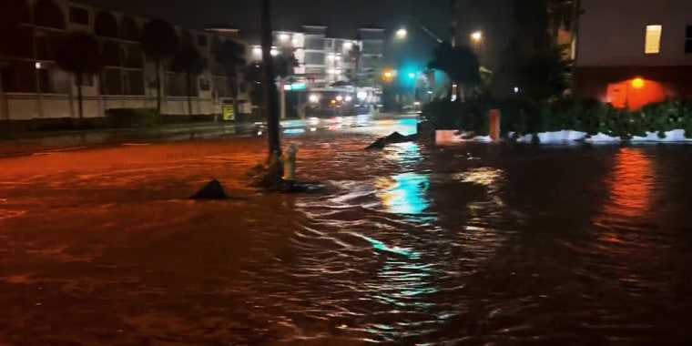
Floodwater covers streets in Charleston
CHARLESTON, S.C. — Peak tides swelled over the Battery wall in downtown Charleston on Wednesday night, inundating nearby roads after Idalia brought what the National Weather Service said could be the fifth-highest peak tide on record.
Water on the streets around the Battery was ankle or shin deep in areas, submerging parts of the White Point Garden park.
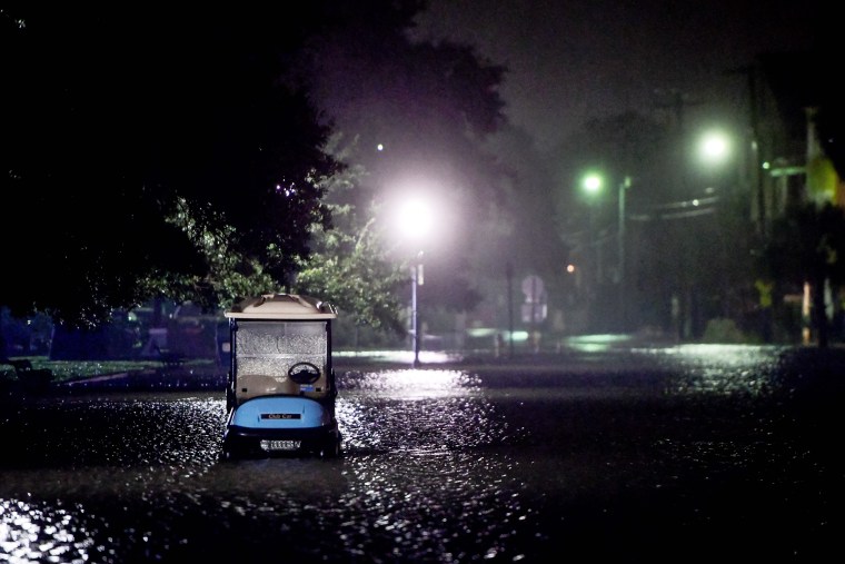
Floodwater rolled down a street like a river as downed branches, leaves and debris lined nearby sidewalks.
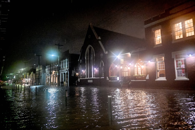
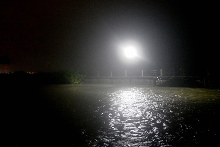
Near the boarded-up Charleston City Market, traffic lights illuminated a flooded road, which was empty except for one police car with flashing lights parked on a dry side street.
Charleston tide thought to be 5th-highest on record
Tonight’s tide in Charleston ranks fifth highest on record, the National Weather Service there said.
It peaked at 3.47 feet “mean higher high water,” which is a value that measures the higher of two tides, or 9.23 feet using the mean lower, the weather service said on social media.
“Preliminarily, this event will rank as the 5th highest peak tide on record (back to 1921),” it said.
A car crash that killed a person in Pasco County, Florida, is being considered a "traffic fatality," authorities said.
"The weather was not that bad when the gentleman was driving," said Andy Fossa, Pasco County's emergency management director.
The road was "extremely curvy" and "slick," which led the driver to lose control of the vehicle and strike a tree.
The Florida Highway Patrol had initially said the incident was weather-related.
The revision brings the known Idalia death toll in Florida back to one. A 59-year-old Gainesville man died after his truck veered into a ditch in "extremely rainy" conditions in Alachua County, the highway patrol said.
Gainesville residents getting back to business as usual
GAINESVILLE, Fla. — “This one hasn’t been that bad,” Randolph James, 72, who has lived in Gainesville 20 years, said today. “I called my family in Carolina, and they said it’s tearing it up up there.”
James bought essentials like food and water, and his home never lost power.
Hundreds of thousands of other people in Florida, as well as Georgia, did lose electricity, according to the tracking website poweroputage.us. In Charleston, South Carolina, winds of 55 mph had been recorded by 7 p.m., according to the National Weather Service.
Kyle Shi, 34, the owner of Mahzu Sushi & Grill in Gainesville, said that he thought the storm would be bad but that today went relatively smooth. The restaurant opened at its normal time, and it was packed. “So many people called to ask if we were open," Shi said.
Charleston tide within top 8 peak tides on record
The tide in Charleston, South Carolina, which recently was a little over 9 feet, is within the top eight peak tides on record, the National Weather Service said.
It was 9.03 feet at around 8 p.m., the weather service in Charleston said.
Flooding was occurring in downtown Charleston and had breached the Battery, according to the agency.
Some streets flooding rapidly in downtown Charleston
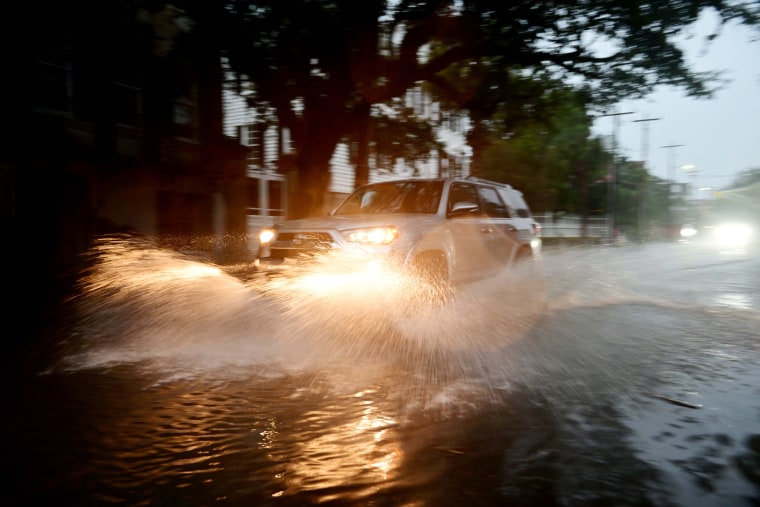
CHARLESTON, S.C. — Some streets in downtown Charleston began to flood quickly as tides fueled by Idalia continued to rise just before 8 p.m.
Around Lockwood Drive and Broad Street, police blocked off a road where waters rose high enough to cover the street and sweep up over the sidewalks, creeping toward large homes and apartments.
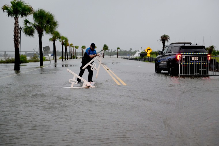
A police officer got out of his SUV and picked up a road barricade that was beginning to float away.
A few cars were still on the road as streets flooded in the downtown area, whipping water as they drove past.
Tornado watch issued for parts of North Carolina coast
Tropical Storm Idalia over southern South Carolina
Once a hurricane, Tropical Storm Idalia was over southern South Carolina tonight and still carried the risk of floods and storm surge, forecasters said.
The storm was around 60 miles west of Charleston shortly before 8 p.m., the National Hurricane Center said in an update, and it had maximum sustained winds of 65 mph.
Water has breached the Battery in Charleston
Winds whip and waves crash in downtown Charleston as tides rise
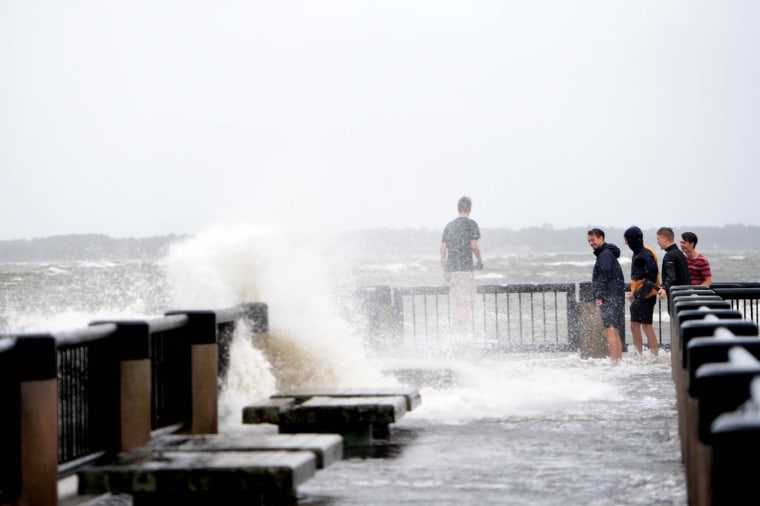
CHARLESTON, S.C. — Along the Battery downtown, high winds whipped and large waves began to crash over the wall and spill onto the street around 6 p.m, about two hours before Tropical Storm Idalia was expected to bring harbor tides reaching 8.7 feet and flooding to the area.
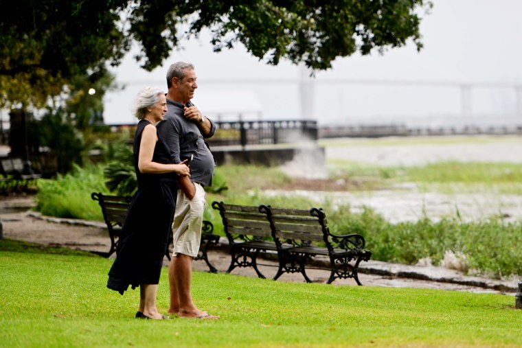
As some palm trees swayed, the occasional jogger or spectator passed by.
Christian Rabens, 49, a local boat captain, said he wanted to come out and see how the storm was beginning to affect the harbor.
“It’s starting to look pretty bad,” he said as waves crashed onto the Battery, a defensive seawall and promenade in Charleston. “I’m glad I’m not on the boat right now.”
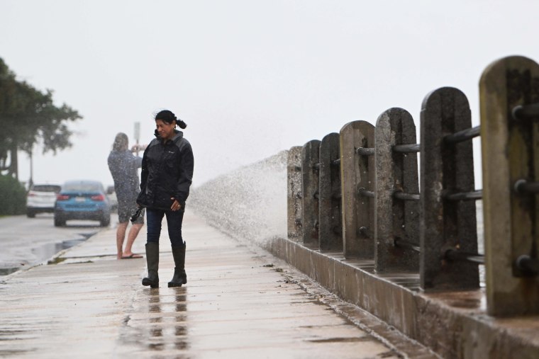
“You never see the waves crash over the Battery unless there’s a storm like this,” he added. “In this area, you don’t see it coming over the sidewalk and into the road.”
On a nearby street downtown, Lee Tawes was sweeping a storm drain outside his home.
Tawes, 75, said that during storms, the floodwaters can block off the street completely.
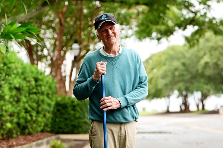
“It can build up a lot, and you can’t get traffic through here,” he said.
Meanwhile, the National Weather Service in Charleston said at 6:20 p.m. that tides in Charleston Harbor were expected to pass 7 feet shortly.
“The risk for major coastal inundation will quickly increase over the next few hours,” it said on social media. “If in Downtown Charleston, be sure cars are out of flood prone area. Be alert for likely road closures.”
South Carolina police department: Stop driving around road closed signs
Police in Horry County, South Carolina, are warning people to stay in because of the tropical storm and scolding those who ignore warning signs.
“If you are on the roads, heed these signs. (We are seeing people drive right around them, in floodwaters…),” Horry County police said today on the social media platform X, formerly known as Twitter.
Police also asked people to stay off the roads, saying conditions were deteriorating.
Horry County and other areas are under a tropical storm warning, according to the National Weather Service. Heavy rain could cause flooding, it said.
Officials routinely warn people not to drive in floodwaters, because vehicles can be swept away and their occupants can drown.
Florida residents eager to check property, assess damage
As Florida’s west coast tries to dry out, people are braving floodwaters to check on their homes after Hurricane Idalia.
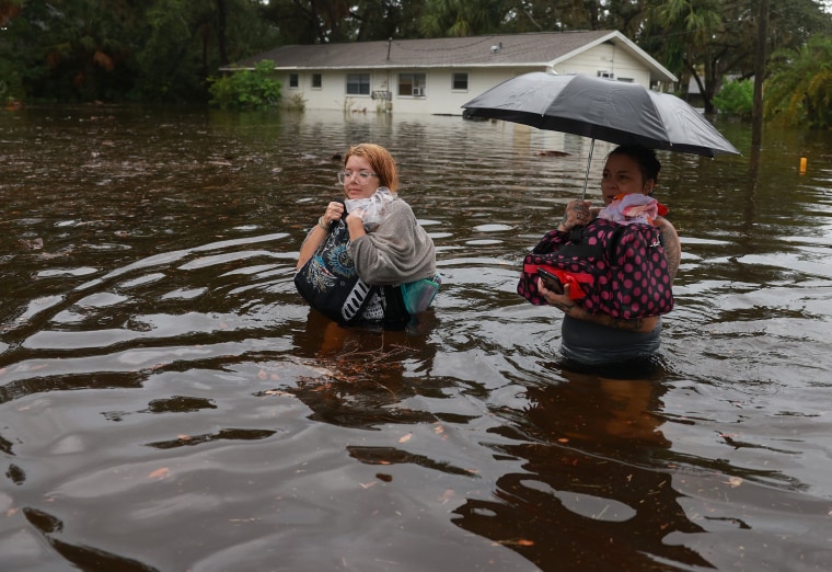
Kristen Sarmiento, a property manager and real estate agent, walked through calf-deep water with her 7-year-old son on the streets of Hudson this morning to check on a rental property. She stopped short of her destination.
“The water got deep and kind of nasty,” Sarmiento said. “I couldn’t really see the bottom, so I didn’t want to keep going, because of snakes and stuff like that.”
Water was flowing slowly down the streets in Hudson, which is about 30 miles northwest of Tampa Bay. Sarmiento said it smelled like boat fuel and the water had an oily sheen on its surface. She said most houses, which are raised on stilts or blocks, did not appear to be inundated.
“I didn’t see houses where there was water through the front door. I did see three or four cars stuck and submerged under water,” she said.
Sarmiento saw people with airboats or rafts taking people who did not evacuate away from the waterfront neighborhoods along Sea Ranch and Del Mar drives. She saw at last three people being rescued, she said.
“It felt, like, pretty calm,” Sarmiento said. “It didn’t feel like a freak emergency situation. I didn’t hear anybody or see anybody injured.”
No reports of flood-related deaths or missing people
Officials sounded optimistic this evening, saying mass evacuations appear to have mitigated large loss of life.
With initial searches and rescues 75% completed, officials have yet to find anyone who died related to the flooding, said Kevin Guthrie, the executive director of Florida's emergency management agency. He also said there have been no missing person reports from local law enforcement agencies throughout the state.
Gov. DeSantis also said the tone of emergency calls made during Idalia was dramatically different from the tone of calls last year during Ian, when many people died.
"I remember when that storm was hitting. ... Panicked phone calls of people calling whose homes were filling up with water was something that was very, very ominous," DeSantis said.
Officials are working on a major disaster declaration to be submitted to FEMA tonight, the governor said.
About 250,000 power outages had been reported by 6 p.m. ET, but more than 315,000 customers' electricity was restored today. All state bridges, including the Cedar Key Bridge, have been inspected and cleared by the state Transportation Department.
None of the 10 evacuated hospitals are expected to be fully operational after a state assessment to clear patients' returns, DeSantis said.
Prison in Florida county where Idalia made landfall was not evacuated
Taylor Correctional Institution, which was in Idalia's path and is about 5 miles off the Gulf Coast, remained open ahead of landfall this morning.
"At Taylor CI, inmates are housed in hardened dorms built to withstand high winds. This was done to ensure the highest level of safety and security for those under our care and custody," the state Corrections Department said.
The facility’s structure was not damaged, and all inmates are safe and secure, the department said.
"There was no need to evacuate," the statement said.
The prison's capacity is listed at 1,282 inmates, according to the Corrections Department.
The prison is in one of the hardest-hit areas of the state. Videos and photos showed a gas station awning toppled by winds, as well as buildings and homes with their roofs ripped off.
More than 4,000 inmates were moved ahead of Idalia, including some farther inland than Taylor Correctional Institution.
Tides are rising in Charleston as Idalia heads that way
More than 450,000 customers without power in Florida and Georgia
Almost half a million homes and businesses across storm-battered Florida and Georgia are without power this evening, according to the tracking website poweroutage.us.
Florida has around 225,000 customers out, and in Georgia it's more than 232,000, according to the website. A utility customer is a home or a business, not the number of people affected by an outage.
Georgia Power said crews from Mississippi came to assist before the hurricane.
In Florida, crews traveled to the northeastern part of the state to help, the utility Florida Light and Power said.
A look at Shore Acres, Fla., flooding
Tornado reported to flip car in South Carolina
What was reported to be a tornado flipped a car in Goose Creek, north of Charleston, according to the National Weather Service.
Police said two people were inside and suffered minor injuries, NBC affiliate WCBD of Charleston reported. Emergency management officials in Berkeley County reported the incident to the weather service.
Goose Creek is around 15 miles north and slightly to the west of Charleston.
Rep. Nancy Mace, R-S.C., warned that tornadoes had touched down in the Lowcountry and urged people to pay attention to weather alerts.
Tonight's supermoon could worsen flooding from Idalia
A rare “blue supermoon” rises tonight — a treat for skywatchers but a celestial occurrence that could worsen the risk of flooding from Idalia.
Beyond making for a pretty spectacle in the night sky, the moon’s gravitational pull on Earth has a profound influence on the planet’s tides. High tides during full moons and new moons can cause “major problems on some coasts, especially if weather adds high waves or a storm surge (due to low atmospheric pressure over the involved area),” according to NASA.
Idalia is moving over southeastern Georgia, about 40 miles west of Savannah. Tonight’s supermoon could make tides even higher than normal, worsening tidal flooding in Florida, Georgia and the Carolinas.
The second full moon of the month is known as a “blue moon,” and because the moon is closer to Earth than normal, it’s dubbed a “supermoon” because it tends to appear bigger and brighter in the night sky.
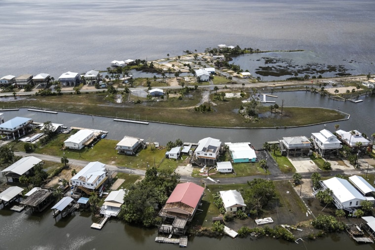
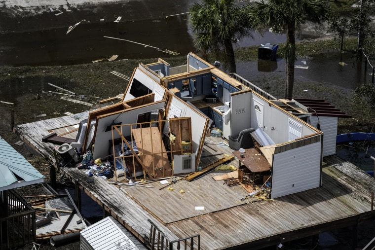
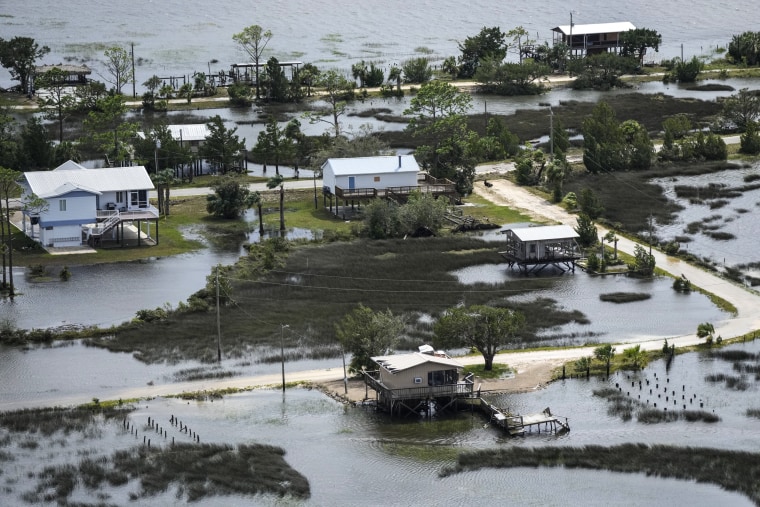
Photos: Receding stormwaters surround homes in Keaton Beach, Fla.
Here's a view of damaged homes in Keaton Beach, Florida, after Hurricane Idalia passed through today. The images were captured during a flight provided by mediccorps.org.
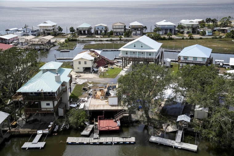
Idalia downgraded to a tropical storm
Idalia has slowed down significantly since it made landfall this morning and has been downgraded to a tropical storm, with sustained wind speeds lower than 70 mph.
The storm system was 40 miles west of Savannah, Georgia, at 5 p.m. ET, according to the National Hurricane Center.
Storm surge warnings and watches have been discontinued for Florida.
The hurricane watches for Georgia and South Carolina have been changed to tropical storm warnings.
This is one of the many reasons not to go out in floodwaters
Idalia should be a 'wake-up call' for Tampa Bay, scientist says
Tampa avoided a direct hit from Idalia, but the impacts from the hurricane’s wind and rain show how vulnerable the entire region is to major storms, said Jeff Masters, a former hurricane scientist with the National Oceanic and Atmospheric Administration.
Preliminary estimates suggest much of the area around Tampa experienced 3 to 4 feet of surge, with the National Hurricane Center forecasting that some areas could get up to 5 feet of storm surge.
Those figures would be among the highest storm surges on record for Tampa Bay going back to 1940, said Masters, who now works as a meteorologist for Yale Climate Connections.
“That’s a big deal, and there’s going to be considerable damage in that heavily populated area,” he said. “They’re seeing just what storm surge can do even though it missed by more than 100 miles. That should definitely be a wake-up call for Tampa Bay.”
Some Florida Gulf Coast residents who chose to ride out Hurricane Idalia at home were forced to “swim out of their windows” to escape waves of water crashing through their front doors early this morning.
In Crystal River, the powerful Category 3 hurricane left a trail of destruction behind, including toppled trees and homes and buildings almost completely underwater.
Brenda and Phil Henley, who live in Crystal River and chose not to evacuate, told MSNBC’s José Díaz-Balart that some people had to swim to safety.
“Swimming out of their windows, literally, from their homes,” Phil Henley said, adding that the water moved in fast.
Citrus County, where Crystal River is located, was under a mandatory evacuation order for all low-lying areas west of U.S. Highway 19. The Henleys chose to ride out the storm at home but left once the water started coming.
“I said we got to get out of here because we’re fixing to get flooded out,” he said.
Idalia charges across Georgia
Map: rainfall totals across Florida
CHARLESTON, S.C. — The governor of South Carolina said Wednesday that while Idalia may not be as destructive as some previous storms, it will still wreak havoc on parts of the state.
"It’s going to cause high winds," Gov. Henry McMaster said at a news conference. "There will be a lot of water, particularly of course in the low country.”
McMaster, a Republican, said that he would not be ordering any evacuations or closing of state agencies.
Still, officials said people should prepare for dangerous flooding, flash floods, downed trees and power outages.
“A reminder: This is not just a coastal event," Kim Stenson, the director of South Carolina’s emergency management division, said at the news conference. "Much of South Carolina is going to be affected by the impacts of this hurricane over the next 24 to 48 hours."
Officials said that there were multiple shelters open throughout the state including one in Charleston County, two in Williamsburg County and one in Jasper County, with more potentially opening over the next 24 hours.
Flooding from Steinhatchee River
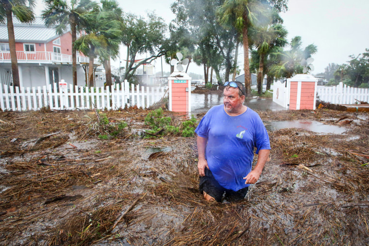
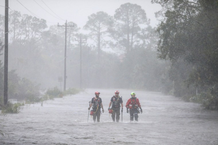
How Hurricane Idalia went from a Category 1 to a Category 4 overnight
Warm waters in the Gulf of Mexico helped fuel Hurricane Idalia’s rapid intensification hours before it made landfall, a phenomenon that experts say will likely occur more often in a warming world.
As Idalia moved through the Gulf on Tuesday, its winds rose by 55 mph in just 24 hours, strengthening from a Category 1 hurricane to a Category 4 by early Wednesday. It weakened slightly to a Category 3 hurricane before making landfall a few hours later in Florida’s Big Bend, near Keaton Beach.
But Idalia’s intensification as it approached the Florida coast is “to be expected with hotter ocean temperatures,” said Jeff Masters, a former hurricane scientist with the National Oceanic and Atmospheric Administration who now works as a meteorologist for Yale Climate Connections.
The world’s oceans in recent months have shattered temperature records, with multiple bodies of water — including the North Atlantic, the Gulf of Mexico and the Caribbean Basin — engulfed in severe marine heat waves.
In a White House briefing Wednesday, FEMA Administrator Deanne Criswell said hurricanes in recent years have intensified rapidly because of elevated ocean temperatures.
These events have added to the challenges faced by local officials in the days and hours before storms hit.
“These storms are intensifying so fast that our local emergency management officials have less time to warn and evacuate and get people to safety,” Criswell said.
Biden receiving updates on Idalia; FEMA administrator to head to Florida
The White House said President Joe Biden is receiving updates on the hurricane's path, along with regular briefings from his team.
Biden had directed the federal government to pre-position people and resources ahead of Idalia's landfall in an effort to support recovery efforts in Florida and the surrounding states, including more than 1.3 million meals and 1.6 million liters of water, the White House said.
FEMA Administrator Deanne Criswell said Biden had directed her to go to Florida and join Gov. Ron DeSantis in assessing recovery needs.
Idalia’s winds subside as storm brings heavy rain to Georgia and the Carolinas
After whipping through Florida, Idalia now has maximum sustained winds near 80 mph, the National Hurricane Center said in a 1 p.m. ET update. While still fierce, it's weaker than the 125 mph maximum sustained winds recorded during landfall.
Idalia quickly moved over Florida and is now 40 miles northeast of Valdosta, Georgia, bringing heavy rains to southern Georgia and parts of the Carolinas, the weather service said.
It's moving north-northeast at 20 mph. A weather station near Jekyll Island in Georgia reported sustained winds of 43 mph, the agency said.
Tree falls on Florida Governor's Mansion; no injuries
A massive tree fell at the Florida Governor's Mansion in Tallahassee, according to Florida's first lady.
Casey DeSantis posted a photo on X, the website formerly known as Twitter, showing an oak tree that apparently cracked and then toppled over near the mansion.
DeSantis said her children — Mason, Madison and Mamie — were at the mansion when the tree fell, but there were no injuries.
Tallahassee was spared the worst effects of Hurricane Idalia, but wind gusts did tear down several trees. The hurricane’s impacts knocked out power to tens of thousands in the city.
Florida’s Apalachee Bay hit by major hurricane for first time in recorded history
Florida is no stranger to ferocious storms, but the state’s Apalachee Bay — an estuary 25 miles south of Tallahassee — usually dodges the most fearsome weather conditions.
Hurricane Idalia had other plans.
Idalia, which made landfall in Florida as a Category 3 storm on Wednesday, became the first major hurricane to enter Apalachee Bay since modern record-keeping started in 1851, according to the National Weather Service office in Tallahassee, the state capital.
Tallahassee spared worst of Idalia
Hurricane Idalia grazed Tallahassee, but the city avoided much of the storm's punch.
“We were fortunately spared from the worst,” said Israel Gonzalez, a National Weather Service meteorologist in Tallahassee.
Gonzalez said winds gusted above 50 mph at times this morning, but the storm tracked far enough east to avoid the most dangerous impacts for the city of about 200,000, which is Florida’s capital.
“Most impacts we’ve heard have been in the form of power outages, but nothing too much more than that at the time,” Gonzalez said. “That could change as the dust settles.”
Nearly 30,000 people were without power in Tallahassee as of 12:30 p.m. ET, according to a city utility outage map.
Leon County, which contains Tallahassee, reported a handful of downed trees, blocked roads and damaged structures in a Wednesday morning update. There were about 500 people using county shelters, according to a county update.
A slight deviation in the storm track could have spelled catastrophe for Tallahassee.
“If the track was more westward, it’s likely Tallahassee would have experienced more impacts. Fortunately, we stayed more on the north side of Idalia’s circulation,” Gonzalez said.
Charleston County tells residents to stay indoors for next 24 hours
CHARLESTON, S.C. — The emergency management director of Charleston County in South Carolina said Wednesday afternoon that his message ahead of Idalia’s arrival here tonight was “to stay indoors and not go out for like the next pretty much 24 hours.”
“We’re about to start receiving tropical storm force winds within the county,” Joe Coates, the Charleston County emergency management director, told NBC News early Wednesday afternoon.
Coates said that storm surge from Idalia and the King Tides, which bring especially high tides, mean the tide is forecast to hit 8.3 feet later tonight when Idalia is expected to arrive, around 8 p.m.
First responders cut path through devastation in Perry
PERRY, Fla. — First responders and some residents are working to cut a path through downed tress and power lines as storm response continued this morning.
Beach Road — a main road into the city that sits southeast of Tallahassee — was impassable. Significant tree damage was apparent, and a gas station awning had fully collapsed.
Videos and photos show Idalia's wrath in Florida
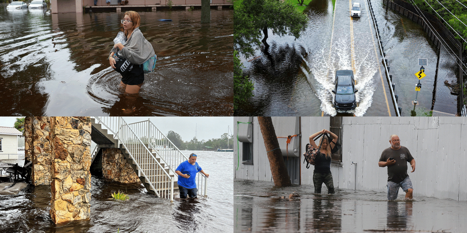
Tampa police shared an early morning video showing waves from the coast crashing over a railing and flooding the waterfront road of Bayshore Boulevard as winds whipped palm trees and traffic lights around 2:45 a.m. ET.
Reporter Beth Rousseau of NBC's Tampa affiliate WFLA shared video showing Pasco County neighborhoods submerged in water.
In the city of Perry, the hurricane’s western eyewall brought strong winds and heavy rains about an hour after it made landfall, according to a video posted on X.
Second death from weather-related crash in Florida
A 59-year-old man from Gainesville died Wednesday after getting into a rain-related crash in Alachua County, the Florida Highway Patrol said.
The man was driving a Toyota Tacoma and traveling westbound on Florida State Road 20 in “extremely rainy conditions,” the agency said. The vehicle veered out of its lane and into a ditch on the north side of the road and ultimately crashed into the nearby tree line, officials said.
"The Alachua County Fire Rescue arrived on the scene and declared the driver of the Toyota deceased," the Florida Highway Patrol said in a press release.
That brings the known Idalia death toll in Florida to two.
DeSantis said in a briefing Wednesday afternoon that there have been no confirmed storm-related fatalities, and the two weather-related traffic deaths must be reviewed.
“There’s a process for confirmed fatalities. It just goes through law enforcement and medical examiners. That has not been done yet where we have a confirmation. I know there are unconfirmed reports. Those may end up becoming confirmed,” he said.
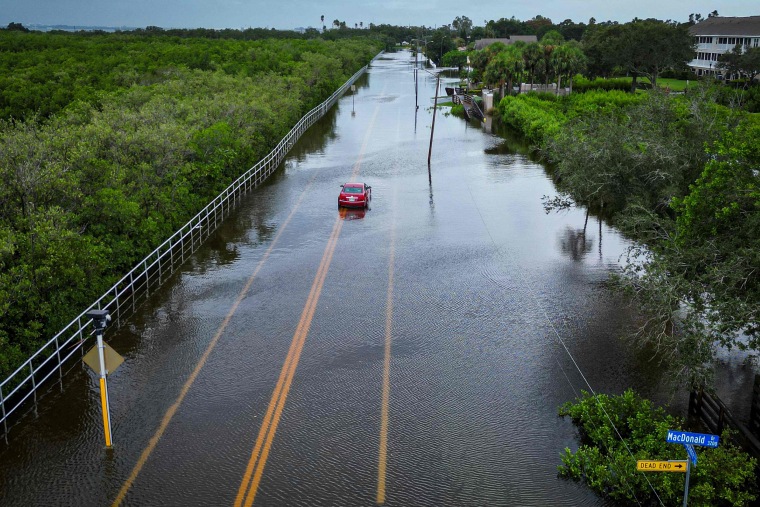
Roads flooded in Tampa
Hurricane Franklin creating life-threatening surf along the Eastern Seaboard
As Idalia hammers Florida and heads northeast, another storm — Hurricane Franklin — is churning in the western Atlantic.
Franklin, the second hurricane of the 2023 Atlantic hurricane season, is creating “potentially deadly surf and rip currents along the U.S. East Coast,” the National Weather Service said today, warning of dangerous beach conditions.
As of 11 a.m., Franklin’s outer bands were passing near Bermuda with maximum sustained winds of 105 mph, moving northeast at 13 mph.
Franklin isn’t forecast to make landfall; instead, it's anticipated to swirl northeast toward the open water east of Canada.
Idalia weakens to Category 1
Idalia is now a Category 1 hurricane, the National Weather Service in Tallahassee said in an 11 a.m. update.
“Damaging wind gusts continue around the storm and heavy rains around the center are leading to several water rescues in south-central Georgia. Additionally, storm surge concerns remain across the Big Bend,” it said.
Pinellas County ‘spared’ by Idalia, but flooding forecast to worsen
Pinellas County, Florida, which includes the popular beach cities of St. Petersburg and Clearwater, was “spared” from a direct hit by Idalia, but officials warned that overnight flooding and storm surge will worsen this afternoon.
“We’re going to see the greatest impact with storm surge about two hours after it made landfall and the problem there is that it coincides with a high tide," Pinellas County Sheriff Bob Gualtieri said in a morning briefing. "So we’re gonna see some peak water especially in the Clearwater Beach area, the Gulf beaches and then moving south."
He noted the county has already seen several rescues.
“High tides around the county will be starting at around 11:15 a.m. to about 4 p.m.,” county Emergency Management Director Cathie Perkins said.
Idalia's damaging winds move into Georgia
Damaging winds from Hurricane Idalia are now spreading into southern Georgia, according to the National Hurricane Center.
The storm has maximum sustained winds near 105 mph, with higher gusts, based on radar data from the National Oceanic and Atmospheric Administration.
At the moment, Idalia is located around 25 miles south of Valdosta, Georgia. An airport in that city reported sustained winds of 39 mph, with gusts of 63 mph, according to the hurricane center.
Driver dead in weather-related car crash, Florida Highway Patrol says
A 40-year-old man has died in a weather-related accident in Pasco County early this morning, the Florida Highway Patrol said.
The driver, who has not been identified, was in a Ford Ranger traveling eastbound on Saint Joe Road in “inclement weather” and driving “too fast for conditions,” around 6:15 a.m., Sgt. Steve Gaskins said.
The driver lost control of the vehicle, which veered off the roadway and collided with a tree. The individual suffered “fatal injuries” at the scene, he said.
Idalia becomes eighth major hurricane to hit U.S. since 2017
When Idalia made landfall this morning as a 125 mph Category 3 hurricane, it became the eighth major hurricane (defined as Category 3 or above) to make landfall on the United States since 2017.
- Idalia, 2023
- Ian, 2022
- Ida, 2021
- Laura, 2020
- Zeta, 2020
- Michael, 2018
- Irma, 2017
- Harvey, 2017
These past six years have seen an extraordinary stretch of damaging hurricanes striking the country.
When examining the six-year period prior to 2017, there were no major hurricane landfalls on the mainland U.S. More astonishing, still, prior to 2017, the last major hurricane landfall was 12 years earlier, when Hurricane Wilma slammed into Florida.
When Category 1 and 2 hurricanes are included, total landfalls since 2017 skyrocket to 19 in six years, including Idalia. That’s an average of three hurricane landfalls per year.
Prior to 2010, the U.S. averaged just one to two hurricane landfalls each year, and major hurricane landfalls were even more rare.
Water levels at Steinhatchee River surged from 1 to 8 feet in just an hour
Water levels in the Steinhatchee River in Big Bend Florida ballooned rapidly this morning as storm surge moved in from Idalia — surging from 1 foot to 8 feet in just an hour, the National Weather Service in Tallahassee said.
As of 8:30 a.m., that meant the river was 2 feet above major flood stage, which is at 6 feet.
Flooding and fierce winds batter Sarasota
Overnight video footage showed a downtown Sarasota neighborhood inundated and slammed by winds that shook trees and street signs around 1 a.m. ET, ahead of Idalia’s landfall.
Streets turning into rivers is just a glimpse of the damage Florida's Gulf Coast cities are facing today.
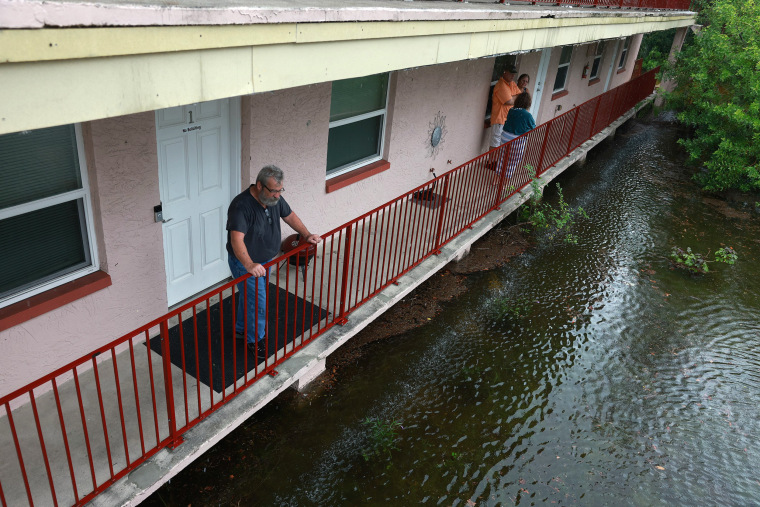
Some flee the rising waters with what they can carry
Charleston could see its 11th-highest tide
Charleston, South Carolina, could record its 11th-highest tide as Hurricane Idalia spirals northeast.
Last evening, a tide of 7.7 feet was recorded at Charleston Harbor, hitting moderate flood stage. The tide is forecast to hit 8.5 feet by tonight, according to the National Weather Service Office in Charleston.
The highest crest on record in Charleston was at 12.52 feet in September 1989. If the high tide does hit 8.5 feet, it’ll fall under the 10th-highest crest on record, which was 8.51 feet Nov. 7, 2021.
Idalia is forecast to be at hurricane strength when it reaches southeast Georgia later this afternoon, then become a tropical storm as it tracks along the South Carolina coast, the weather service said.
More than 215,000 customers without power
More than 215,000 utility customers in Florida are experiencing power outages this morning, according to Poweroutage.us.
Florida's Big Bend, where Idalia made landfall, was hit the hardest.
In Leon County, more than 35,000 customers were without power as of around 9 a.m. ET., while more than 18,700 were experiencing outages in Suwannee County.
In Tampa, rising waters but also a paddleboarder
TAMPA, Fla. — The rising waters of Tampa Bay can be seen by how they climb up the tires of an abandoned white SUV on Bayshore Boulevard, one of the main thoroughfares of the city that sits just off the water.
Just last night, people drove down Bayshore. This morning, with Idalia making landfall, it's now underwater. And more storm surge is expected throughout the day.
Authorities have pleaded with people to take shelter or move inland, but some are still around — some walking to observe the damage and at least one paddleboarding in the bay.
At Tampa General Hospital this morning, one employee said it's rare to see the the bay breach the sea wall outside the hospital. And things are expected to get worse before they get better.
Florida airports shutter as Idalia pummels state
A slew of Florida airports have shuttered their doors because of Hurricane Idalia.
Gainesville Regional Airport announced early this morning it will shutter until 5 p.m. ET, saying: “No flights are operating until this evening ... The airport is not available as a shelter. Stay safe!”
Tampa International Airport had closed yesterday ahead of the hurricane. St. Pete-Clearwater International Airport also shut down yesterday afternoon with plans to reopen today at 3 p.m. Jacksonville International Airport remains open but warned that cancellations are expected throughout the day.
Sarasota Bradenton International Airport closed overnight but was open and operational this morning. Tallahassee International Airport, which also closed its doors last night, anticipated to resume operations tomorrow morning.
NOAA says some water levels 6 feet above normal high tide
The National Oceanic and Atmospheric Administration said that water levels were continuing to rise as Idalia made landfall, with one tide station already showing water 6 feet above normal high tide.
Map: Track river flooding across Florida
Strongest storm to hit Big Bend since the 19th century
Idalia is the strongest hurricane to make landfall on the Big Bend region in 127 years. It tied the unnamed hurricane of 1896 with 125 mph winds.
More than 160,000 utility customers without power
More than 160,000 customers were without power as Idalia made landfall in Florida, according to poweroutage.us.
More than 17,000 customers were out of power in Leon County, while in Wakulla County, more than 11,400 customers were without power around 8 a.m. ET, the website said.
One person rescued from floodwaters in St. Petersburg
At least one person was rescued early today from Twin City Mobile Home Park, St. Petersburg police said.
Officials shared jarring video footage showing mobile homes and cars submerged in several feet of storm surge, while urging locals to stay out of flooded areas.
Another video captured early today ahead of Idalia's landfall showed the parking lot of Derby Lane, the city’s greyhound racing track, inundated.
Downgrade does not diminish danger Idalia presents
Idalia’s downgrade to a Category 3 hurricane does not diminish the dangers the storm presents.
“Devastating damage will occur,” according to the Saffir-Simpson hurricane wind scale, which gives storms a 1 to 5 rating based only on its maximum sustained wind speed and estimated potential property damage.
With wind speeds between 111-129 mph, a Category 3 hurricane will inflict “major damage” on “well-built framed homes,” according to the scale, which does not take into account other potential hazards such as storm surge, rainfall flooding and tornadoes.
“Many trees will be snapped or uprooted, blocking numerous roads,” according to the scale, which adds that “electricity and water will be unavailable for several days to weeks after the storm passes.”
Idalia makes landfall as a Category 3 hurricane
Idalia made landfall along the coast of Florida's Big Bend near Keaton Beach around 7:45 a.m. ET, the National Hurricane Center said.
It had maximum sustained winds estimated to be around 125 mph, with its present track set moving north northeast at 18 mph, the agency said.
The storm is causing catastrophic storm surge and damaging winds, the hurricane center said.
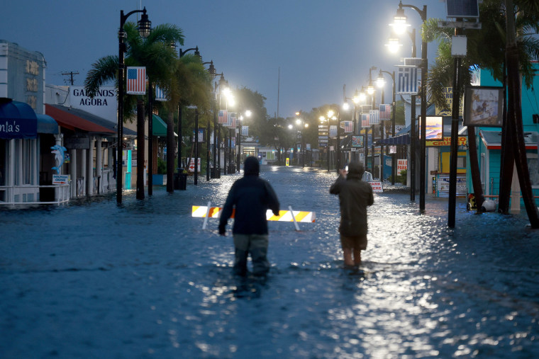
Reporters could be seen wading through floodwaters in downtown Tarpon Springs in the early hours of today.
Idalia will be biggest storm to hit Tallahassee in city's history, mayor says
Tallahassee Mayor John Dailey warned that Idalia would be the biggest storm to hit the city in the history of the Floridian capital.
“The wind and the trees and the powerlines,” topped the list of concerns for the city, he told NBC’s Willie Geist, adding that workers had been preparing for the storm for a week.
“Stay home and stay in place,” Dailey warned residents.
Northern eyewall of Idalia now onshore
The northern eyewall of Idalia is now onshore.
The center of the hurricane is expected to cross the coast and make landfall around 8 a.m. ET.
Tornadoes could hit Sarasota, Tampa, Jacksonville, meteorologist says
Idalia could spawn tornadoes as far south as Tampa and Sarasota, east to Jacksonville and north to the Georgia coast later today, NBC News Meteorologist Bill Karins warned.
Hurricane downgraded to Category 3
Hurricane Idalia has been downgraded to a Category 3 storm, with maximum sustained winds near 125 mph, with higher gusts.
The system is still expected to hit Florida's Big Bend as a major hurricane.
Gov. Ron DeSantis said the hurricane was expected to make landfall around 8 a.m. ET.
More than a thousand flights canceled or delayed
Air travel has been severely disrupted, with more than a thousand flights to and out of the United States already canceled or delayed, according to FlightAware.

In total, 790 flights to or out of the U.S. have been canceled and 523 have been delayed, with Tampa International Airport the worst affected, the tracking site said on its website.
Not all heeded warnings to evacuate affected areas, governor says
Gov. Ron DeSantis noted that not all residents in counties under evacuation orders have heeded calls to leave the areas in Idalia's path.
"Most people did heed the warning," he said, but he said not all followed evacuation orders.
The governor said rescue efforts and work to restore power would be underway in the storm's wake.
'Not my concern' that Trump hasn't commented on storm: DeSantis
Gov. Ron DeSantis said it was "not my concern" that former President Donald Trump, his rival for the GOP presidential nomination, had not commented on the storm as it threatened Florida, the former president's home.
"My concern is protecting the people of Florida," he said in the morning news conference.
If you're in the storm's path, time to 'hunker down,' DeSantis says
Counties in the storm's path must "hunker down," Gov. Ron DeSantis said.
"If you’re in the path of where the eyewall’s going at this point, you’ve gotta hunker down," he said in this morning's news conference.
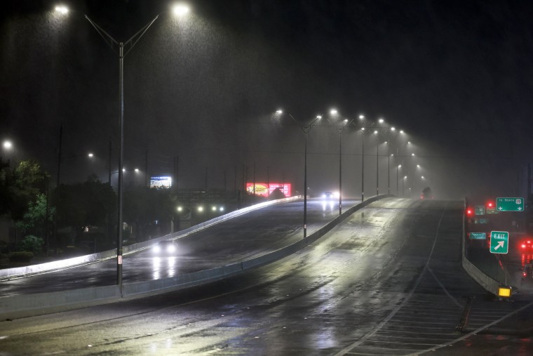
Leon County Commissioner Christian Caban also urged residents impacted by the storm to "shelter in place."
Video of overnight storm surge in Cedar Key
Lights briefly go out during DeSantis' news conference
PERRY, Florida — The lights briefly went out during Gov. Ron DeSantis' news conference this morning.
They appeared to go out for a moment, before flickering back on.
"And there we go with our power here," DeSantis said, before noting: "We're back."
Hurricane could make landfall in next hour and a half, DeSantis says
Hurricane Idalia could make landfall as early as in the next hour and a half, Gov. Ron DeSantis said.
The storm would probably hit by 8 a.m., he said, and warned residents not to do anything "dumb" at this point.
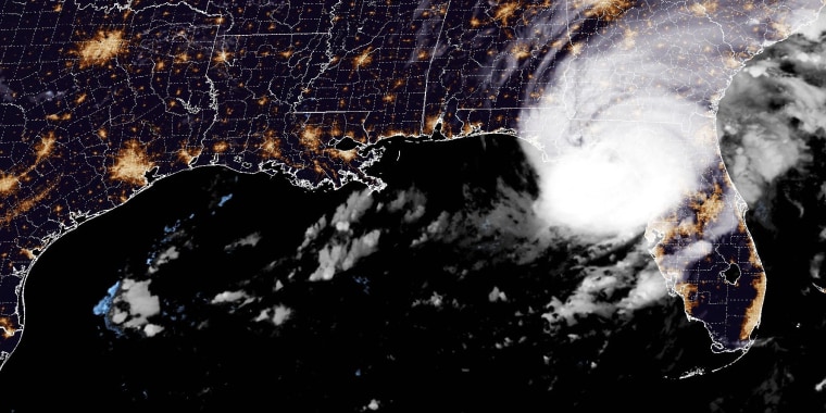
"If you're inside, just hunker down until it gets past ya," he said, warning that the expected storm surge associated with the hurricane would be "very dangerous."
Do not drive through flooded streets, assume all downed power lines are 'hot and live,' DeSantis warns
Gov. Ron DeSantis has warned Florida residents not to drive through flooded streets and to assume that all downed power lines are still "hot and live."
Speaking at a news conference at 6:30 a.m. ET, he said people should stay alert for hazards in the "immediate aftermath of the storm."
Already, around 54,000 utility customers were without power, he said. He said efforts to restore power would be underway.
Hurricane Idalia barrels closer toward Florida's Big Bend
Hurricane Idalia continues to barrel toward Florida's Big Bend, with the system about 55 miles west northwest of Cedar Key as of 6 a.m. ET.
The hurricane continued to have maximum sustained winds of about 130 mph, with higher gusts, the National Hurricane Center said in an update.
Flooding in Pinellas County as Idalia nears
First responders in Pinellas County have warned any residents in the area to stay sheltered and stay off the roads as images show cars flooded on the streets.
Vehicles could be seen partially submerged on a flooded street in photos from the city of St. Petersburg early this morning.
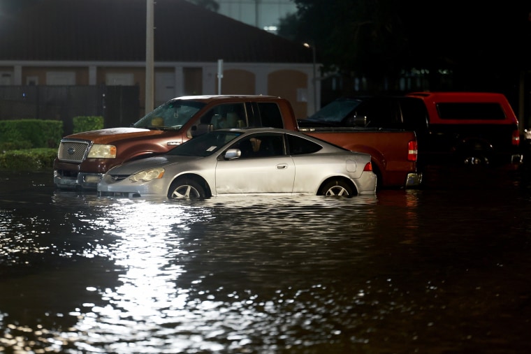
Pinellas County’s Department of Emergency Management said flooding was being reported on roadways throughout coastal areas of the county as winds continued to gust from 40-60 mph.
“Some traffic signals have been reported to be out. All residents are advised to stay off the roads and remain sheltered,” it said.
Evacuation orders were issued in Pinellas County ahead of Idalia's arrival.
'Destructive life-threatening winds' expected onshore, along with strong winds inland
"Destructive life-threatening winds" are expected where the core of Idalia moves onshore in the Big Bend region this morning, the National Hurricane Center said.
"Strong winds will also spread inland across portions of northern Florida and southern Georgia near the track of the center of Idalia where Hurricane Warnings are in effect," it said in its 5 a.m. ET update.
Catastrophic and life-threatening storm surge likely along Florida Gulf Coast
Catastrophic and life-threatening storm surge is likely along parts of the Florida Gulf Coast, the National Hurricane Center said early this morning as Idalia nears.
Catastrophic impacts from storm surge inundation of 12 to 16 feet above ground level and destructive waves were expected somewhere between the Wakulla/Jefferson County line and Yankeetown, it said in a 5 a.m. ET update.
Life-threatening storm surge inundation was also likely elsewhere along parts of Florida's Gulf Coast, where a storm surge warning is in effect, it said. Residents have been warned to follow advice given by officials.
The small eye of Idalia that everyone wants to avoid
DeSantis to hold news conference at 6:30 a.m. ET
Florida Gov. Ron DeSantis will hold a news conference on Idalia at 6:30 a.m. ET.
The governor will be joined by Florida Division of Emergency Management Director Kevin Guthrie, Florida Major General John D. Haass, U.S. Coast Guard Rear Adm. Doug Schofield and Leon County Commissioner Christian Caban, according to a news release.
On the ground in Perry, Florida, as Idalia nears
PERRY, Florida — As Idalia approaches, winds are picking up here but we still have power.
Police say they won’t respond to calls once winds reach 45 mph.
Taylor County imposed a curfew overnight after closing its emergency shelters, busing residents to nearby Leon County. The Taylor County sheriff’s office is warning of “great potential for death and catastrophic devastation.”
The National Weather Service in Tallahassee says there have been no major hurricanes going back to 1851 that have tracked into Apalachee Bay. “This has the making of an unprecedented event for this part of the state.”
More than 50,000 utility customers without power in Florida
More than 50,000 utility customers were without power in Florida as of 5 a.m. ET as Idalia barreled toward the Big Bend region, according to the online outage tracker PowerOutage.us.
Further outages are expected as the Category 4 hurricane makes landfall.
Hurricane Idalia becomes Category 4 storm
Hurricane Idalia has strengthened into a Category 4 storm as it barrels toward Florida's Gulf Coast.
The storm is expected to make landfall along the coast of Florida's Big Bend region, where catastrophic storm surge and destructive winds are expected.
Around 5 a.m. ET, the hurricane was about 60 miles west of Cedar Key and about 90 miles south of Tallahassee, with maximum sustained winds of 130 mph.
Some Cedar Key residents plan to ride out hurricane, despite evacuation orders
Some Cedar Key residents have reportedly chosen to ride out the hurricane, despite evacuation orders issued ahead of Idalia's arrival.
Almost 900 residents were under mandatory orders to evacuate the island city, but some told NBC South Florida they planned to ride out the hurricane.
“I have a house on a high elevation sitting on top of a hill and I have a second floor and I have a boat tied up and ready to go,” one resident, Michael Bobbitt, told the outlet. “When the streets become waterways, I’m going to get out and about to see who I can get to to help.”
Traci Argraves said she had friends that planned to stay, but said she didn't want to take her chances and would be staying at a hotel in Gainesville.
“We do have friends here that are staying, we have neighbors that are staying, I would like to see them still here,” she said.
Florida's Big Bend to see 'catastrophic' storm surge, destructive winds
Florida's Big Bend will soon face "catastrophic storm surge and destructive winds" as Hurricane Idalia continues to "rapidly intensify," forecasters warned.
Data from an Air Force Reserve Hurricane Hunter aircraft showed that Idalia is quickly strengthening, with maximum sustained winds increasing to 125 mph with higher gusts around 4 a.m. ET.
At that time, the hurricane was about 90 miles west southwest of Cedar Key in Levy County.
A mandatory evacuation order was issued for residents and visitors of coastal areas of Levy County, including Cedar Key.
Live camera captures storm surge before going offline
A public live camera streaming footage of a beach on Boca Ciega Bay in the city of Gulfport appeared to show the effects of storm surge, with waves rushing toward the shore, before the camera went offline.
Within the span of minutes, the scene appeared to become more chaotic, with water beginning to lash at the camera before it suddenly went offline around 4 a.m. ET.
Gulfport is in Pinellas County, which saw evacuation orders issued in advance of Idalia's arrival.
What's the difference between Category 3 and Category 4?
The National Hurricane Center considers any storm with sustained wind speeds of 111 mph or higher a "major storm." But even without that qualifier, any hurricane can be deadly and destructive.
Hurricanes are categorized on the Saffir-Simpson hurricane wind scale, based on maximum sustained wind speed, which leads to different levels of damage.
Here's how they break down:
- Category 1: Wind speeds of 74 to 95 mph producing some damage
- Category 2: Wind speeds of 96 to 110 mph producing extensive damage
- Category 3: Wind speeds of 111 to 129 mph producing devastating damage
- Category 4: Wind speeds of 130 to 156 mph producing catastrophic damage
- Category 5: Wind speeds of 157 mph or higher producing catastrophic damage
Idalia could cut across parts of Georgia and South Carolina as a hurricane
Idalia was expected to continue to gain strength early this morning and then weaken over land, but not enough that it will lose its hurricane status, forecasters said.
On its path toward the Atlantic, the storm was expected to cut across parts of Georgia and possibly South Carolina still at hurricane strength, according to the National Hurricane Center.
"Idalia is likely to still be a hurricane while moving across southern Georgia, and possibly when it reaches the coast of Georgia or southern South Carolina late today," itr said in its latest public advisory this morning.
The weakest sustained windspeed for hurricane status is 74 mph; lower than that and Idalia would return to a tropical storm.
Forecasters say parts of Georgia and the Carolinas could see as much as 12 inches of rain from the storm, and the risk of tornadoes was likely to shift from Florida into those states during the day.
Idalia now a Category 3 hurricane
Hurricane Idalia has been upgraded to a Category 3 storm, according to the National Hurricane Center.
The storm, with maximum sustained winds of 120 mph, is classified as a major hurricane, with catastrophic storm surge and destructive winds expected in the Big Bend region.
The hurricane was about 100 miles southwest of Cedar Key and 175 miles south of Tallahassee, and it was moving at about 15 mph.
Idalia is expected to make landfall this morning as a Category 4 hurricane, according to the hurricane center.
Landfall is expected south of Perry along the coast of Florida’s Big Bend region, according to NBC News’ Weather and Climate Unit.
The Big Bend region could encounter a dangerous storm surge of 12 to 16 feet in parts of the area, according to the hurricane center.
Damaging storm surge could stretch up to 200 miles south into the Tampa area, according to the unit.
Water coming over the sea wall in Treasure Island
Flooding reported in St. Pete Beach
Idalia nearing Florida's Big Bend
Idalia was nearing Florida's Big Bend coast early this morning, with the storm estimated to be 160 miles south of Tallahassee at 1 a.m. ET.
The hurricane was moving north, almost parallel to the state's west coast, at 16 mph, federal forecasters said.
The state capital is not right on the coast — about 25 miles could be shaved off that distance to measure Idalia's path to the coastline.
The storm was also about 115 miles southwest of Cedar Key, in Levy County, where a mandatory evacuation order was issued yesterday.
The storm remained just below Category 3 strength, with sustained winds believed to be at 110 mph. Forecasters said it is likely to move up to Category 4 before it makes landfall sometime this morning.
In either category, Idalia jumps to "major hurricane" status and the destruction associated with categories 3 through 5.
Idalia expected to make landfall as Category 4
Idalia is expected to be a Category 4 hurricane by the time it makes landfall along Florida’s Big Bend region this morning, the National Hurricane Center said late last night.
A Category 4 storm brings with it the possibility of catastrophic damage, structural damage and uprooted trees and utility poles, the hurricane center says. It means some areas might not be habitable for weeks.
With sustained winds of 110 mph, the storm was 1 mph shy of Category 3 on its way to the more powerful Category 4 status, according to the agency.
Sustained winds of 111 mph would put it at Category 3. Sustained winds of 130 or greater would make it a Category 4 storm. Either would mean a shift from hurricane to major hurricane, a status given at Category 3 and higher.
The hurricane was about 125 miles west of Tampa and gaining strength, the hurricane center said. It was moving north at 18 mph and was expected to make landfall sometime in the morning.
Florida has agencies and fuel on standby to respond to post-storm needs
To prepare for Idalia, Florida Gov. Ron DeSantis activated the National Guard, and President Joe Biden approved an emergency declaration.
DeSantis said the state had resources ready to respond throughout Florida, addressing power needs and threats to residents.
He said Florida was ready with 1.1 million gallons of fuel and almost 30,000 workers who would help restore power.
Florida’s Big Bend, the 'Nature Coast,' is in Idalia's path
ORLANDO, Fla. — Florida’s Big Bend is one of the last truly natural places in the state. It’s not Disney World; it’s not South Beach. This is where people go to hunt alligators, fish for tarpon and search for scallops in the shallow waters. Now it’s in the bull’s-eye of a major hurricane.
The Big Bend is where the peninsula merges into the Panhandle, just southeast of the capital, Tallahassee, and well north of metropolitan Tampa. Idalia would be the first major storm to hit there since Hurricane Easy in 1950, according to the National Hurricane Center.
This is where people go to appreciate nature and be left alone.
“The counties of Florida’s Nature Coast believe that many people — our residents, and those who travel here from far away — think having a good time involves more than expensive restaurants, theme parks, and crowded beaches,” a website devoted to the region says.
Because of the unique shape of the Big Bend coastline, Idalia “is going to bring some pretty massive storm surge,” said Kristen Corbosiero, an atmospheric scientist at the State University of New York at Albany. “The water can get piled up in that bay. And then the winds of the storm come around, they go around counterclockwise, that’s going the same direction, the same shape of the bay, so that water can just get pushed in there.”
Hurricane Idalia tracker: Follow its path
Hurricane Idalia is headed for Florida’s Gulf Coast.
As of last night, Idalia was a Category 2 hurricane with wind speeds reaching 110 mph.
Forecasts show the storm strengthening to Category 4 before it makes landfall early today, with wind speeds capable of snapping trees, damaging houses and knocking out electricity.


